


Refine your search for walks in Les Geneveys-sur-Coffrane
Les Geneveys-sur-Coffrane walks
 Mont Racine
 Visorando Member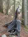
 9.47 mi
 +1,713 ft
 -1,706 ft
 5h 50
5h 50
 Moderate
 Departure from La Sagne (Canton of Neuchâtel)
Starting from La Sagne, you will go to Tête de Ran (1,422 m) via Combe des Quignets. From there, take the Chemin des Crêtes to Mont Racine (1,439 m), where you will have a view of Lake Neuchâtel and the Alps. At the end of the Chemin des Crêtes, head towards the Chemin des Statues to finish your hike: sculptures carved from tree stumps by Georges-André Favre over a period of 35 years.
From La Corbatière to Les Ponts-de-Martel via La Pouette Combe
 8.57 mi
+1,060 ft
-1,394 ft
4h 50
Moderate
Departure from La Sagne (Canton of Neuchâtel)
8.57 mi
+1,060 ft
-1,394 ft
4h 50
Moderate
Departure from La Sagne (Canton of Neuchâtel)
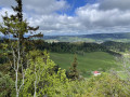
A route allowing you to discover the bucolic landscapes of the Neuchâtel Jura, as well as the Communal de La Sagne and the enchanting Pouette Combe with its Grande Grotte. This itinerary, accessible by public transport, is ideal in spring or autumn.
Areuse Gorges
 5.65 mi
+1,063 ft
-1,089 ft
3h 30
Moderate
Departure from Boudry (Canton of Neuchâtel)
5.65 mi
+1,063 ft
-1,089 ft
3h 30
Moderate
Departure from Boudry (Canton of Neuchâtel)
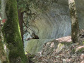
Hike from Chambrelien, passing through Champ du Moulin and following the Gorges de l'Areuse trail, with several views of Lake Neuchâtel. You will follow the blue trail, where you may spot chamois, then the gorge trail to admire the waterfalls.
View of the Alps - Chasseral
 11.63 mi
+2,749 ft
-1,909 ft
7h 45
11.63 mi
+2,749 ft
-1,909 ft
7h 45
 Difficult
Departure from Unknown (Canton of Neuchâtel)
Difficult
Departure from Unknown (Canton of Neuchâtel)
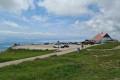
Eighth stage From Les Rousses to Lake Constance via the Jura ridges. From the Col de la Vue des Alpes, the flower-filled route winds through pastures to Mont d'Amin, offering a vast panorama of the Mittelland and the Chasseral massif. A long descent then leads to Les Vieux Prés, whose bocage landscape is reminiscent of Normandy: hedges, trees and dry stone walls delimit the plots. After the farming village of Le Pâquier, the trail crosses the Combe Biosse, a limestone gorge carved out by erosion, before reaching the Chasseral ridge, with the Alps and the lakes of Morat, Biel and Neuchâtel as a backdrop.
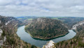
Roche Moron and Tour Jurgensen at the start of the Col des Roches
 11.60 mi
+3,885 ft
-3,891 ft
8h 45
Difficult
Departure from Le Locle (Canton of Neuchâtel)
11.60 mi
+3,885 ft
-3,891 ft
8h 45
Difficult
Departure from Le Locle (Canton of Neuchâtel)
Set off to explore this magnificent trail, from La Roche and Côte de Moron, including the "Pillichody" trail (a high-altitude path, not suitable for children, impassable in winter) – sure-footedness is essential! The path is very narrow in places, with cables in place to secure the tricky sections.
The Jurgensen Tower, which is often open, is located along the route. There is a panoramic view of Villers-le-Lac, Les Brenets and the valley.
Do not attempt this hike in wet weather.
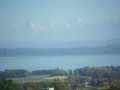
Along the Areuse River in Switzerland.
 6.64 mi
+459 ft
-1,056 ft
3h 25
Moderate
Departure from Noiraigue (Canton of Neuchâtel)
6.64 mi
+459 ft
-1,056 ft
3h 25
Moderate
Departure from Noiraigue (Canton of Neuchâtel)
A superb walk along the River Areuse with its various gradients and several bridges spanning it, leading out of the gorges to a magnificent view of Lake Neuchâtel and the Alps. The return journey from this hike will be by train from Bole station.
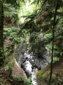
The Areuse Gorges
 14.52 mi
+2,812 ft
-2,815 ft
9h 05
Difficult
Departure from Noiraigue (Canton of Neuchâtel)
14.52 mi
+2,812 ft
-2,815 ft
9h 05
Difficult
Departure from Noiraigue (Canton of Neuchâtel)
The small village of Noiraigue in the Val de Travers is the starting point for the magnificent Gorges de l’Areuse hike, the upper entrance to which is only about 1 km away.
The route runs alongside the railway line and the valley narrows considerably. The impressive gorge, with its idyllic old stone bridge, is at Saut de Brot. Continuing towards Champ-du-Moulin along a small road, you will find another crossing via a section of path that leads you back into the gorges. Gigantic rock faces soar skywards. The path takes you over small bridges and through tunnels. Then, a power station marks the end of the spectacle; just one last bridge to cross and head towards Champ-du-Moulin for the return journey along a forest road and a view of Le Creux du Van.
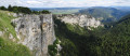
Noiraigue - Les Rochats
 8.48 mi
+2,848 ft
-1,394 ft
6h 25
Moderate
Departure from Noiraigue (Canton of Neuchâtel)
8.48 mi
+2,848 ft
-1,394 ft
6h 25
Moderate
Departure from Noiraigue (Canton of Neuchâtel)
During this first stage, after the tedious climb up the 14 contours, you will be rewarded by the local geological curiosity, the Creux du Van. This Swiss version of the "Grand Canyon" is a large rocky cirque 1.5 km long and 200 m high.
At Soliat, you will enjoy a splendid panorama of Lake Neuchâtel.
The peaks of the Swiss Jura, from Noiraigue to Saint Cergue
 66.06 mi
+13,068 ft
-11,952 ft
6 days
Moderate
Departure from Noiraigue (Canton of Neuchâtel)
66.06 mi
+13,068 ft
-11,952 ft
6 days
Moderate
Departure from Noiraigue (Canton of Neuchâtel)
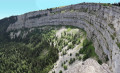
This magnificent route passes through peaceful forests, along long ridges and steep cliffs. Every day offers panoramic views of the peaks of the Alps, the lakes of Neuchâtel, Geneva and Joux, and curiosities such as the great Cirque du Creux du Van.
Le Creux du Van and the Saut de Brot
 8.66 mi
+2,628 ft
-2,602 ft
6h 15
Difficult
Departure from Noiraigue (Canton of Neuchâtel)
8.66 mi
+2,628 ft
-2,602 ft
6h 15
Difficult
Departure from Noiraigue (Canton of Neuchâtel)
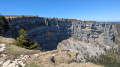
Le Creux du Van is a natural cirque located in the Swiss Jura. It was formed by the freezing and thawing action of a glacier. It is now accessible from several locations, such as from Noiraigue via the Sentier des Quatorze Contours. This hike has a significant climb over the first few kilometres. It is also possible to return via the Gorges de l’Areuse, at the Saut du Brot.
Via Creux du Van and Soliat
 5.04 mi
+1,670 ft
-1,677 ft
3h 45
Moderate
Departure from Noiraigue (Canton of Neuchâtel)
5.04 mi
+1,670 ft
-1,677 ft
3h 45
Moderate
Departure from Noiraigue (Canton of Neuchâtel)
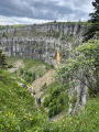
Le Creux du Van is one of the most famous geological formations in the Jura. This immense cirque with its impressive vertical cliffs offers steep landscapes that contrast with the gentle neighbouring pastures. This is the hike to do to discover the Val de Travers. It is very easy to see ibex here, as they are used to walkers.
Circular Creux du Van route via Ferme du Grand Vy and Fontaine Froide
7.80 mi
+1,811 ft
-1,831 ft
5h 10
Moderate
Departure from Noiraigue (Canton of Neuchâtel)
This beautiful hike in the Swiss Jura mountains will take you along the renowned Sentier des Quatorze Contours to the magnificent Creux du Van cirque with its steep cliffs, home to a herd of around twenty ibexes, which you’re almost certain to spot provided you keep a safe distance from them.
Pass the summit of Mont Soliat before reaching the Grand Vy farm and restaurant and beginning your descent.
You’ll then walk along the foot of these magnificent cliffs to the aptly named Fontaine Froide, before reaching the Ferme Robert – a seasonal relaxation area – and returning to your car park, your eyes still filled with images of this spectacular landscape.
The Saut du Doubs and the tour of Lake Moron
 9.18 mi
+3,967 ft
-3,967 ft
7h 40
Difficult
Departure from Les Planchettes (Canton of Neuchâtel)
9.18 mi
+3,967 ft
-3,967 ft
7h 40
Difficult
Departure from Les Planchettes (Canton of Neuchâtel)
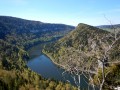
A superb hike around Lake Moron, culminating in the Saut du Doubs and its 27-metre waterfall.
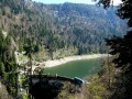
The Châtelot dam
 7.16 mi
+1,942 ft
-1,942 ft
5h 00
Moderate
Departure from Villers-le-Lac (Doubs)
7.16 mi
+1,942 ft
-1,942 ft
5h 00
Moderate
Departure from Villers-le-Lac (Doubs)
The Doubs river flows through 35 kilometres of deep, winding gorges from Villers-le-Lac to Goumois. You will only cover a few of them, from Lac de Moron, bordered by high cliffs forming a semicircle, to the Grotte du Grenier, where even human constructions cannot detract from the riches of the wild natural environment.
Grotte du Grenier, Lac de Moron, Tête de Calvin and Saut du Doubs
11.27 mi
+2,441 ft
-2,441 ft
7h 20
Difficult
Departure from Villers-le-Lac (Doubs)
Depart from Le Pissoux, descend to the Grotte de Grenier above the Doubs and cross the river on stepping stones, allowing you to cross dry-shod downstream from the Châtelot dam, followed by the magnificent marked trail on the right bank of the Doubs (Lac du Moron) on the Swiss side. At the Saut du Doubs, head back and forth to the Tête de Calvin to see the meanders of the Doubs basins stretching from Viller-le-Lac to the Saut du Doubs from above, then cross the Doubs via the footbridge upstream of the Saut du Doubs, pass by the viewpoints overlooking the Saut du Doubs and climb directly up through the forest to Le Pissoux, via the Belvédère du Châtelard overlooking Lac de Moron.