The Bregille ditches

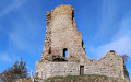
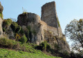
A lovely walk for city-dwellers seeking nature and sweeping views of the capital of the Franche-Comté region and its hills, just a stone’s throw from the city. After exploring the lime kilns, the walk offers superb views of the feudal castle of Montfaucon, our Citadel and the old town nestled within its circular shape. Then, after a fascinating stroll through the fort’s moats, you’ll venture, just a stone’s throw from the bustling city, onto quiet paths, accompanied by the scent of budding boxwood.

Details

n°22329249
Creation:
Last update:
Last review:
  • Walking
    Activity: Walking
  • ↔
    Distance: 4.22 mi
  • ◔
    Average duration: 2h 25 
  • ▲
    Difficulty: Easy

  • ⚐
    Back to start: Yes
  • ↗
    Ascent: + 515 ft
  • ↘
    Descent: - 509 ft

  • ▲
    Highest point: 1,444 ft
  • ▼
    Lowest point: 1,132 ft
  • ⚐ Country: France
  • ⚐ City: Chalezeule (25220)
  • ⚑
    Start/End: N 47.250696° / E 6.063753°
  • ❏
    IGN map(s): Ref. 3323ET
  • Hour-by-hour weather

Photos

Description of the walk

Car park in front of the old lime kilns on Rue des Fours à Chaux in Chalezeule. The route is marked by signposts at the junctions.

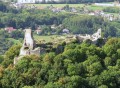
(S/E) Walk round the kilns and return to Rue des Fours à Chaux; turn right, and at the end of the street continue straight on along Rue des Vareilles du Milieu. Then head up to the left along Chemin des Buis to reach the viewpoint overlooking the Doubs valley and the ruins of the feudal castle of Montfaucon.

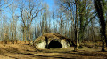
(1) Set off again along the path at the far end, passing between two large stones. After 200 metres, ignore the path leading down to your left and head up to the right. At the first fork, carry on straight ahead along the left-hand path. At the next fork, just before a signpost, head down to the left towards the Grotte du Renard.

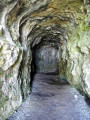
If you walk past it without noticing, don’t panic – carry on to the signpost and head down to the left (towards Près de Vaux) for a few metres, then turn left again for a round trip to the cave.

(2) Leave the cave by continuing along the path; when you come to another path, carefully head down to the left (handrail and step). Further down, take a wider path on the right. Continue to the dead end of a small tarmac road (marker post 113, towards Mont de Bregille).

(3) Head up to the right, passing over some old ruins, perhaps former ‘cabordes’ – those winegrowers’ huts commonly found in the Besançon hills. You’ll come across a path at right angles to the one you’re on; take this to the right for about fifty metres. Take the path that climbs steeply to the left. At the top, you’ll come to a wide forest track; turn left onto it for a few dozen metres to reach the ‘dry grasslands’ of the Grand Désert.

(4) Head straight ahead across the open space, following the forest track, guided by a signpost (121) at the edge of a small tarmac road. Cross the road and continue straight on along the gravelly path that winds through the grasslands, keeping the edge of the woodland on your left.

(5) Enter the woods on the left (post 129e), heading towards Fort de Bregille, to reach the cliff-top path (129d). Then turn right. Carry on straight ahead, following the top of the moats, and go down a few steps on the left. Do not take the dangerous path that runs along the top of the walls. You’ll pass a superb view of the Citadel and the Besançon hills.

(6) Descend into the moats and turn left (129c) to reach the fort’s esplanade (picnic table), which offers another view of the Citadel and the old town of Besançon. Head towards the radio mast and turn right towards the ramparts (trail 3) along the stony path, then weave your way to the left to take a curious detour around the moats and retrace your steps.

(5) Cross (at marker 129e) the lawns, but this time diagonally, towards the car park, passing between the barriers. Head right onto the small tarmac road, passing a metal barrier about fifty paces further on (marker 122 Grand Désert).

Turn left onto the stony path towards Les Vareilles-Dessus and enter the woods. At the nearby fork, take the wider path on the right. At the next two crossroads, carry on straight ahead. You’ll reach the fitness trail (station No. 7) and a crossroads. Carry on straight ahead until you reach a nearby gravel farm track (signpost 130).

(7) Turn right, still heading towards Les Vareilles, until you reach a fork (marker post 132). Carry on straight ahead.

At the next fork (trail marker 3), head down the widest path on the left to reach a gate. At marker post 136, turn right (towards Chalezeule), immediately passing two paths on your right.
You’ll arrive at the rear of a house and walk alongside a wire fence. The path turns at a right angle, climbing to the right, and joins another path at right angles (trail marker on a tree). Turn left onto a path of large stones to reach the rear of some buildings again and a crossroads.
Turn right, following the fence to return to the Clementigney viewpoint, and make your way back at a leisurely pace to the car park (S/E).

Waypoints

  1. S/E : mi 0 - alt. 1,175 ft - Chalezeule – The lime kilns
  2. 1 : mi 0.29 - alt. 1,227 ft - Clémentigney Viewpoint
  3. 2 : mi 0.64 - alt. 1,302 ft - The Fox’s Cave
  4. 3 : mi 1.36 - alt. 1,168 ft - Échenoz Saint-Paul – View of the - Doubs (rivière)
  5. 4 : mi 1.68 - alt. 1,398 ft - The Grand Désert
  6. 5 : mi 1.91 - alt. 1,437 ft - The dry grasslands
  7. 6 : mi 2.02 - alt. 1,401 ft - View of the Citadel and the Bregille moats
  8. 7 : mi 3.48 - alt. 1,352 ft - Fitness trail
  9. S/E : mi 4.22 - alt. 1,175 ft - Chalezeule – The lime kilns

Notes

From the point (7), the paths form a somewhat labyrinthine network, but don’t panic! If you take the wrong path, just keep going in the general direction – they’ll all lead you to the Clementigney viewpoint.

Part of the route (3 km) is shared with Les Monts de Bregille, but these are two walks with very different character: explore the fort’s moats and the dry grasslands of the Grand Désert, then return via more rugged paths.

Worth a visit

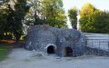
(S) The lime kilns: lime production in Chalezeule is a long-standing tradition, dating back to the 12th century; it was the village’s main economic activity, and its name, Calisola, was derived from the word ‘lime’. The lime kiln, or ‘chaufour’ – a calcination kiln (a vertical, fixed structure open at the top with a wide inner wall, usually lined with bricks) – transformed limestone into quicklime. This was then slaked in an adjacent pit using a large quantity of water, before being placed in barrels for use in masonry. During the 19th century, lime was also used in agriculture to liming the soil, restoring a neutral pH to soil that tends to become acidic.

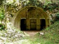
(2) The Grotte du Renard: remember to bring a torch. The main interest of this cave lies in its geology, but in 1805, there was mention of a small cave on Mont Bregille where a small treasure was discovered: two axes, a copper vase, a bronze handle and 250 coins, some of which were from the time of Nero.

(4) The Grand Désert: dry grasslands occur on shallow limestone soils, which are generally poor in nutrients available to plant species, well-drained and exposed to harsh conditions of drought and heat. Often regarded as wasteland, they are in fact home to a rich variety of flora and fauna, with Mediterranean affinities, and play an important role in the landscape.

(6) The Citadel: overlooking the old capital of the Comté region from a height of around 100 metres, it is one of the masterpieces of Sébastien Le Prestre de Vauban (1633–1707), military engineer to King Louis XIV. The site was listed in 1924 and has been inscribed on the UNESCO World Heritage List since 2008. The foundation stone of the Citadel was laid on Mont Saint-Étienne (whose strategic importance was noted as early as 58 BC by Julius Caesar) in 1668, whilst the town was still a possession of the Spanish Crown.

(6) Bregille Fort – also known as Fort Morand – perched at an altitude of 446 metres, was built from 1820 onwards. Like most of Besançon’s fortifications (and fortunately so), it was never used in times of conflict. You can walk around it via the moats, making for an interesting and pleasant stroll.

Reviews and comments

4.7 / 5
Based on 1 review

Reliability of the description
5 / 5
Ease of following the route
5 / 5
Route interest
4 / 5
Christian delode
Christian delode

Overall rating : 4.7 / 5

Date of your route : Sep 09, 2022
Reliability of the description : ★★★★★ Very good
Ease of following the route : ★★★★★ Very good
Route interest : ★★★★☆ Good
Very busy route : No

A lovely, easy walk, featuring some very pretty views and an unexpected discovery of the fort’s moats

Machine-translated

Other walks in the area

For more walks, use our search engine .

The GPS track and description are the property of this route's author. Please do not copy them without permission.