Country:
 City:
City:


The walk starts from the car park at the viewpoint at the top of the village of Montfaucon, Rue des Alpes.
Yellow-blue markings. Some sections are unmarked.
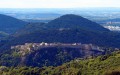
(S/E) Enjoy the view from the viewpoint and head down to the left across the small meadow below the viewpoint. At the clearing, continue straight on along the ridge, following the fort’s ditches.
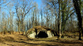
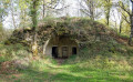
(1) Just before a bend in the ditch, at the fork, turn left, continuing to follow the ditch to reach the entrance to Fort Woirol. At the fort’s entrance, take the descending path on the left, which forms a hairpin bend with the road. Take care: rockfalls are possible. You will pass the rock shelter comprising five casemates built between 1890 and 1893, which could have served as barracks in times of war; most of them have collapsed. Do not be reckless enough to enter them.
This stony path becomes the Chemin des Poudrières as it reaches the first houses at the top of the village of Montfaucon; follow it until you reach the ‘Give Way’ sign. Just before this, you’ll pass a pretty eco-friendly house. At the sign, where the path meets Rue du Château, head down to the right.
(2) When the road bends sharply to the left (90°), turn right onto the small tarmac road. Take a moment to admire the valley and the castle ruins, but then turn left onto the stony path (Sentier de Nacra). There’s a lovely view to the left of the Besançon mountains. The path becomes a track running alongside an old pile of stone gathered from fields on the right. At a fork, just as the path begins to descend, take the left-hand path. The path becomes very steep and can be slippery at times (it has recently been fitted with steps), winding its way between the rocks and daffodils in spring. There’s a view of the Doubs valley through the trees, which are still bare. You’ll come to a path.
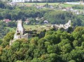
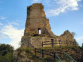
(3) Leave the signposted path and head off to the right. Directly ahead of you are the ruins of the feudal castle of Montfaucon; to your right, you’ll walk alongside some beautiful rock formations. You’ll soon reach the Reculée sauvageonne de Nacra. At the end of the rocks, head down to the left to wade across the stream, continuing along the path on the other side, then crossing a second stream. You’ll walk along the hillside, beneath the ruins of the old fortified castle, keeping to the right; when you reach a more open area, you’ll see dry-stone walls, no doubt remnants of terraced farming. You’ll rejoin a wider, signposted path.
(4) Head up to the right. Opposite you lies the Roche de la Côte d’Arbois. To your left, you’ll look down on a charming little valley and its stream. Leave the woods and climb the hillside to the right along the path that winds through the grass. At a sign reading ‘Be careful’, where the path forks into a T-junction, continue to the left , skirting the ruins of the old village without entering them, as there is a risk of rockfalls.
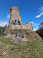
At the foot of the castle, turn left to walk round the ruins (following the mountain bike markers for the Grand Tour de Besançon). You’ll pass below the old church; keep an eye out for the council’s caretakers, responsible for maintaining the ruins: llamas!
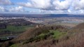
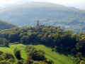
At the far end of the ruins, when the path begins to head back, leave it to climb up to the left at the foot of the keep via the small stone steps and a metal footbridge. There’s a viewpoint overlooking the Montfaucon valley and the Doubs valley, the Citadel and the Besançon mountains.
(5) Make your way back towards the entrance along the ramparts. There is a cellar you can visit via a flight of steps. Head down to the right, passing under the postern gate to the small tarmac road. You’ll find yourself in front of the signposts for two routes. Head up towards the cliffs via the Sentier des Falaises (yellow-blue markings).
(6) Halfway up the slope, leave the stony path and head down to the left towards the Fontaine de la Dhuit. At the ruins of the old fountain, retrace your steps for about twenty metres and climb up the unmarked path on the left (always choosing the fork that leads uphill) to rejoin the stony path. For those who do not have the greatest confidence in their sense of direction, return via the same path.
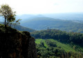
(7) At its highest point, the stony path turns 90° to the right. Carry on for about fifty metres and a yellow-and-blue sign will direct you to climb up to the right onto the Château Cliff Path. You’ll walk along the cliffs, crossing several pastures. You’ll reach an unprotected viewpoint with a lovely view of the ruins and the valley. Continue along the path which skirts the old Fort Woirol.
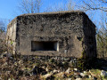
(8) As you come within sight of the entrance, shortly after the fourth ‘Military Ground’ sign, head up into the woods on the left via the path leading to the observation post.
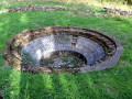
Set off again, turning your back on the post towards the open area, veering left towards the bases of the anti-aircraft batteries. After the third one, enter the woods via a path on the left which quickly joins a wider track; follow this track up to the right towards the small tarmac road. Continue to the right for a few metres and enter the woods via the path on the left, which rejoins the original track.
(1) Walk along the left-hand side of the ditches until you reach the car park (S/E).
 The route includes ledge paths and unsecured viewing points. The paths are rocky and slippery in places. Sturdy footwear is essential and the use of walking poles is recommended.
 Visorando Member
 Easy
Easy