The medieval castle of Montfaucon

Starting from the Belvédère des Alpes, this circular walk offers superb panoramic views of the Doubs valley, the hills around Besançon and the citadel. The route takes us to the ruins of the feudal castle, its old keep, the remains of the medieval market town and the former parish church. We then explore the Fontaine de la Dhuit and the cliffs, before reaching Fort Woirol and its former signal station. A route steeped in history.

Details

n°110806142
Creation:
Last update:
Last review:
–
  • Walking
    Activity: Walking
  • ↔
    Distance: 3.91 mi
  • ◔
    Average duration: 2h 25 
  • ▲
    Difficulty: Moderate

  • ⚐
    Back to start: Yes
  • ↗
    Ascent: + 758 ft
  • ↘
    Descent: - 751 ft

  • ▲
    Highest point: 1,985 ft
  • ▼
    Lowest point: 1,404 ft

Photos

Description of the walk

Car park at the Belvédère des Alpes at the top of Montfaucon. Yellow-blue, white-yellow and yellow-red markings. Some sections are unmarked.

(S/E) Leave the viewpoint on the left (facing the valley) via a few stone steps, walking along the ledges a few metres from the edge, with lovely views over the valley. You’ll enter a copse and come to a small clearing with another viewpoint over the valley, the citadel and the Montfaucon valley. Set off again along the path that leads away from the ledges. You’ll reach the hamlet of À Regardot and the Chemin des Pâturages.

(1) Walk down the Chemin des Pâturages. At the bottom of the street, turn right into the dead-end road, and continue past the barriers along the Chemin des Granges in the ‘no entry’ direction. Turn right onto Rue du Château, passing an old cider press whilst still enjoying lovely views over the Doubs valley, crowned by the Citadel. At the ‘Give Way’ sign, carry on downhill to the nearby bend.

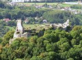
(2) Head down to the right onto Chemin du Donjon. There’s a lovely view of the valley, dominated by the ruins of the feudal castle. This path takes you to the foot of the castle and to a fork in the road. On the right is an old spring.

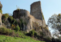
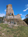
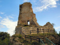
(3) Head left up to the castle, passing under the reconstructed old gate. Turn left, first passing the old parish church built in 1311, then under the entrance tower and the ramparts to reach the old keep, now home to crows. There is a table set up for a picnic. Climb up to the foot of the keep via a small footbridge to admire the view over the Doubs valley and the small valley.

(4) Cross the footbridge again and walk past the flagpole flying the colours of Montfaucon (at the tip of the promontory) to find a stone staircase, which leads down to the path that winds around the ruins. Continue to the right, passing beneath the beautiful rocks crowned by the feudal ruins, then down below the church.

(5) At the far end of the ruins, turn sharply right and head down the path that runs alongside a wooden hut; then, immediately, turn left, following the old, ivy-covered ruins of the old village (keep well clear of the walls, as there is a risk of rockfall) until you reach a stone staircase. Head down to the right, following the path that winds through an orchard and joins the signposted hiking trail further down. Head back up to the right to the foot of the castle.

(3) Head left up towards the cliffs via the Sentier des Falaises (yellow-blue markings).

(6) Halfway up the slope, leave the stony path and head down to the left towards the Fontaine de la Dhuit. At the ruins of the old fountain, turn back and continue the climb at the foot of the cliffs. When the path veers sharply to the right, carry on for another fifty metres or so and look out for the path on your right (signpost marked ‘Sentier des falaises du château’).

(7) Climb up to the right. You’ll enter the pastures, walking alongside the cliffs on your right. You’ll reach an unprotected viewpoint with a superb view of the ruins, the valley and the mountains of Besançon and the Jura, stretching as far as Mont Poupet.

(8) Continue along the path skirting the old Fort Woirol and its moats. You’ll arrive just before the entrance, and after a sign reading ‘Military Ground’, look out for a path on the left.

(9) Climb up through the woods along the path leading to the observation post. Return to the path running alongside the moats. Walk past the fort’s entrance and follow the small tarmac road for about twenty paces. Take the lovely path branching off to the right. When it reaches the edge of the cliff, leave it and take a small stony path that climbs to the left (sign for ‘Grand tour de Besançon VTT’ in the opposite direction to the walk). It bends to the left and runs alongside the ditches again, then moves away from them to join a cross-country path which you’ll follow to the right until you reach the car park (S/E).

Waypoints

  1. S/E : mi 0 - alt. 1,962 ft - Alps Viewpoint
  2. 1 : mi 0.25 - alt. 1,834 ft - In Regardot
  3. 2 : mi 0.73 - alt. 1,654 ft - The Montfaucon valley
  4. 3 : mi 1.36 - alt. 1,486 ft - Château de Montfaucon
  5. 4 : mi 1.59 - alt. 1,585 ft - Montfaucon Keep
  6. 5 : mi 1.85 - alt. 1,519 ft - The old village
  7. 6 : mi 2.4 - alt. 1,575 ft - Fontaine de la Dhuit (Montfaucon)
  8. 7 : mi 2.83 - alt. 1,686 ft - The castle cliffs
  9. 8 : mi 3.08 - alt. 1,844 ft - Viewpoint overlooking the feudal castle
  10. 9 : mi 3.47 - alt. 1,969 ft - The Signal Post - Fort Woirol (ou de Montfaucon)
  11. S/E : mi 3.91 - alt. 1,962 ft - Alps Viewpoint

Notes

(!) Rocky and slippery paths in places. Sturdy footwear is essential and the use of walking poles is recommended. The cliff-top viewpoint is not secured.

Worth a visit

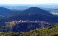
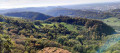
(S/E) The Alps viewpoint:situated at an altitude of 617 metres, it offers an almost circular panorama of the Franche-Comté countryside. In the foreground lie the ruins of the medieval castle, the Doubs valley and Besançon, dominated by its Citadel. To the south, the view takes in the hills around Besançon and the Jura plateaus. On a clear day, the Alps and Mont Blanc can be seen on the horizon, giving the site its evocative name. The viewpoint is also a popular spot for paragliders and hikers.

(3) The feudal castle of Montfaucon dates back to the 11th century, when the first wooden fortress was built by Conon de Montfaucon. Rebuilt in stone at the end of the 13th century by Amédée III, it became the centre of a castle town complete with a church and a bailey. A fief of one of the most influential families in the County of Burgundy, it subsequently passed to the Chalon-Arlay family, Princes of Orange, before being abandoned following the Ten Years’ War in the 17th century. Acquired by the local council in 1984, the site has since undergone restoration work and offers visitors the imposing remains of its walls, towers and keep, perched on a rocky outcrop overlooking the valley.

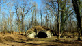
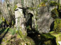
(6) The Dhuit Fountain:nestled on the slope of the old castle, the Dhuit Fountain bears witness to the importance of springs in life in days gone by. Also referred to as the Douïe Fountain in historical documents, it was first mentioned as early as the 18th century. Its structure was entirely rebuilt during the 19th century. Now in ruins, it serves as a reminder of the ancient links between the village, its castle and the valley’s water sources.

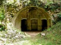
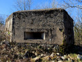
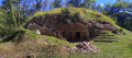
(9) The signal post at Montfaucon Fort is a small vaulted masonry casemate, partially buried beneath a thick layer of earth to provide solid protection against shells dating from before 1885. Light was provided by a paraffin lamp, later by electricity. During the day, a heliostat captured the sun’s rays through a chimney. The fort was in communication with three other fortifications: the Grelimbach redoubt at Salins, the Larmont at Pontarlier and the Lomont defensive pier. The system utilised a variable light source: in broad daylight, a heliostat (a mechanical device comprising mirrors automatically tracked by a clockwork mechanism) captured the sun’s rays, directed them through a chimney cut into the vault, and focused them into transmission ducts (horizontal conduits) precisely aimed at the distant forts. In the absence of sunlight or at night, light was provided either by a paraffin lamp or, from the early 20th century onwards, by an electrical system. The forts in the Séré de Rivières system were equipped with alternative means of communication to mitigate the risks of electrical cables being cut or intercepted. Optical telegraphy remained a robust and discreet method, resistant to enemy attacks or espionage.

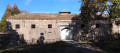
(9) Woirol Fort, built between 1874 and 1878 as part of the Besançon fortified camp, overlooks the Thise valley and the Saône plateau, and was one of the few ‘Séré de Rivières’ forts: constructed of masonry covered with earth to withstand the artillery of the time. On 16 September 1906, in the early afternoon, several witnesses saw lightning strike the fort whilst the lightning conductor was not yet operational; a massive explosion followed, blowing up the main powder magazine, shattering numerous windows within a 1,200-metre radius and reducing part of the new fort to a heap of rubble where eight bodies were discovered, including six civilians (walkers, as it was a Sunday) and several injured, including five soldiers. Armed with around ten artillery pieces and firing casemates, it exemplifies the determination to strengthen French defences following the War of 1870. Quickly rendered obsolete by military advances, it lost its strategic role at the start of the 20th century and was occasionally used as a depot or training ground. Now abandoned and partially overgrown, it remains a testament to the military architecture of the Third Republic and a discreet yet historically significant site, steeped in history.

Other walks in the area

For more walks, use our search engine .

The GPS track and description are the property of this route's author. Please do not copy them without permission.