Country:
 City:
City:


Park at the top of Rue de la Vue des Alpes, on the gravel area at the hairpin bend, before the last houses. Yellow and blue markings. Some sections are unmarked.
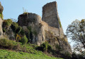
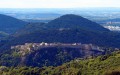
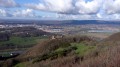
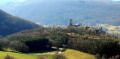
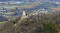
(S/E) Walk back down a few steps towards the electricity substation and turn right into Rue À Regardot. At No. 10, climb up to the right across the lawn to find, at the corner of a low wall, the zigzag path. Walk along the edge of the pasture, passing the first path on your left and taking the second one to get closer to the cliffs and a beautiful viewpoint over the Citadel and the ruins of the feudal castle. Follow the path back to the pasture and on to the Alpes viewpoint.
(1) Enjoy the view, then head down the grassy path that runs alongside the road. Set off along the forest track, following the yellow-and-blue markings. Soon, at a fork, head up to the left over the scree. At the clearing, carry on straight ahead along the ridge. You’ll come to a small tarmac road. Head towards the entrance to Fort Woirol and walk along the ditches on the right.
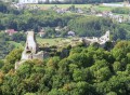
(2) Take a path on the right for a return trip to the Optical Post. Return to the fort’s ditches and continue along them until you reach the viewpoint (unsecured) overlooking the feudal castle. Then, cross three meadows and follow the edge of the woodland on your left. At the last one, you’ll enter the woods and soon come out onto a wider path with a signpost. Turn right, following the sign for “Sentier du Fort et des Batteries”. Leave the woods and walk past the old Fontaine du Champ des Creux. Walk for about one hundred and fifty metres to reach the car park for the climbing site (sign for “Protected Natural Area”).
(3) Head down to the left along the small stony track, leaving the signposted route for a moment. When the track turns sharply to the left, take a path on the right into a long, narrow copse (markings are likely temporary: blue arrows and dots). Stay on this path and through this copse until you reach the Bois des Épesses and a wider forest track, which you follow to the right for just under 100 metres until you reach a Yellow Cross.
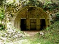
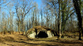
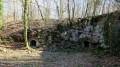
(4) Turn onto the path (not shown on the IGN map) which climbs up to the right (markings pointing in the opposite direction). You’ll soon come across a path at right angles; continue climbing along the edge of a fir forest. You’ll reach an old, moss-covered pile of stone gathered from fields and continue along the path which will lead you to the powder magazine carved out of the rock.
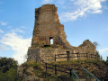
(5) Set off again along the widest path that goes round it. At the crossroads, carry on straight ahead towards the small tarmac road and its signpost. Then turn left and, at the nearby fork, turn right onto the Chemin des Épesses (red and white metal barrier). The road gradually loses its tarmac surface and leads to the entrance to the fort. There you will find the remains of an old bridge and its moat, and a little further on, some ruins; if curiosity draws you there, do not let it override caution. Keep your distance for fear of rockfalls.
(6) To the right of the entrance, take the yellow-and-blue signposted path, following the ditches for about a hundred metres. This path joins another at right angles; the signposts will suggest you turn left. Do not do so; turn right instead. Leaving the signposted path, continue straight on and you will reach a junction of five paths. Choose the one that leads to the clearing. This one runs straight across the field.
Enjoy an unobstructed view to the left of the Jura mountains, the small peak of Mont Mahoux and, further on, the massive silhouette of Mont Poupet.
The path becomes stony and joins a small tarmac road, which you take to the right.
(7) You’ll come to a bench and a signpost marking an X-shaped crossroads. Walk on for about ten steps and head up to the right, then immediately left at the fork (towards “Sentier du Fort et des Batteries”). You’ll enter the woods and soon pass an artillery post that once covered the Saône plain. Stay on this lovely stony path at all times, even when you reach signposts directing you to climb up to the right. Continue straight on along mountain bike route No. 113.
(8) Only leave it when it turns uphill to the right, to head down a path on the left. Pass under a power line, then climb back up to the right (blue paint marks, which are probably not permanent). If you miss the ascending path, you’ll come to a pasture; in that case, head back up for about a hundred metres to find it again.
You’ll emerge behind some houses. At a tree with four trunks, head down at a 90° angle to the left for about thirty paces, without being put off by a ‘Private Property’ sign. You’re on a marked path. At the wooden garage, a tree with three trunks has a marker facing away from the direction of travel. At the foot of this tree, a small path branches off to the left; descend carefully, as you are above bunkers with pits on your right.
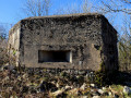
You’ll come to a concrete section, where you can carefully look through the embrasure by leaning forward slightly. Walk back up about ten paces to the right, then head down towards another opening. Climb down into the scree. You’ll reach an open area and turn right; the path passes beneath the rocks of the firing post.
Turn right onto the small tarmac road which joins Rue de la Vue des Alpes at a hairpin bend. Follow it uphill to the right to return to the car park (S/E).
 The route includes ledge paths and unsecured viewing points. The paths are rocky and slippery in places. Sturdy footwear is essential and the use of walking poles is recommended.
 Visorando Member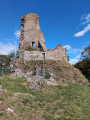

 Moderate