The Montfaucon viewpoint

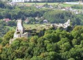
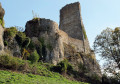
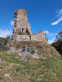
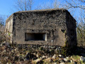
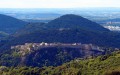
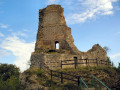
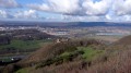
The Montfaucon viewpoint over the Doubs valley, the Citadel, the Jura mountains and, on a clear day, Mont Blanc. Fort Woirol, its anti-aircraft batteries, its redoubts and, finally, a lovely view of the ruins of the feudal castle.

Details

724806
Creation:
Last update:
Last review:
  • Walking
    Activity: Walking
  • ↔
    Distance: 1.90 mi
  • ◔
    Average duration: 1h 00 
  • ▲
    Difficulty: Easy

  • ⚐
    Back to start: Yes
  • ↗
    Ascent: + 138 ft
  • ↘
    Descent: - 131 ft

  • ▲
    Highest point: 1,982 ft
  • ▼
    Lowest point: 1,834 ft

Photos

Description of the walk

Car park at the viewpoint at the top of the village of Montfaucon, Rue des Alpes. Yellow-blue markings.

(S/E) Enjoy the view from the viewpoint and walk down the road for about 200 metres, then take the path on the left after the high-voltage transformer, following the yellow-blue markings. At the clearing, continue straight on along the ridge to reach the entrance to Fort Woirol.

(1) You’ll reach a small tarmac road; 100 metres before the entrance, turn right. You’ll soon come across a ‘Military Ground’ sign; turn left into the field to discover the three bases where the anti-aircraft batteries once stood. At the third one, take the path on the right, heading into the woods, which leads you to the observation post.

(2) Set off again along the path opposite to reach the fort’s ditches, which you go round by turning right, continuing to follow the ditches to the unsecured viewpoint overlooking the feudal castle.

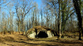
(3) Shortly afterwards, at the meadow, head up to the right along the edge. About thirty paces past a marker, don’t miss the path that branches off to the right into the woods. Pass in front of the redoubts and join a wide stony path. Take care if you visit them, the ceiling is low!

(4) Then head off to the right. At the fork, continue straight on, following the VTT113 cycle route to the small tarmac road, which you take to the left until you reach the barrier, then turn right to the car park. (S/E)

Waypoints

  1. S/E : mi 0 - alt. 1,965 ft - Montfaucon viewpoint car park
  2. 1 : mi 0.38 - alt. 1,959 ft - Fort Woirol
  3. 2 : mi 0.58 - alt. 1,972 ft - Viewpoint
  4. 3 : mi 0.99 - alt. 1,834 ft - Viewpoint overlooking the feudal castle
  5. 4 : mi 1.34 - alt. 1,952 ft - Redoute
  6. S/E : mi 1.9 - alt. 1,965 ft - Montfaucon viewpoint car park

Notes

The route includes ledge paths and unsecured viewpoints. The paths are rocky and slippery in places. Sturdy footwear is essential and the use of walking poles is recommended.


Reviews and comments

4.2 / 5
Based on 6 reviews

Reliability of the description
4 / 5
Ease of following the route
4 / 5
Route interest
4.7 / 5
Babibelle
Babibelle

Overall rating : 4 / 5

Date of your route : Oct 17, 2021
Reliability of the description : ★★★★☆ Good
Ease of following the route : ★★★☆☆ Average
Route interest : ★★★★★ Very good
Very busy route : Yes

This route is interesting, but… In fact, it’s very busy in some areas and very quiet in others along the route itself. As a result, there are loads of paths that cross, branch off and go in all directions, but the route described in the guide isn’t always very clear. So we end up retracing our steps quite a bit.

Machine-translated

Tiffy03
Tiffy03

Overall rating : 3 / 5

Date of your route : May 21, 2020
Reliability of the description : ★★☆☆☆ Disappointing
Ease of following the route : ★★★☆☆ Average
Route interest : ★★★★☆ Good
Very busy route : No

It was our first hike... unfortunately, right from the start we missed the path on the left after the ‘military zone’ sign, so we ended up just wandering about but didn’t get to see everything we’d planned 😕

Machine-translated

tonnoguh
tonnoguh

The path does indeed continue past the substation and is even signposted!
Claude

Machine-translated

Emoine
Emoine

Overall rating : 3.3 / 5

Date of your route : Sep 09, 2017
Reliability of the description : ★★★☆☆ Average
Ease of following the route : ★★★☆☆ Average
Route interest : ★★★★☆ Good

Hello,

The starting directions were a bit odd, as after 200 metres it said to turn left onto a path that doesn’t exist at that point – there’s only the main road. I wondered if the ‘left’ sign wasn’t actually meant to be ‘right’ and before rather than after the transformer (which is easily identifiable), but I didn’t check after the walk.

Otherwise, it was a nice little walk, even though the route I took was different due to a mistake at the start...

Emoine

Machine-translated

MaryRando2017
MaryRando2017

Overall rating : 5 / 5

Date of your route : Sep 17, 2017
Reliability of the description : ★★★★★ Very good
Ease of following the route : ★★★★★ Very good
Route interest : ★★★★★ Very good

A lovely walk with beautiful scenery

Machine-translated

tonnoguh
tonnoguh
• Edited:

Don’t worry, I’ve had my fair share of knocks too. I’ll make a note of it for the absent-minded among us.
Best regards
Claude

Machine-translated

Baleinette
Baleinette

Overall rating : 5 / 5

Date of your route : Aug 25, 2017
Reliability of the description : ★★★★★ Very good
Ease of following the route : ★★★★★ Very good
Route interest : ★★★★★ Very good

A really lovely walk, with stunning views – easy and quick. A small suggestion for the description: put the warning about the redoubts just before the relevant section in the text ^^ Some very clever people (like me) might not read the paragraph all the way through and end up bumping into the redoubts rather painfully ^^
Thanks for suggesting this walk (there are even blackberries as a bonus)!

Machine-translated

46497477
46497477

Overall rating : 5 / 5

Date of your route : Aug 28, 2017
Reliability of the description : ★★★★★ Very good
Ease of following the route : ★★★★★ Very good
Route interest : ★★★★★ Very good

Beautiful views, very pleasant

Machine-translated

Other walks in the area

For more walks, use our search engine .

The GPS track and description are the property of this route's author. Please do not copy them without permission.