Country:
 City:
City:


Starting car parks in the village centre (town hall, post office).
(S/E) From the post office car park, head towards and take Avenue des Petites Landes (north-east). Turn left at the second road onto Chemin de Duran and follow it to the end.
(1) Turn right onto Chemin du Hurouqué, which becomes a track and gradually turns north-west, winding through the woodland and along the edge of the fields.
(2) At the crossroads, turn left. Further on, turn right then left to return to the vicinity of the village.
(3) Turn right onto the Chemin des Arroubis (road). At the end, turn left onto the Route de Beillons.
(4) At the hamlet of Le Poteau, at the three-way junction, turn right onto Route de la Halte. Continue straight on until you reach the junction where the road meets two paths.
(5) Turn left. At the end of the path through the woodland (elevation 118), turn right onto the road towards a poultry farm, Route de Bostens.
(6) At a place called Le Progrès, just after the farmyard, turn left onto Route de Lescoupé. Continue almost straight on, passing several airials. Follow the high fence of the Wildlife Rescue Centre until you reach Route de Mont de Marsan (D933N).
(7) Cross the road carefully and take the path opposite. Keep to the left after 20 metres, then head south-east. Pass the tracks on your right and left and walk past the ruins at the hamlet known as Le Mouliot.
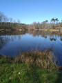
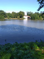
(8) Keep left at the pond (Moulin de Pouydesseaux, Centre Jean Rostand, with a picnic area, Presqu’île des Aulnes). Quickly move away from the pond to the right, up a slight incline, heading east. At the next junction, turn left (north-east) onto the DFCi track no. 204.
(9) Turn left onto the Route de Sainte Foy, heading due north.
Pass the access road to the Jean Rostand Interpretation Centre.
Then pass several properties, including Le Marcadé, until you reach the end of a left-hand bend where you can see the D 933n.
(10) Turn right past the metal-clad hangar. On this track, make a wide circular loop around the Grand Ruste estate.
At the crossroads of four paths, turn left towards the east, then north, passing through several airials(*).
Pass through Camelong and go round the Petit Ruste on the left, continuing on to reach the D 933N. Then turn left.
(11) Turn right immediately at the hamlet known as Le Camp (take care when crossing the Route de Mont-de-Marsan).
Continue along this wide track, which becomes the Route du Treytin, until you reach the roundabout.
Keep to the right to return to your starting point (S/E).
 Visorando Member
 Easy
Easy 
 Tourism professional