Country:
 City:
City:


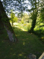
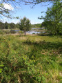
Large car park at the entrance to the Massy site, after leaving the D392.
(S/E) With your back to the large electricity pylon, and between the cars (especially at weekends), head west and take the track that follows the fitness and educational trail (track not shown on the map). Walk amongst the fitness equipment and information boards about the flora.
(1) Where the fitness trail meets the signposting (Blue Rectangle), turn right. Continue straight on along the path which leads into Gaillères and runs alongside the cemetery on the right-hand side. Turn right, then left onto Route de Villeneuve (D392). Pass the town hall and the orienteering information sign.
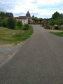
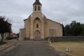
(2) At the crossroads at the foot of the church, continue to the right and cross the Ruisseau de l’Église. At the Fork in the road, take the Chemin de Hourcata on the left, which runs parallel to the stream. Cross the stream and follow the Chemin de Lacoume West-North-West.
(3) Just before the Route du Marsan (D392), turn left onto the track. rejoin the road and follow it as it continues ( with caution). At the end of the crash barrier, turn right to cross the road carefully. Enter the Quartier de Claous and take the cul-de-sac of the same name.
(4) Turn left onto Chemin de Bellevue. After the barriers, turn left again. Walk across the fields. After about 350 metres, the path turns right. Pass some buildings and continue along the edge of the woods.
(5) Follow a track to the left. After about a hundred metres, turn right onto Chemin de Gouarrigues and follow it straight on (south-west). At the end, turn left twice and you’ll arrive at the hamlet of Coucut.
(6) At the first houses, turn right to cross the road. Then follow the Route de Bougue to the right (signposted GR®654-West). At the Fork in the road, turn left onto the Route de Saint-Cricq.
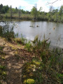
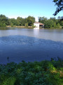
(7) At the next Fork in the road, leave the road and turn left onto the Chemin de Massy, heading towards the pond of the same name. Turn right between the picnic and play areas, and continue to a building (available for hire, equipped with a kitchen and barbecue).
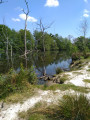
(8) Carry on straight ahead, along the boundary of a large estate. Walk through an area that is sometimes damp on the well-marked path alongside the Ruisseau du Penin. Pass the tip of a pond, turn right, then ignore a path branching off to the left.
(9) At the junction, carry on straight ahead. Follow the Ruisseau du Penin and then the Étang de Lamoulasse. You’ll come out onto the Route de Saint-Cricq; follow it to the left. Cross the bridge over the Ruisseau du Penin.
(10) Turn left at the first track, which climbs slightly. Continue alongside a very deep ditch. Walk for some time between the boundaries of the fields belonging to the farms known as Le Mougat and Ricaou and the edge of the forest.
(11) Turn right, moving away from the fields, until you reach a large farm shed with a roof covered in solar panels. Then follow the Route de Villeneuve to the right and, after about 200 metres, take a clearly marked track leading to the Route de Sainte Foy. Then first turn right then left, and continue along a track that runs alongside a beautiful private estate.
(12) Just before a gate, turn left onto a small, picturesque path that runs alongside the Étang de Lassus and climbs slightly. You’ll come out onto Route de Sainte-Foy; turn right. At the end, turn right onto Route de Villeneuve (D392). After about 200 metres, turn left towards the car park at the Site de Massy (S/E)
 Visorando Member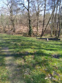
 Moderate
 Tourism professional