Country:
 City:
City:


Start from the Étang de Brocas car park.
(S/E) Leave the Étang de Brocas car park, heading towards Garein, following the D353, and exit the village. Continue as far as the businesses (transport and garage).
(1) After the second business, turn right at the Y-junction, into the woodland. Continue almost straight on for a long distance until you reach a road.
(2) Cross the road and continue along the sandy track.
(3) At the four-way crossroads, turn left. Carry on until you reach the D353.
(4) Cross this road, and opposite, take the poorly marked path, which isn’t always easy to follow. Through the vegetation, on your right, a high-voltage power line will guide you towards it.
(5) Turn right onto this wide, well-trodden track. At the DFCI406 warning sign and before a pylon, continue to the left.
(6) On this track through the pine trees, carry on to the second junction.
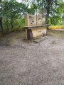
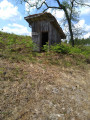
(7) Turn left at the four-way junction and you’ll very quickly reach the “Sauveté de Gabarchet”. Take the opportunity to have a break. Go round the hut on the left and continue along this path heading due east.
(8) Turn right onto the small road, then left at the first wide track.
(9) At the yellow schist track, turn left.
(10) Leave this wide track, turning right just before the Bario stream, on a slight incline.
(11) At the T-junction, turn left. At the end of the path, turn right.
(12) At the four-way junction, turn left, join the wide, compacted track and walk on until you reach a hairpin bend. Pass under the high-voltage power line heading north.
(13) Continue to the right along the sandy path beneath the pine trees, until you reach the edge of the pine forest. In front of the houses, keep to the right until you reach the campsite. Go round the hill to the left and return to the starting car park (S/E).



 Visorando Member
 Easy
Easy