The Clears of Sales

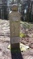
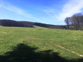
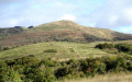
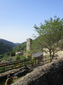
An easy route, to the west of Sales, in the southern part of the Bois de Vaissières. With its varied landscapes, it will appeal to lovers of unspoilt countryside, offering the chance to discover numerous Occitan crosses.

Details

13156624
Creation:
Last update:
Last review:
  • Walking
    Activity: Walking
  • ↔
    Distance: 5.09 mi
  • ◔
    Average duration: 2h 45 
  • ▲
    Difficulty: Easy

  • ⚐
    Back to start: Yes
  • ↗
    Ascent: + 512 ft
  • ↘
    Descent: - 492 ft

  • ▲
    Highest point: 3,120 ft
  • ▼
    Lowest point: 2,746 ft

Description of the walk

Start from the village of Sales, at the small square at the foot of the slender iron cross.
Yellow markings and regional signposts, sometimes shared with the red-and-white markings ofthe GR®7and the red-and-yellow markings ofthe GRP® Haute Vallée du Thoré.

Yellow markings

(S/E) From the foot of the cross, on your left, head along the road that passes in front of the house, heading north-west. After about fifty metres, at the Y-junction, veer right onto the wide Chemin du Chalet. Follow the track, ignoring all the paths that join it, until you reach the junction at the entrance to Farail.

(1) Turn right, stay on the track and pass a water collection point. When you reach the inverted Fork in the road, carry on straight ahead. Look for a path on the right after the wide bend.

Unmarked

(2) Cut right onto the unmarked path and head towards an X-junction. Keep to the left of this path, which rejoins the wide track,PR® Clairières de Sales.

Yellow markings

(3) Turn right, then, after about 300 m, leave the track and head straight on along a dirt track. You’ll come out onto a white track. Turn left onto the track. Continue for about 200 m.

Red and white markings forthe GR®7and red and yellow markings forthe GRP® Haute Vallée du Thoré

(4) Head left along the wide grassy path that appears, signposted ‘Clairières de Sales’. Walk through the woodland until you reach the entrance to Ravaillé.
Head left towards Ravaillé, without actually going into the village. Immediately turn right onto a tree-lined path which ends on the tarmac in front of Baylé Farm. A thick concrete cross marks the entrance to the farm. Continue left for about fifty metres.

(5) Follow the wide dirt track, Chemin du Sante. Cross a ford made of flat stones. Continue to the T-junction.

(6) Turn right to reach the hamlet of Lebrat. In front of the first house, head down the narrow path on the left until you reach the tarmac road.

(7) Turn left, then, at the end of the road, continue along the dirt track. Ignore a side road on the right and you’ll come to an inverted Y-junction.

(8) Keep to the path straight ahead until you reach Farail.

(9) Just before Farail, go round the whole group of houses. The road takes you back to the hamlet of Sales and its small starting point (S/E).

Waypoints

  1. S/E : mi 0 - alt. 2,746 ft - Small clearing at the entrance to the village
  2. 1 : mi 0.92 - alt. 2,808 ft - Junction
  3. 2 : mi 1.36 - alt. 2,799 ft - Junction onto a path
  4. 3 : mi 2 - alt. 2,959 ft - Resumption of the PR
  5. 4 : mi 2.77 - alt. 3,110 ft - GR7 and GRP Upper Thor Valley
  6. 5 : mi 3.37 - alt. 2,851 ft - Chemin du Sante
  7. 6 : mi 3.71 - alt. 2,858 ft - Junction
  8. 7 : mi 3.95 - alt. 2,776 ft - Lebrat – Junction
  9. 8 : mi 4.45 - alt. 2,858 ft - Y-junction
  10. 9 : mi 4.71 - alt. 2,785 ft - Farail
  11. S/E : mi 5.09 - alt. 2,746 ft - Small clearing at the entrance to the village

Notes

From (2) to (3), you can stay on the wide white track, marked in yellow.

Another walk starting from Sales, already published on Visorando.

Always be cautious and plan ahead when you're outdoors. Visorando and the author of this route cannot be held responsible for any accidents occurring on this route.

The GR® and PR® markings are the intellectual property of the Fédération Française de Randonnée Pédestre.

Reviews and comments

4.7 / 5
Based on 2 reviews

Reliability of the description
4.5 / 5
Ease of following the route
5 / 5
Route interest
4.5 / 5
User 15535614

Overall rating : 4.7 / 5

Date of your route : Jul 30, 2025
Reliability of the description : ★★★★☆ Good
Ease of following the route : ★★★★★ Very good
Route interest : ★★★★★ Very good
Very busy route : No

A beautiful, easy and pleasant hike with lovely sections through the woods. Ideal in warm, sunny weather

Machine-translated

MICMUR
MICMUR

Overall rating : 4.7 / 5

Date of your route : Apr 10, 2023
Reliability of the description : ★★★★★ Very good
Ease of following the route : ★★★★★ Very good
Route interest : ★★★★☆ Good
Very busy route : No

A peaceful walk with a fairly varied route, alternating between footpaths and wide tracks. We just weren’t paying enough attention at one point and missed the footpath detour. A shame for us. The footpath sections are lined with magnificent beech trees. However, two hamlets are more like rubbish dumps than havens of peace, but we passed through them quickly. No problem. Thank you for this interesting route.

Machine-translated

Other walks in the area

For more walks, use our search engine .

The GPS track and description are the property of this route's author. Please do not copy them without permission.