The Stations of the Cross at Saint-Saire

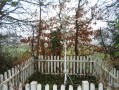
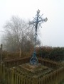
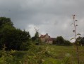
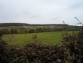
This route takes you through the Pays de Bray around Saint-Saire, along small country lanes and, on the return journey, along a section of the Avenue Verte. During the route, you’ll discover four of the seven wayside crucifixes in Saint-Saire.

Details

927826
Creation:
Last update:
Last review:
  • Walking
    Activity: Walking
  • ↔
    Distance: 6.23 mi
  • ◔
    Average duration: 3h 10 
  • ▲
    Difficulty: Easy

  • ⚐
    Back to start: Yes
  • ↗
    Ascent: + 387 ft
  • ↘
    Descent: - 397 ft

  • ▲
    Highest point: 604 ft
  • ▼
    Lowest point: 318 ft

Photos

Description of the walk

The route starts from the car park at the Saint-Saire village hall, Rue des Cloutiers.

(S/E) As you leave the car park, turn right onto Rue des Cloutiers and continue along this street until you reach the junction opposite the church.

(1) At the crossroads, turn right and take the first road on your right, Route de la Côte Pavée. Continue along Route de la Côte Pavée, which climbs steeply at first and then more gently. At the top, you’ll reach the crossroads by the Red Cross wayside cross.

(2) At the crossroads, turn left onto Route de la Sablière and carry on straight ahead until you reach the crossroads in the hamlet of Le Guide.

(3) Turn right onto the Route de Sommery (D7). Follow the D7 for about 1.7 km until you reach the junction with the Route des Bois Illards at the wayside shrine, the Croix des Bois Illards.

(4) Leave the D7 and turn left onto the Route des Bois Illards. Follow this road down to the junction with the Route de la Rosière.

(5) At the junction, turn left onto the Route de la Rosière. Continue along this road until you reach the junction with the Chemin des Calluets, near the wayside cross, the Croix des Calluets.

(6) At the wayside cross, carry on straight ahead along the Route de la Rosière, which climbs towards the hamlet of Le Guide. Once you reach the hamlet, join the Route de Sommery (D7)

(3) Turn right onto the D7. Continue along this road and, after the last houses of the hamlet on your left, pass the fourth wayside cross, the Blue Cross. Head down the Route de Sommery to the junction by the church of Saint-Saire.

(1) Turn right onto Rue du Moulin. Pass the old mill on your left. Continue to the junction with Avenue Verte.

(7) Take Avenue Verte on your left. Carry on straight ahead, passing the restored old railway station.
Leave Avenue Verte on your left immediately after passing the old station. Cross the car park, which leads onto a road; take this road on your left after crossing the car park.

(8) Carry on along Rue de la Gare to reach the centre of Saint-Saire at the church.

(1) At the crossroads by the church, turn right onto Rue des Cloutiers to reach the car park for the village hall (S/E).

Waypoints

  1. S/E : mi 0 - alt. 381 ft - Car park at the village hall
  2. 1 : mi 0.11 - alt. 367 ft - The crossroads by the church
  3. 2 : mi 0.86 - alt. 574 ft - Turn right onto Route de la Sablière
  4. 3 : mi 1.05 - alt. 587 ft - The Guide, on the right
  5. 4 : mi 2.13 - alt. 505 ft - The Croix des Bois Illards, on the left
  6. 5 : mi 2.93 - alt. 400 ft - Turn left onto Route de la Rosière
  7. 6 : mi 3.23 - alt. 433 ft - The Croix des Calluets
  8. 7 : mi 5.54 - alt. 325 ft - The Avenue Verte is on the left after the - Béthune (rivière) - Affluent de l'Arques
  9. 8 : mi 5.97 - alt. 335 ft - Rue de la Gare
  10. S/E : mi 6.23 - alt. 381 ft - Car park at the village hall

Notes

This route is entirely on tarmac; you may wish to cycle it.

Worth a visit

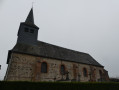
The church of Saint-Saire with its crypt.
The themed gardens at Neuville-Ferrières.
The Avenue Verte.
Artmazia in Massy.

Reviews and comments

4.3 / 5
Based on 3 reviews

Reliability of the description
4.3 / 5
Ease of following the route
4.7 / 5
Route interest
4 / 5
Nesle76270
Nesle76270

Overall rating : 3.7 / 5

Date of your route : Feb 23, 2023
Reliability of the description : ★★★★☆ Good
Ease of following the route : ★★★★☆ Good
Route interest : ★★★☆☆ Average
Very busy route : No

Nice, but it’s all tarmac. I think I’ll do it again, taking the one little path (marked ‘hiking trail’) on the way back

Machine-translated

Martin Ader
Martin Ader

Overall rating : 5 / 5

Date of your route : Jun 23, 2021
Reliability of the description : ★★★★★ Very good
Ease of following the route : ★★★★★ Very good
Route interest : ★★★★★ Very good
Very busy route : No

A lovely route through the Pays de Bray; as it consists of two circular loops, it can therefore be done in two stages.

Machine-translated

robal1
robal1

Overall rating : 4.3 / 5

Date of your route : Oct 20, 2018
Reliability of the description : ★★★★☆ Good
Ease of following the route : ★★★★★ Very good
Route interest : ★★★★☆ Good

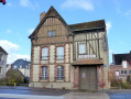
A lovely walk with beautiful rolling countryside (in the Pays de Bray), pretty houses (the village of Saint Saire is very charming), and the little river and old mill offer a lovely view.
The walk is entirely on tarmac, so make sure you wear suitable footwear to avoid blisters.
The 10 km were completed in 2 hours 17 minutes.

Machine-translated

Other walks in the area

For more walks, use our search engine .

The GPS track and description are the property of this route's author. Please do not copy them without permission.