Country:

 City:
City:


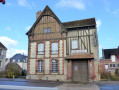
(S/E) Parking and starting point: Place de la Gare, at the former Neufchâtel railway station, now a crêperie. Head towards Avenue Verte on the side of the station platform. With your back to the station, turn right; at the first barrier, cross the road and continue straight ahead until you reach a second T-junction.
(1) Leave Avenue Verte by turning left onto Rue Sainte-Claire, then take the first right onto Impasse Rue Sainte-Claire. At the end of the cul-de-sac, cross the ford and continue straight ahead along Chemin de Sainte-Claire until you reach a T-junction. Turn left onto Route de Bully and continue to the church in the village of Quièvrecourt.
(2) At the junction just before the church, turn right onto Route d’Esclavelles. Follow the road uphill, with the church on your left.
(3) After the last house, turn into the first lane on the left, Chemin de Marie-Cloche. Continue to the T-junction with the road, Route de Rouen.
(4) Turn left onto Avenue des Canadiens, pass ‘Les Tourelles’ on your left and, after about 500 metres, turn right into the car park at Plan d’Eau les Aulnes. Cross the car park, go over the bridge and turn immediately left to cross a second bridge over the River Béthune.
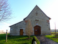
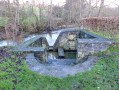
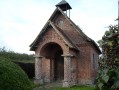
(5) After the bridge, turn onto the path leading off to the right which runs along the riverbank. Pass the Sainte-Radegonde spring on your right and turn left just before the fire station. Continue to the Sainte-Radegonde Chapel and walk round it to see how the reconstruction work is progressing.
(6) Retrace your steps back to the riverbank and turn left. Pass the fire station on your left and follow the riverbank to the bridge on Rue du Moulin Bleu (D1).
(7) At the bridge, turn left, pass the first T-junction and continue to the T-junction with the traffic lights.
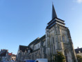
Turn right onto Boulevard Maréchal Joffre, ignore three left-hand turns and turn left onto Rue Poissonnière. Pass the T-junction. At the church, turn left to walk past the entrance to the building on Place Notre-Dame. At the main road, cross over and turn right.
(8) Turn left onto Rue du Pot d’Étain and turn right onto the square, just before the right-hand bend. Walk between the buildings of the Centre Robert Auzelle. At the road, with the town hall on your right, cross over and continue straight ahead, climbing the steps in front of the Théâtre Robert Auzelle. At the top, continue uphill to the left along Rue du Vieux Château to reach the Esplanade of the same name. Then retrace your steps and follow Rue du Vieux Château to the junction with the main road a few metres further on.
(9) Cross the road, continue straight ahead and take the first right onto Rue du Marché. At the T-junction, turn right and then immediately left. Walk down to the church, turn left to go round the back of the building. Turn right, walk alongside the church on your right and, at the end, turn right onto Place Notre-Dame and then immediately left to walk down the high street.
(10) Just before the roundabout, turn left, cross the car park and, when you reach the road, turn right. At the T-junction, cross the road and continue straight ahead onto Rue Pierre Corneille. At the end of the street, veer right and then immediately right again before the bridge. Cross Square Saint-Pierre. At the end, turn left and cross the road. At the foot of the museum, head right until you reach the roundabout and turn left onto Rue du Général De Gaulle. Turn left onto the first street, Boulevard de Goville. At the T-junction, continue straight ahead and immediately turn right onto Avenue Verte to return to the old station (S/E).



 Visorando Member

 Moderate