The Béthune Valley between Beaussault and Compainville

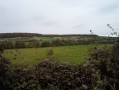
This walk will take you from Beaussault to Compainville, following the River Béthune through the Bray countryside.

Details

866808
Creation:
Last update:
Last review:
  • Walking
    Activity: Walking
  • ↔
    Distance: 7.00 mi
  • ◔
    Average duration: 3h 40 
  • ▲
    Difficulty: Moderate

  • ⚐
    Back to start: Yes
  • ↗
    Ascent: + 545 ft
  • ↘
    Descent: - 568 ft

  • ▲
    Highest point: 761 ft
  • ▼
    Lowest point: 417 ft

Photos

Description of the walk

Park in the car park in front of Beaussault Town Hall.

(S/E) Opposite the town hall, leave the car park on the right and continue along Rue Principale heading south-west.

(1) Turn into the first street on your left, Chemin à l’Eau, and follow this street to the T-junction.

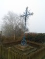
(2) Turn left onto Rue de la Croix Colos, take a sharp right as the road bends, and carry on straight ahead until you reach the junction with the D135 at the wayside cross.

(3) Cross the D135, then take Impasse du Moulin de Glinet opposite until you reach the second crossroads.

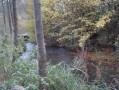
(4) Keep to the right to join the Chemin de Glinet. Pass the Moulin Glinet site – now a landscaped park – on your left and cross the River Béthune via the footbridge linking Beaussault to Compainville. Continue to the end of this track, which leads to the D13 (Route de Gaillefontaine).

(5) Turn left onto the D13 and carry on to the crossroads.

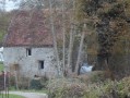
(6) Take the road on your right, Chemin du Bas Bénard, and note the Moulin du Trépied on your left as you pass it. Continue along this road until you reach a junction of roads and tracks.

(7) Take the Chemin des Mûres on your right, which climbs towards Mont Bénard and becomes the Chemin du Mont Bénard. Carry on to the end of this track, which alternates between left and right-hand bends before joining the D13 (Rue Olivier de Bracquemont) at the end.

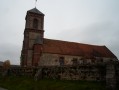
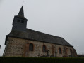
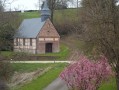
(8) Once on the road, turn right and head downhill to Compainville Church, which is at the junction with the Route de Louvicamp.

(9) Turn left onto Route de Louvicamp. Follow the cemetery wall and carry on straight ahead along this road towards Louvicamp for 1,500 metres until you reach a junction, about twenty metres before the D35.

(10) Take the small road on your right, Chemin des Carrières à Louvicamp (Mesnil Mauger). Carry on straight ahead along this road, cross over the Béthune and follow the stream before joining the D135 at the sewage treatment works.

(11) Cross the D135 and follow it on your right for 150 metres. Take the first road on your left, Rue de la Croix Colos, until you reach the junction with Chemin à l’Eau.

(2) Turn left and continue along this small road until you reach the junction with Rue Principale, which you take on your right to reach the car park in front of the town hall (S/E).

Waypoints

  1. S/E : mi 0 - alt. 453 ft - Car park in front of the town hall
  2. 1 : mi 0.12 - alt. 449 ft - Chemin à l’Eau on the left
  3. 2 : mi 0.31 - alt. 440 ft - Crossroads at the end of the circular loop
  4. 3 : mi 0.92 - alt. 518 ft - D135, opposite on Impasse du Moulin de Glinet
  5. 4 : mi 1.14 - alt. 509 ft - Glinet path on the right, towards the - Béthune (rivière) - Affluent de l'Arques
  6. 5 : mi 1.9 - alt. 591 ft - D13, turn left
  7. 6 : mi 2.5 - alt. 472 ft - Chemin du Bas Bénard on the right
  8. 7 : mi 2.91 - alt. 571 ft - Chemin des Mûres on the right
  9. 8 : mi 3.79 - alt. 676 ft - D13 on the right
  10. 9 : mi 4.46 - alt. 561 ft - Crossroads, turn left onto the Louvicamp road
  11. 10 : mi 5.4 - alt. 476 ft - Chemin des Carrières on the right
  12. 11 : mi 6.48 - alt. 430 ft - D135, turn right
  13. S/E : mi 7 - alt. 453 ft - Car park in front of the town hall

Notes

It’s a shame that the landscaped park at the Moulin de Glinet site isn’t being looked after.

Worth a visit

Places of interest in Beaussault:
* Saint-Germain Church in Beaussault
* Saint-Jean-Baptiste Chapel in Grattenoix (hamlet of Beaussault)
* Saint-Sauveur Chapel in Toupray (hamlet of Beaussault)
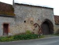
* Ruins of the old fortified castle with its gatehouse; private property

Places of interest in Compainville:
* Saint-Pierre Saint-Marc Church
* Restored former communal washhouse
* Landscaped park on the archaeological site of the Moulin de Glinet, on the walking trail
* Trépied Mill

Reviews and comments

4.8 / 5
Based on 2 reviews

Reliability of the description
4.5 / 5
Ease of following the route
5 / 5
Route interest
5 / 5
Martin Ader
Martin Ader

Overall rating : 5 / 5

Date of your route : Jun 13, 2021
Reliability of the description : ★★★★★ Very good
Ease of following the route : ★★★★★ Very good
Route interest : ★★★★★ Very good
Very busy route : No

A superb walk in the Bray region, over rugged and varied terrain.
Not suitable for pushchairs due to very rough dirt tracks

Note: there’s a table with benches between points 1 and 2

And on the way to Compainville, a bus shelter with a bench – a welcome feature in case of rain

Machine-translated

CatherineCouillet
CatherineCouillet

Overall rating : 4.7 / 5

Date of your route : Apr 07, 2018
Reliability of the description : ★★★★☆ Good
Ease of following the route : ★★★★★ Very good
Route interest : ★★★★★ Very good

A lovely walk with a mix of uphill and downhill sections.
Best done in dry weather. The Glinet path is very muddy, and in places is barely passable.
(Don’t forget to take a few minutes to visit the mill).

Machine-translated

Other walks in the area

For more walks, use our search engine .

The GPS track and description are the property of this route's author. Please do not copy them without permission.