The Teilhet and Lhéris huts from Campan

A lovely, easy walk, but a good sense of direction is essential in the mountain pastures.
This walk should only be undertaken when there is no fog; it offers the chance to explore little-visited valleys.

Details

n°155220
Creation:
Last update:
Last review:
  • Walking
    Activity: Walking
  • ↔
    Distance: 7.81 mi
  • ◔
    Average duration: 5h 50 
  • ▲
    Difficulty: Difficult

  • ⚐
    Back to start: Yes
  • ↗
    Ascent: + 2,530 ft
  • ↘
    Descent: - 2,546 ft

  • ▲
    Highest point: 4,318 ft
  • ▼
    Lowest point: 2,139 ft
  • ⚐ Country: France
  • ⚐
    Area: Pyrenees
  • ⚐ City: Campan (65710)
  • ⚑
    Start/End: N 43.01675° / E 0.179248°
  • ❏
    IGN map(s): Ref. 1746SB, 1747ET
  • Hour-by-hour weather

Photos

Description of the walk

Access: From Bagnères-de-Bigorre, take the D935 towards the mountain passes. Pass through Beaudéan and arrive at Campan. Turn left towards the post office and the “Bar de l’Adour” on Rue de Lesponne. Park opposite or just next to it in a car park.

(S/E) Start. Head down towards the Adour via the Chemin du Pont Noir. Pass by the fish farm. Cross the first bridge and continue on to cross a narrower bridge over the Adour.

(1) Turn right (south-east) and go through a gate, which you must close behind you. Keep to the right bank and stay on level ground above the Adour. After passing above the sports ground (below), the path begins to climb into the forest.

(2) Beware of a confusing fork with five directions, situated on a small, open plateau (835m). Look for the barely marked path on the left, which climbs steeply through the coppice heading due north.
N.B. The other paths are: straight ahead to Ordincède, to the right to Chapelle Saint-Roch, and to the left to Le Teilhet, which is the path we will take on our return.
Now simply follow this path, which is barely marked at the very start and very little used. This path runs above the “Coume d’Articaou”. After several hairpin bends and a steep slope, the path emerges onto a “raillère” (a steep, stony slope in the Pyrenees) and reaches a platform at 1,020 m (EDF tunnel).

(3) Window No. 8, which corresponds to one of the tunnels used to carry water to the EDF power station at Beaudéan. Head right, due south, along a flat stretch of an old path overgrown with vegetation.

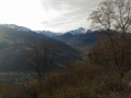
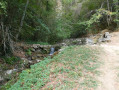
(4) At a junction in an open area with views across the whole valley and the Bigourdan mountains, turn left and head due north. The stony path climbs steeply and enters the forest. It then turns more towards the north-east. Pass the Coume Hérède. Continue climbing. Cross a stream that is very often dry. After a few hairpin bends, you’ll reach a mountain pasture.
The IGN map is inaccurate; the Teilhet hut is on the left and much higher up. The refuge shown on the map is a closed, private hut

(5) Turn right, heading due east, into the valley floor and climb gently towards the drinking troughs.

(6) Join a well-marked path. Look out for the yellow markings and continue south-east. The path enters the forest and joins a track not shown on the IGN map. Continue along this track, which does not descend. The track becomes a path again. As you emerge from the forest, head for an old, derelict stone hut. Pass to the right of this hut. Continue towards the Cabane du Lhéris.

(7) You’ll reach the hut at the bottom of the valley. A spring feeds the drinking trough next to the hut. To the left is the Casque du Lhéris and, in the distance, the Col du Lhéris.
A well-deserved break here is lovely.
Now turn back and follow the same path you took on the way there until you reach the previous junction.

(6) From here, simply follow the well-trodden path to the right – marked in yellow in places – until you reach the next junction.

(8) Be careful not to take a wrong turn here. Ignore a path on your right heading towards Crastes and a signposted path heading north-west. Ignore the path marked ‘Le Teilhet’.
Climb up a steep path that heads left, due west. Stay well above the forest.
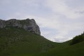
The summit of Le Téilhet is visible. You can reach it by following paths through the mountain pastures due west; this is completely safe.

(9) From Le Teilhet (1,287 m), head down towards the actual Cabane du Téilhet – which has been restored and is well-maintained – heading due east.

(10) Continue due east, following the markings which lead into the hollow of the mountain pasture.

(5) Turn right and follow the path back along the route you took on the way up until you reach the junction.

(4) Carry on straight ahead, heading down this wide, very stony path.

(11) At the crossroads, turn right and head down this path through the woodland. You’ll come out onto a fairly wide path.

(12) Turn right and, after a few metres, you’ll reach the crossroads you passed on the way there.

(2) Carry on straight ahead, following the path in the opposite direction to the way there.

(1). Cross the two bridges and return to the car (S/E).

Waypoints

  1. S/E : mi 0 - alt. 2,156 ft - Rue de Lesponne.
  2. 1 : mi 0.11 - alt. 2,152 ft - Turn right after the bridge over the Adour - Adour (fleuve)
  3. 2 : mi 0.89 - alt. 2,743 ft - On the left, a path that is barely marked at the start
  4. 3 : mi 1.42 - alt. 3,360 ft - To the right, due south
  5. 4 : mi 1.64 - alt. 3,271 ft - To the left, due north
  6. 5 : mi 2.22 - alt. 3,898 ft - To the right, due east
  7. 6 : mi 2.49 - alt. 4,163 ft - Turn right onto the well-marked path
  8. 7 : mi 3.65 - alt. 4,255 ft - Mountain hut
  9. 8 : mi 5.1 - alt. 3,986 ft - Go straight on at the junctions
  10. 9 : mi 5.52 - alt. 4,213 ft - Summit of Téilhet
  11. 10 : mi 5.73 - alt. 4,055 ft - Mountain hut
  12. 11 : mi 6.68 - alt. 3,038 ft - On the right, a path through the undergrowth
  13. 12 : mi 6.88 - alt. 2,779 ft - On the right
  14. S/E : mi 7.81 - alt. 2,156 ft

Notes

Spring at the drinking trough by the Lhéris hut.
Mid-mountain area.
Minimum equipment for a mountain walker.
A packed lunch, two litres of water, and clothing to protect against wind and rain.
A walking stick may prove useful on stony descents.

The route description and map are essential as signposting is sparse and the directions are ‘fanciful’.

Worth a visit

In Campan. You can do a bit of shopping and there are two bars in the village centre. You can take a few photos of the ‘mounaques’.
Campan
The Campan Valley

Reviews and comments

4.7 / 5
Based on 1 review

Reliability of the description
5 / 5
Ease of following the route
5 / 5
Route interest
4 / 5
Noliot65
Noliot65

Overall rating : 4.7 / 5

Date of your route : Jun 10, 2024
Reliability of the description : ★★★★★ Very good
Ease of following the route : ★★★★★ Very good
Route interest : ★★★★☆ Good
Very busy route : No

We went on this hike on 8 June. Regarding Level 2, firstly it states that the path runs above the Coume d’Articaou, whereas we actually took that very path. Secondly, I strongly advise against taking this trail, as it is very rarely used and is full of grass reaching mid-calf height and sometimes higher. This grass was literally teeming with tiny ticks, and every two minutes we had to stop to pick them off our legs, socks, rucksacks and arms. It was a nightmare… what’s more, this path is far less scenic and pleasant than going straight on (towards 12/11/

Machine-translated

Noliot65
Noliot65
• Edited:

We went on this hike on 8 June. Regarding Level 2, firstly it states that the path is above the Coume d’Articaou, whereas that is actually the path we took. Secondly, I strongly advise against taking this path, as it is very rarely used and is full of grass up to mid-calf height and sometimes higher. This grass was literally teeming with tiny ticks, and every two minutes we had to stop to pick them off our legs, socks, rucksacks and arms. It was a nightmare… what’s more, this path is far less scenic and pleasant than going straight on (towards 12/11/4, which we took for the return journey).
Once you reach the Tilhet hut, I strongly recommend carrying on straight for 600 metres to reach the pass and the Casque du Lheris, as the scenery there is magnificent!!
Thank you for sharing this walk!

Machine-translated

EQuinoxe14
EQuinoxe14

Hello
Hike completed in mid-October 2019. Splendid weather, a beautiful view of the valley and the Pyrenees for the first 3 km, followed by the mountain pastures higher up.
We searched in vain for point 3 with its five directions!!!!!!
A stony path on the climb before Le Teilhet.
Thanks for the walk
Ch. D

Machine-translated

LATAPIE JP
LATAPIE JP

A lovely walk undertaken on 30 April 2017 by our walking club, though somewhat marred by gale-force winds which knocked over several of our lighter-built friends. The summit is a promontory offering a magnificent view, with a vertiginous drop, and we stayed well back from the edge for fear of being blown off the cliff.
It was a new experience for the whole group – made up of seasoned mountaineers, mind you – but with the guidebook and the GPX file, we had no trouble reaching the summit.
Thank you for this walk – the details in the guidebook are very accurate.

Machine-translated

Other walks in the area

For more walks, use our search engine .

The GPS track and description are the property of this route's author. Please do not copy them without permission.