The Bois de la Chartre from Oinville-sur-Montcient

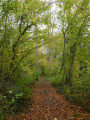
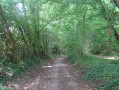
A walk almost entirely through woodland, between the Montcient Valley and the Seine Valley.

Details

31624211
Creation:
Last update:
Last review:
  • Walking
    Activity: Walking
  • ↔
    Distance: 6.61 mi
  • ◔
    Average duration: 3h 40 
  • ▲
    Difficulty: Moderate

  • ⚐
    Back to start: Yes
  • ↗
    Ascent: + 712 ft
  • ↘
    Descent: - 702 ft

  • ▲
    Highest point: 587 ft
  • ▼
    Lowest point: 144 ft

Photos

Description of the walk

Park in the car park at Oinville-sur-Montcient Town Hall on Rue de Gournay.

(S/E) Set off along the Chemin des Moines, which starts in front of No. 24 Rue de Gournay. Take the first path on the right and follow it to the end. You’ll come out onto a street; follow it to the right, passing the Church of Saint-Séverin, and continue for a few metres.

(1) Turn left up Rue de l’École and go to the end. Then turn left onto a track suitable for vehicles and follow it for one kilometre until you reach a crossroads (elevation 126), after entering a woodland.

(2) Turn right and then immediately left; continue for 400 metres until you reach another crossroads.

(3) Turn left onto Chemin de la Ferme des Bois (yellow sign), pass under the power lines and, once you’ve entered the woods, take the first path on the right uphill.

(4) At the top, turn left (Red Cross and White Cross). On the descent, turn right and continue downhill until you reach a fairly wide path.

(5) Follow this path to the left. Leave the woodland. At the crossroads, carry on straight ahead for 100 m.

(6) Then turn right onto a path that runs diagonally. At the next crossroads, continue straight ahead along the Chemin du Marais to Oinville and, on the descent, turn right onto the Chemin Tournant via Fond Val (yellow sign) and follow it until you reach the first house in Juziers.

(7) Head up to the right along the Chemin d’Ablemont to Oinville, ignore the first path on the left, continue uphill through the woods and turn left at the junction. You’ll come to a crossroads with a small road.

(8) Take the Chemin des Granges (tarmac) straight ahead and turn into the first path on the right. At the top of the hill, cross the road and follow the Chemin de la Gueule Rouge straight ahead, which eventually descends quite steeply.

(9) At the bottom of the descent, turn left. After a bend to the right, the track climbs until it joins a wider track. Follow this to the right for 100 m and you’ll come back to a crossroads you’ve already passed on the way there.

(4) Head all the way to the left; when you reach a junction beneath the high-voltage power lines, turn right onto a stony, downhill track. Pass an old motocross track and you’ll come to a junction you’ve already passed on the way out.

(3) Continue straight ahead, following the reverse route of the outward journey, until you reach the town hall car park (S/E).

Waypoints

  1. S/E : mi 0 - alt. 144 ft - Town hall car park
  2. 1 : mi 0.4 - alt. 243 ft - Église Saint-Séverin (Oinville-sur-Montcient)
  3. 2 : mi 0.99 - alt. 417 ft - Bois du Gros Antoine crossroads
  4. 3 : mi 1.26 - alt. 492 ft - Crossroads on the first circular loop
  5. 4 : mi 1.63 - alt. 535 ft - Crossroads on the second circular loop
  6. 5 : mi 1.85 - alt. 479 ft - Fonds d’Herval crossroads
  7. 6 : mi 2.35 - alt. 502 ft - Junction
  8. 7 : mi 3.44 - alt. 348 ft - Entrance to Juziers
  9. 8 : mi 3.86 - alt. 449 ft - Junction with road
  10. 9 : mi 4.74 - alt. 482 ft - Chataignier crossroads
  11. S/E : mi 6.61 - alt. 144 ft - Town hall car park

Reviews and comments

4.1 / 5
Based on 4 reviews

Reliability of the description
4.5 / 5
Ease of following the route
4.3 / 5
Route interest
3.5 / 5
Kaloun
Kaloun

Actually, there is a way to get round the bit of the path covered in brambles and stinging nettles: you need to climb up to the right just before it, and you’ll find a parallel path.

Machine-translated

Maxime768
Maxime768

Overall rating : 3 / 5

Date of your route : Aug 05, 2024
Reliability of the description : ★★★★☆ Good
Ease of following the route : ★★☆☆☆ Disappointing
Route interest : ★★★☆☆ Average
Very busy route : No

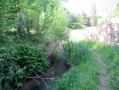
July 2024: poor signposting and route marking; it was very tricky in places. Between points 6 and 7, we had to push through brambles and stinging nettles as there was no way round – the path has all but disappeared there; it was a nightmare for a few metres. A route of little interest.

Machine-translated

Kaloun
Kaloun

Overall rating : 4.3 / 5

Date of your route : Jul 03, 2024
Reliability of the description : ★★★★☆ Good
Ease of following the route : ★★★★★ Very good
Route interest : ★★★★☆ Good
Very busy route : No

Accessible car park, either in front of the town hall or on Rue de Gournay. A pleasant walk; the path is often stony and frequently runs through woodland. There are no particular viewpoints. We had a picnic just before crossing the road to take the Chemin des Granges.
No major difficulties; it can be done in 4 hours, including a picnic, without rushing too much. I’d recommend it.

Machine-translated

ealet
ealet

Overall rating : 4.3 / 5

Date of your route : Mar 14, 2024
Reliability of the description : ★★★★★ Very good
Ease of following the route : ★★★★★ Very good
Route interest : ★★★☆☆ Average
Very busy route : No

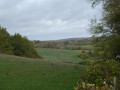
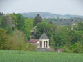
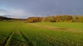
A walk through fields and woods with lovely views of the Vexin; not too many historical sites
A walk best avoided in the days following heavy rain
Thanks to the author for sharing this

Machine-translated

Marc1953
Marc1953

Overall rating : 4.7 / 5

Date of your route : Jun 20, 2023
Reliability of the description : ★★★★★ Very good
Ease of following the route : ★★★★★ Very good
Route interest : ★★★★☆ Good
Very busy route : No

A lovely walk, mostly through woodland. Ideal in hot weather. (June 2023).

Machine-translated

Other walks in the area

For more walks, use our search engine .

The GPS track and description are the property of this route's author. Please do not copy them without permission.