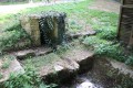
Fountains and wash houses at Mareuil and Mouchedune in Bournaveau

A lovely walking route starting from Bournaveau, offering varied scenery (countryside and woodland). This route allows you to discover some of the traditional architecture of southern Deux-Sèvres, notably at La Baudrière (well, bread oven) and two old wash houses at the Mareuil and Mouchedune fountains.

Details

n°371756
Creation:
Last update:
Last review:
  • Walking
    Activity: Walking
  • ↔
    Distance: 5.52 mi
  • ◔
    Average duration: 2h 40 
  • ▲
    Difficulty: Easy

  • ⚐
    Back to start: Yes
  • ↗
    Ascent: + 135 ft
  • ↘
    Descent: - 105 ft

  • ▲
    Highest point: 558 ft
  • ▼
    Lowest point: 456 ft

Photos

Description of the walk

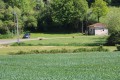
Before setting off on the route itself, we recommend taking a moment to admire the Mareuil washhouse fountain, situated right next to the car park.

(S/E) Head north-east up the road towards L’Épine.

(1) In the centre of the hamlet, turn right onto a farm track. At the next junction of farm tracks, turn left.
When you reach the road, head slightly to the right, leaving the road on your left which leads back to L’Épine.
At the next T-junction (triangular), take the farm track straight ahead, which is a tree-lined lane. This farm track joins the D305 road near the hamlet of La Corbillière.

(2) Where the track joins this road, turn left (Caution: this road is quite busy). Ignore the first track on the right leading to the farmyard at La Sauvagère, and instead take the road on the right about a hundred metres further on.
Pass through La Sauvagère and, at the T-junction immediately afterwards, turn left. The fairly shaded track leads to a crossroads with six paths.

(3) Continue along the track straight ahead, ignoring two tracks on the left and two on the right. The track runs alongside the woodland on the right and a field on the left. Follow it until it joins a small road. Turn right onto the road which runs alongside the Bois Charbonnier and which, a little further on, enters the Bois de la Garde.

(4) After three to four hundred metres, turn left onto the forest track that appears. At the crossroads about two hundred metres further on, continue to the left.
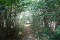
At the next T-junction, turn left onto a path lined with numerous chestnut trees on the left and a bramble hedge on the right. The path runs along the edge of the woodland, skirting the perimeter of a field.

When you reach the road, follow it straight on towards La Maison Neuve

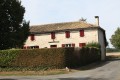
(5). At the entrance to La Baudrière, turn left in front of a beautiful house typical of the Pays Mellois. Shortly after the bend into La Baudrière, you’ll see on the right a fine example of a bread oven (of which there are many in the region) and a well.
Continue through the hamlet of La Baudrière towards the D305 road; cross this and carry on straight ahead along a small track through the fields.

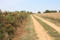
At the first junction with a farm track, turn right onto this gently ascending track. It offers a lovely view of the surrounding countryside.
At the next ‘T’-junction of farm tracks, turn left onto a lane lined with sparsely spaced trees. At the entrance to La Bernardière, near the first houses, the lane becomes a road.

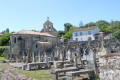
(6) At a bend in the next road, turn right onto the path that opens up. This path runs past several Protestant cemeteries, of which there are many in this region. The path leads onto a small road; take this by turning right
Follow the road, leaving the paths and the road leading to a house set slightly apart on your right. At the crossroads at the entrance to La Valtière, carry on straight ahead.

A little further on, the road passes a house, beside which a sign indicates that you are in Terre Noire.

(7) Immediately afterwards, in a bend, a path appears on the left; take this to continue our route. This path ends at a small road, which you follow by turning right.

At the next junction, take the farm track which lies slightly to the left ahead. This track leads to a small road. Turn left.

(8) Just before the road starts to climb, turn right onto a path leading downhill between two embankments. This path leads onto a small road; take this by turning left. About two hundred metres further on, you’ll reach the Mouchedune Fountain and Washhouse.

Carry on towards Mouchedune; the road passes through a farmyard. Stay on the main road, which, shortly after a left-hand bend, crosses another road at a right angle. Continue straight on along the road heading towards the water tower.
The route passes at the foot of the water tower, leaving the path that crosses the road at this point. Carry on along the road and you will soon see the car park where you started (S/E).


Waypoints

  1. S/E : mi 0 - alt. 456 ft - Fontaine de Mareuil in Bournaveau
  2. 1 : mi 0.21 - alt. 499 ft - l’Épine
  3. 2 : mi 1.03 - alt. 531 ft - La Corbillière
  4. 3 : mi 1.43 - alt. 535 ft - Junction of six paths
  5. 4 : mi 1.84 - alt. 505 ft - Junction between the road and the forest path
  6. 5 : mi 2.7 - alt. 554 ft - La Baudrière (entrance)
  7. 6 : mi 3.59 - alt. 548 ft - Junction of the road and the farm track
  8. 7 : mi 4.1 - alt. 528 ft - Crossroads between the road and the track near Terre Noire
  9. 8 : mi 4.75 - alt. 505 ft - Road–track junction
  10. S/E : mi 5.52 - alt. 456 ft - Fontaine de Mareuil in Bournaveau

Notes

A route across varied terrain, mostly along farm tracks and forest paths. Hence the need for suitable footwear.

In winter, after heavy rain, the forest section can be a little slippery, making the walk less enjoyable.

Parking is available in Bournaveau, near the Fontaine de Mareuil, on a grassy area.

Worth a visit

Mareuil Fountain and Washhouse
It is fed by the 1.6 km-long Mareuil Spring stream, which runs entirely through the commune of Saint-Léger-de-la Martinière.

Fountain – Mouchedune Washhouse
Remains from the Neolithic period, discovered near Mouchedune, bear witness to a very ancient settlement. In the Légère valley, a whole network of tunnels testifies to the presence, during the Gallic period, of prospectors searching for silver-bearing lead, intended to supply the mint at Melle. The name ‘Mouchedune’ seems to be particularly common in the Poitou-Charentes region. It refers to hamlets, farms and localities. In his *Topographical Dictionary of the Deux-Sèvres Department*, Bélisaire Ledain mentions ‘Mouchelune’, the pronunciation of which may have evolved into ‘Mouchedune’.

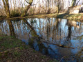
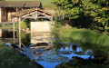
Beside a narrow road flows the spring that feeds Mouchedune’s modest covered washhouse. The spring is protected by a small structure enclosed on three sides and covered by a large boulder. The clear water flows through a hollowed-out stone into the small washhouse, which is open on two sides.
(Extract from the “Fontaines de France” website)

Melle
Saint-Hilaire Church: a Catholic church situated in Melle, France. It has also been listed as a UNESCO World Heritage Site since 1998, as a stop on the Way of St James in France. Of particular note is the chevet, characterised by the stepped arrangement of the roofs of the apses, followed by the ambulatory, and finally the chancel, surmounted by the bell tower. It is a model of balance. The south façade: above the portal runs a cornice with historiated modillions (symbols of the Evangelists), between which the signs of the zodiac are carved. The north side wall: is notable for its sculptures. The horseman in high relief, set in a niche, is said to symbolise Constantine I’s victory over the pagans; he surmounts the depiction of the battle between the vices and the virtues on the outer spandrel of the arch. The current sculpture dates mainly from a restoration in 1872; only the central section is authentic.

There are two other Romanesque churches in the town: Saint-Savinien and Saint-Pierre. The Hôtel du Ménoc is also worth a visit (the former courthouse).

In addition to the Romanesque churches, Melle boasts a variety of monuments and notable sites:
- The Hôtel du Ménoc, a composite building with stair towers in the Flamboyant Gothic style
- The Art Deco bandstand
- The market halls, with their metal framework
- The Hôpital, a former Capuchin convent
- The Protestant church and cemeteries, reflecting the strong influence of the Reformation
- The Discovery Trail
- The Green Belt
- The Forest Arboretum
- The Loubeau quarries

Reviews and comments

4.3 / 5
Based on 2 reviews

Reliability of the description
4 / 5
Ease of following the route
5 / 5
Route interest
4 / 5
User 6568250

Overall rating : 3 / 5

Date of your route : Nov 17, 2025
Reliability of the description : ★★★☆☆ Average
Ease of following the route : Not used / Not applicable
Route interest : ★★★☆☆ Average
Very busy route : No

No signage. Fortunately, we had the PDF.

Machine-translated

pgetrochon
pgetrochon

Thank you for your message.
I’m delighted that this will enable the Vouillė group to enjoy some lovely walks, just as I do for the Foyer Rural de St Martin-les-Melle. Our Mellois region is rich in both beautiful natural scenery and historic architecture.
Enjoy your walks

Machine-translated

BETIN
BETIN

Overall rating : 5 / 5

Date of your route : Nov 26, 2022
Reliability of the description : ★★★★★ Very good
Ease of following the route : ★★★★★ Very good
Route interest : ★★★★★ Very good
Very busy route : No

A lovely route, with not much tarmac, lovely in autumn but one we’ll do again when the weather’s sunnier.
Thanks again to the ‘pgetrochon’ walkers, whose routes allow our little group from Vouillé (79) to enjoy some lovely walks that are always well-documented and have very reliable GPS tracking.
Pierre.

Machine-translated

Other walks in the area

For more walks, use our search engine .

The GPS track and description are the property of this route's author. Please do not copy them without permission.