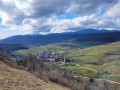
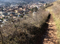
The Val du Pâtre as seen from Guebwiller

This very beautiful walk starts at the Guebwiller cemetery and climbs up to Val du Pâtre via the Mission Cross, then the Rocher du Coucou. After reaching the Rocher du Grossfels and returning to the Sainte-Marie Chapel, you walk through the vineyards from the village of Orschwihr back to the starting point.

Details

39863439
Creation:
Last update:
Last review:
  • Walking
    Activity: Walking
  • ↔
    Distance: 10.91 mi
  • ◔
    Average duration: 6h 10 
  • ▲
    Difficulty: Moderate

  • ⚐
    Back to start: Yes
  • ↗
    Ascent: + 1,322 ft
  • ↘
    Descent: - 1,293 ft

  • ▲
    Highest point: 1,834 ft
  • ▼
    Lowest point: 843 ft

Photos

Description of the walk

From Colmar, Mulhouse or Cernay, head to Guebwiller and its cemetery.

(S/E) From the car park opposite Guebwiller cemetery on Route de Colmar (D3b), follow the road to the left until you reach the junction near the River Lauch.

(1) Continue to the right along the D430 until you reach the old Guebwiller railway station (on the left) and go past it. On the right, there is a petrol station; at the traffic lights, turn right onto Chemin du Kitterlé, which leads into the vineyards.

Yellow Disc signposting

(2) Take this path and turn right at the first junction. You’ll soon be amongst the vineyards. Go round two bends. At the junction after the second bend, carry on straight ahead, then take the path leading uphill to the left. You’ll reach a wood at its end, where there’s a fork in the path.

(3) Turn right twice until you reach the Croix de Mission.

(4) Retrace your steps back to the previous fork.

(3) Carry on straight ahead, climbing through the forest and keeping straight on until you reach the Roche du Coucou.

(5) Continue along the path marked with a Yellow Disc on the left, ignoring the one on the right. When you reach the first junction, head down to the left and you’ll then come to another fork.

Red Ring markings

(6) Turn right towards the Guebwiller quarries. Continue through the woodland until you reach an inconspicuous path on the right.

Unmarked

(7) Leave the signposted path by taking this track on your right. Cross the first track and you’ll come to a second one.

Markings: Yellow Disc

(8) Continue to the left until you reach the Col du Dreibannstein.

(9) Once you reach the pass, turn left and then carry on straight ahead until you reach the Sainte-Marie Chapel.

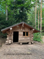
(10) You can have your picnic and fill your water bottles here. This is the Val du Pâtre. Next, take the first road leading off to the left of the chapel and head towards the Romanian military cemetery.

Blue Triangle signposting

(11) Turn right onto the road and head towards the Langenstein menhir.

(12) Carry on straight ahead, then at the first junction turn off onto the inconspicuous path on the left, which runs alongside the track. Continue to the Rocher du Grossfels

(13) Lovely view over the Soultzmatt vineyards. Head down to the right to the little Chapel of Saint Lucy.

Red Diamond markings

(14) Continue along the track to the right. Keep left at the first junction, then carry on straight ahead.

(11) Turn left at the corner of the Romanian cemetery and head for the Sainte-Marie Chapel.

(10) Walk for about 200 metres along the path you took on the way there, then take the forest path on the left signposted ‘Chemin de Compostelle’ and ‘Red Diamond’.

Red Diamond signposting

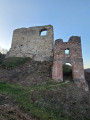
(15) Turn left at this junction. Ignore the path on the left leading to the ruins of Stettenberg Castle and carry on to the next fork.

(16) Turn left onto the descending path. Follow the road until you reach the pretty village of Orschwihr. Ignore the first set of crossroads and continue to the second.

(17) Follow the road straight ahead as it goes downhill. Carry on straight ahead at the next three junctions until you reach a fourth.

Green Saltire signposting

(18) Turn right and carry on straight ahead at the first three junctions.

No signposting

(19) At the fourth junction, carry on straight ahead. Do the same at the next junction, then turn right onto Rue du Vignoble.

Red Diamond Signposting

(20) Turn left at the corner by the cemetery and continue along this path to the Egten junction, where there is a car park on the right.

(21) Carry straight on and make sure you keep going in the same direction, ignoring the various side paths. Cross one final four-way junction and continue to the fork with a track leading downhill on the left.

No signposting

(22) Go down this track, then keep to the right and reach the car park by crossing the cemetery (S/E).

Waypoints

  1. S/E : mi 0 - alt. 909 ft - Start
  2. 1 : mi 0.18 - alt. 925 ft - Crossroads - La Lauch
  3. 2 : mi 0.48 - alt. 948 ft - Junction - Ancienne gare ferroviaire de Guebwiller
  4. 3 : mi 1 - alt. 1,243 ft - T-junction (out and back) at the cross
  5. 4 : mi 1.08 - alt. 1,247 ft - View of Guebwiller - Croix de Mission (Guebwiller)
  6. 5 : mi 1.65 - alt. 1,722 ft - Roche du Coucou
  7. 6 : mi 1.95 - alt. 1,640 ft - Junction. Towards the quarries - Carrière de Bergholtz
  8. 7 : mi 2.28 - alt. 1,644 ft - Junction
  9. 8 : mi 2.4 - alt. 1,759 ft - Junction – Track
  10. 9 : mi 2.99 - alt. 1,765 ft - Col du Dreibannstein (537m)
  11. 10 : mi 4.9 - alt. 1,276 ft - Val du Pâtre. Junction of the circular loop - Chapelle Ste-Marie (Soultzmatt)
  12. 11 : mi 5.25 - alt. 1,270 ft - Cimetière militaire roumain (Soultzmatt)
  13. 12 : mi 5.53 - alt. 1,260 ft - Menhir du Langenstein
  14. 13 : mi 6.01 - alt. 1,266 ft - Rocher du Grossfels
  15. 14 : mi 6.14 - alt. 1,119 ft - Little Chapel of St Lucy
  16. 15 : mi 7.4 - alt. 1,266 ft - Junction. Waymarker for the Way of St James
  17. 16 : mi 8.06 - alt. 1,093 ft - Y-junction
  18. 17 : mi 8.49 - alt. 948 ft - The village of Orschwihr
  19. 18 : mi 8.66 - alt. 883 ft - Crossroads
  20. 19 : mi 8.89 - alt. 860 ft - Crossroads
  21. 20 : mi 9.05 - alt. 873 ft - Rue du Vignoble
  22. 21 : mi 9.6 - alt. 981 ft - Egten, crossroads
  23. 22 : mi 10.64 - alt. 1,007 ft - Junction towards the vineyards
  24. S/E : mi 10.91 - alt. 909 ft - Arrival at the car park opposite the cemetery

Notes

(10) At the Sainte-Marie Chapel (Val du Pâtre), you can have a picnic, but you won’t be able to fill your water bottle, as not a single drop of water flows into the small trough any more.

Worth a visit

(4) At the Mission Cross, there is a lovely view of Guebwiller.

(13) At the Rocher du Rossfells, there’s a lovely view of the Soultzmatt vineyards.

Reviews and comments

4.3 / 5
Based on 3 reviews

Reliability of the description
4 / 5
Ease of following the route
4 / 5
Route interest
5 / 5
jean-marie.baur
jean-marie.baur

Overall rating : 4.3 / 5

Date of your route : Sep 21, 2026
Reliability of the description : ★★★★☆ Good
Ease of following the route : ★★★★☆ Good
Route interest : ★★★★★ Very good
Very busy route : Yes

This route is absolutely stunning and very varied!
Between points 7 and 8, we had to improvise as we couldn’t find the planned route...

We’ll be delighted to do this route again
Jean-Marie

Machine-translated

Mick88
Mick88

Overall rating : 5 / 5

Date of your route : Sep 27, 2023
Reliability of the description : Not used / Not applicable
Ease of following the route : Not used / Not applicable
Route interest : ★★★★★ Very good
Very busy route : No

Hike completed today. I followed the route on my GPS. Lovely forests. A few lovely views.
Thank you for this lovely route

Machine-translated

Nature57
Nature57

Overall rating : 4.3 / 5

Date of your route : Sep 20, 2023
Reliability of the description : ★★★★☆ Good
Ease of following the route : ★★★★☆ Good
Route interest : ★★★★★ Very good
Very busy route : No

A lovely walk starting from Guebwiller. Lots of woodland, several lovely views and a final stretch through the vineyards – which are absolutely stunning at this time of year – between Orschwihr and Guebwiller. Please note that at point No. 1, you should take the Kitterlé path and not the Vignoble path, as is incorrectly stated in the route description.

Machine-translated

Other walks in the area

For more walks, use our search engine .

The GPS track and description are the property of this route's author. Please do not copy them without permission.