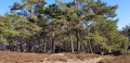
The Guebwiller vineyards

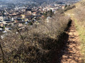
This walk will take you to the heart of the Schlumberger Estate, France’s largest single-block vineyard, where four classified Alsace Grands Crus are produced: the Spiegel, the Kitterlé, the Saering and the Kessler.
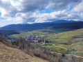
You’ll also pass by the Croix de la Mission, situated on the Unterlinger, from where you’ll be treated to views of the Alsace plain, the Black Forest, the Bernese Alps and the Florival valley.

Details

44183610
Creation:
Last update:
Last review:
  • Walking
    Activity: Walking
  • ↔
    Distance: 3.32 mi
  • ◔
    Average duration: 1h 55 
  • ▲
    Difficulty: Easy

  • ⚐
    Back to start: Yes
  • ↗
    Ascent: + 486 ft
  • ↘
    Descent: - 486 ft

  • ▲
    Highest point: 1,427 ft
  • ▼
    Lowest point: 935 ft

Description of the walk

Park in the car park on Avenue Foch (old railway station).

(S/E) Head towards the bridge and cross the Lauch. At the D430 county road, go straight on past the traffic lights, turn left and then immediately right onto Chemin du Kitterlé (named after a grand cru), signposted with a Yellow Disc.

(1) Navigate the hairpin bend to the right, then take the second track on the right. Continue straight on along the ascending path. After a steep climb, turn right, then right again towards the Croix de Mission, which dates from 1827. You can enjoy an exceptional panoramic view of the Alsace plain, the Black Forest, the Bernese Alps, the Vosges mountains, as well as the Florival valley and the surrounding villages.

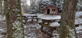
(2) Walk alongside the forest to reach the Lions’ Club shelter. Then take the forest track in front of the house. At the fork, turn right and continue to the next junction.

(3) Turn left onto this unmarked path at the edge of the woods and vineyard, ignoring the first Fork in the road further on. Carry on to the junction with the marked path at a bend.

(4) Take this signposted path to the left towards Heissenstein. Carry on straight ahead until you reach the mast.

(5) Keep going straight on, then turn right to join a track coming from the right. Continue in the same direction until you reach the three-way junction.

(6) Keep to the left until you reach the road (Chemin du Heissenstein): there is a beautiful fountain made of Vosges sandstone to the left of the path.

(7) Head up to the left (unmarked). Then take the first right. Carry on straight ahead until the junction and cross over to follow the Chemin du Vignoble. Continue to the junction with the Chemin du Schimberg.

(8) Carry on straight ahead to follow the path leading past the houses and back to the starting junction.

(1) Turn right, cross the bridge over the Lauch again and turn left to return to the car park (S/E).

Waypoints

  1. S/E : mi 0 - alt. 942 ft - Car park
  2. 1 : mi 0.14 - alt. 971 ft - Junction of the circular loop
  3. 2 : mi 0.69 - alt. 1,247 ft - Mission Cross
  4. 3 : mi 0.86 - alt. 1,319 ft - Woodland, on the left
  5. 4 : mi 1.06 - alt. 1,401 ft - Junction with signposted path, vineyards
  6. 5 : mi 1.56 - alt. 1,421 ft - Junction
  7. 6 : mi 1.85 - alt. 1,368 ft - Three-Way Junction
  8. 7 : mi 2.25 - alt. 1,096 ft - Chemin du Heissenstein
  9. 8 : mi 2.74 - alt. 1,043 ft - Chemin du Schimberg junction
  10. S/E : mi 3.32 - alt. 942 ft - Car park

Worth a visit

Reviews and comments

3.8 / 5
Based on 3 reviews

Reliability of the description
4 / 5
Ease of following the route
3.3 / 5
Route interest
4 / 5
Cordier 72
Cordier 72

Overall rating : 4 / 5

Date of your route : Jul 28, 2025
Reliability of the description : ★★★★☆ Good
Ease of following the route : ★★★★☆ Good
Route interest : ★★★★☆ Good
Very busy route : No

It's hard to say whether the circuit is busy or not

Machine-translated

Metzger François
Metzger François

Overall rating : 3 / 5

Date of your route : Jan 27, 2025
Reliability of the description : ★★★☆☆ Average
Ease of following the route : ★★☆☆☆ Disappointing
Route interest : ★★★★☆ Good
Very busy route : Yes

Hello,

The concept, presentation and suggested walks on VISORANDO are excellent and much appreciated.

Unfortunately, there is a recurring problem. Descriptions based on basic logic are poorly explained, e.g. ‘turn right, keep right’, when it would suffice to say ‘follow the path running perpendicular to the slope’. The wording, intended to be simple, thus becomes ambiguous.

Furthermore, the signposts and landmarks at junctions are insufficiently detailed where there are multiple route options, e.g. where several routes intersect.

Suggestion: propose and implement a table of key terms for drafting walk descriptions.

Kind regards,

F. Metzger

Machine-translated

Rene claude
Rene claude

Overall rating : 4.3 / 5

Date of your route : Jan 29, 2024
Reliability of the description : ★★★★★ Very good
Ease of following the route : ★★★★☆ Good
Route interest : ★★★★☆ Good
Very busy route : Yes

It’s a lovely walk – one worth doing again

Machine-translated

Other walks in the area

For more walks, use our search engine .

The GPS track and description are the property of this route's author. Please do not copy them without permission.