Refuge des Drayeres – Valmeinier 1,800

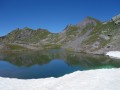
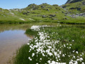
The final stage of this route runs from the Refuge des Drayeres in the Clarée Valley to the resort of Valmeinier. You will pass the Deuil des Rochilles before emerging onto three magnificent high-altitude lakes: Lac de la Clarée, Lac Rond and Lac du Grand Ban. Next comes the ascent of the Col des Plagnettes, followed by the descent with the rocky ridge of the Grande Paré to your left and the Aiguille Noire to your right, then the ascent of the Pas des Griffes, before descending back to Valmeinier, the end point of this 5-day route.

This walk is part of a multi-day hike: The Thabor Circuit in 5 days

Details

1414631
Creation:
Last update:
Last review:
  • Walking
    Activity: Walking
  • ↔
    Distance: 10.62 mi
  • ◔
    Average duration: 7h 05 
  • ▲
    Difficulty: Difficult

  • ⚐
    Back to start: No
  • ↗
    Ascent: + 2,500 ft
  • ↘
    Descent: - 3,848 ft

  • ▲
    Highest point: 8,379 ft
  • ▼
    Lowest point: 5,659 ft

Photos

Description of the walk

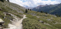
(S) From the Refuge des Drayeres, take theGR® 57 along a magnificent torrent and enjoy a succession of small waterfalls. The scenery is already fabulous, particularly the Pointe des Cerces, the Pointe du Riou Blanc and the Pointe des Banchets – impressive rocky spires with their sheer vertical walls.
You’ll emerge onto a beautiful meadow, flooded with water.

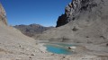
(1) Pass the Seuil des Rochilles to reach the first lake on this stage, the Lac de la Clarée. Along this stretch, numerous snowfields remain in early August. Then, follow a lovely path along the right bank of the Lac Rond, then past the Lac du Grand Ban, which looms overhead.
Above the lake, you’ll reach a junction.

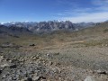
(2) Turn right onto theGRP® du Tour du Thabor, which climbs steeply towards the Col de la Plagnette. At the pass, cross over to the other side and descend the wide valley to a junction. The descent is over boulders. You’ll reach the junction wherethe GRP® meets another path.

(3) Turn right towards the Pas des Griffes.

(4) Cross La Neuvachette.
This beautiful path overlooks the valley leading down to the resort of Valloire. You’ll reach the ruins of La Pissine. Leave the GRP®.

(5) Continue northwards to reach the crossroads of paths at the ruins of Mont Jovet.

(6) Turn right and begin the steep ascent of the Pas des Griffes. At the top, the panoramic view is well worth the effort.

(7) Start the tricky descent to the right towards Les Arendiers. The descent is steep and challenging. Pass a path on the left at around 2,240 m. Reach Les Arendiers.

(8) Turn left and continue the descent to the path leading up to Lac Vert.

(9) Turn right towards the cross and follow this lovely path alongside the Neuvache torrent. Stay on this path and pass the Chalet de l’Ordière.

(10) Continue beneath the Inversins chairlift to eventually reach the car park at Valmeinier 1800 (E).

Waypoints

  1. S : mi 0 - alt. 7,136 ft - Les Drayères Mountain Hut - Refuge des Drayères
  2. 1 : mi 1.35 - alt. 7,877 ft - Seuil des Rochilles – Towards Lac de la Clarée - Clarée (rivière)
  3. 2 : mi 2.24 - alt. 8,110 ft - Turn right at the - Le Lac du Grand Ban
  4. 3 : mi 3.51 - alt. 7,336 ft - Turn right at the junction - Pas des Griffes (2554m)
  5. 4 : mi 4.26 - alt. 7,369 ft - Neuvachette (cours d'eau)
  6. 5 : mi 4.67 - alt. 7,451 ft - Ruins of La Pissine
  7. 6 : mi 6.07 - alt. 7,835 ft - At the junction, turn right at Pas des Griffes
  8. 7 : mi 6.49 - alt. 8,379 ft - Pas des Griffes (2554m)
  9. 8 : mi 7.67 - alt. 6,742 ft - Les Arendiers
  10. 9 : mi 8.11 - alt. 6,365 ft - Turn right until you reach the cross. Follow the - Neuvache (cours d'eau)
  11. 10 : mi 9.44 - alt. 5,863 ft - Chalet de l’Ordière
  12. E : mi 10.62 - alt. 5,791 ft - Arrival in Valmeinier - Valmeinier

Notes

A challenging stage suitable only for experienced and fit walkers. The recommended kit is that for high-mountain walking, as the altitude exceeds 2,400 m. Thunderstorms are common at this time of year.
No need to worry about finding your way.
You’ll find water throughout this final stage

Worth a visit

The Clarée, Long and Grand Ban Lakes.

Always be cautious and plan ahead when you're outdoors. Visorando and the author of this route cannot be held responsible for any accidents occurring on this route.

The GR® and PR® markings are the intellectual property of the Fédération Française de Randonnée Pédestre.

Reviews and comments

4.2 / 5
Based on 2 reviews

Reliability of the description
4 / 5
Ease of following the route
4.5 / 5
Route interest
4 / 5
CRE73
CRE73

Overall rating : 4.3 / 5

Date of your route : Sep 13, 2025
Reliability of the description : ★★★★☆ Good
Ease of following the route : ★★★★★ Very good
Route interest : ★★★★☆ Good
Very busy route : No

Route taken as part of a 4-day route around Thabor. At the end, we returned to the Chenalette car park, our starting point.
An interesting route with beautiful panoramic views, including an interesting section at La Mouillère before the Rochilles threshold. The descent from Pas de la Griffe was easier than I had expected. However, this is still a hike that requires good footwear.

Machine-translated

granmejanlou
granmejanlou

Overall rating : 4 / 5

Date of your route : Oct 07, 2025
Reliability of the description : ★★★★☆ Good
Ease of following the route : ★★★★☆ Good
Route interest : ★★★★☆ Good
Very busy route : No

Good route to reach Valmeinier from Nevache. Don't hesitate to take a detour via Lac Vert, which is a very pleasant place to stop for a break. The path down from Lac Vert is good. Be careful at the end, as there are paths and tracks all around Valmeinier. Don't expect to find a café open outside of school holidays in Valmeinier, even at weekends: it's deserted!

Machine-translated

Other walks in the area

For more walks, use our search engine .

The GPS track and description are the property of this route's author. Please do not copy them without permission.