Névache – Refuge des Drayeres

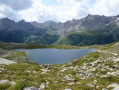
This is the fourth stage of the route, taking you from the village of Névache to the Drayéres mountain hut at the head of the Clarée Valley. The route follows the path known as the Chemin de Ronde, part of theGRP® Tour du Thabor trail. You’ll complete a circular route around Lake Laramon. Alternatively, from this lake you can also reach Lake aux Serpents.
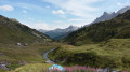
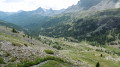
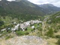
The view over the valley from the top of the Chemin de Ronde is simply stunning.
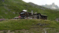
When you reach the Refuge de la Terrasse, take a moment to admire the mountainous landscape of this valley.

This walk is part of a multi-day hike: The Thabor Circuit in 5 days

Details

1414630
Creation:
Last update:
Last review:
  • Walking
    Activity: Walking
  • ↔
    Distance: 10.88 mi
  • ◔
    Average duration: 8h 00 
  • ▲
    Difficulty: Difficult

  • ⚐
    Back to start: No
  • ↗
    Ascent: + 3,451 ft
  • ↘
    Descent: - 1,512 ft

  • ▲
    Highest point: 7,894 ft
  • ▼
    Lowest point: 5,213 ft

Photos

Description of the walk

(S) From the Lodge-Refuge la Découverte, head towards the old village of Névache, following the same route as the previous day.

(1) On leaving the village, cross a stream to reach a junction with a path branching off to the left.
Take this path and continue straight on until you reach the main road.
Cross the road, take the path opposite for a few metres until you rejoin the road that climbs uphill.
Take the road on the left and climb up to the first chapel. Continue along the road until you reach a second chapel on your right.

(2) After the chapel, take the path that climbs steeply to the right, known as the Chemin de Ronde and marked in the red and yellow colours ofthe GRP® “Tour du Thabor”. The climb along this first section of the path is quite strenuous, leading out onto the heights above the valley. Head towards the Chalets de Biaune.

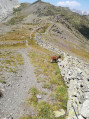
(3) Stay on theGRP®; after a few hairpin bends, you’ll reach a virtually level section. Follow a very gentle ascent, walking continuously along the cliff edge with an extraordinary panorama. After walking along this path for a good while, you’ll see a small lake below on your right. A few metres further on, you’ll come to a junction with a path leading to Lake Laramon.

(4) Leave the GRP®°° to the right and head up to Lake Laramon.
Note: from here, you can continue on to Lac aux Serpents.
Head back down tothe GRP® via the path on the left, emerging at the junction with the path leading up from Fontcouverte.

(5) Join theGRP® on the right. Cross a few streams fed by the snowmelt. You’ll reach the junction with the path to Lac de la Cula.

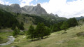
(6) Begin a long descent, which is easy at first but ends with wide hairpin bends, leading to the large car park known as Laval. This is a very tricky descent that requires careful attention.

(7) Turn right onto the wide track which, heading north-west, leads to the valley floor and the Drayères refuge, today’s stop (E). Ignore the adjacent paths.

Waypoints

  1. S : mi 0 - alt. 5,226 ft - Starting from Névache
  2. 1 : mi 0.69 - alt. 5,344 ft - Cross a torrent, a tributary of the - Clarée (rivière)
  3. 2 : mi 1.57 - alt. 5,820 ft - After the chapel, take the GRP on the right
  4. 3 : mi 2.37 - alt. 6,729 ft - Chalets de Biaune
  5. 4 : mi 4.87 - alt. 7,559 ft - Leave the GRP and head right - Lac Laramon
  6. 5 : mi 5.46 - alt. 7,526 ft - Rejoin the GRP on the right
  7. 6 : mi 6.98 - alt. 7,779 ft - Crossroads at Lac de la Cula
  8. 7 : mi 9.12 - alt. 6,677 ft - A break on the banks of the Clarée
  9. E : mi 10.88 - alt. 7,136 ft - Arrival at the Drayères mountain hut - Refuge des Drayères

Notes

A challenging stage suitable only for experienced and fit walkers. The recommended kit is that for high-mountain walking, as the altitude exceeds 2,400 m. Thunderstorms are common at this time of year.
You will find water along the entire route.

Worth a visit

The Clarée Valley.
Lakes Laramon, Serpent and de la Cula.

Reviews and comments

4.3 / 5
Based on 1 review

Reliability of the description
4 / 5
Ease of following the route
4 / 5
Route interest
5 / 5
User 21753457

Hello
We’re coming from Metz and would like to go to Thabor – can we get close to it?
What route would you recommend, starting from where, and can we return via the same route?
If you could give us a rough idea of the time it would take, that would be perfect; we are average hikers
Our last trip to Chamonix was
the Grepons car park, Plan de l’Aiguille. THE NEXT DAY, the North Balcony, descent to Mont-en-Vers, then Les Mottets, then the Caillets restaurant, then down to Chamonix.
Thanks for your help, and which dates would you recommend?
Roland

Machine-translated

bernardino
bernardino ★

Hello
Mont Thabor is an excellent hike, though it does present a bit of a challenge as a day trip. Personally, having climbed this peak several times, I prefer to do it over two days. This allows you to really soak up the atmosphere of the place and its surroundings. To do this, I set off in the morning around 10.00 am to spend the night at the Mont Thabor refuge. The next day, via Lac du Peyron, I complete the ascent of Thabor and then descend via the standard route.
However, this route starts from the hamlet of Vallée Étroite rather than Les Drayères. But Vallée Étroite is, via the Col de l’Échelle, about twenty kilometres from Névache.
If you wish, I can map out the route for you.
In years following a particularly snowy season, you’ll need to wait until late July for this trip.
Best of luck with your preparations

Machine-translated

User 21753457

Overall rating : 4.3 / 5

Date of your route : May 10, 2026
Reliability of the description : ★★★★☆ Good
Ease of following the route : ★★★★☆ Good
Route interest : ★★★★★ Very good
Very busy route : Yes

Hello
We’re coming from Metz and would like to go to Thabor – can we get close to it?
What route would you recommend, starting from where, and can we return via the same route?
If you could give us a rough idea of the time it would take, that would be perfect; we are average hikers
Our last trip to Chamonix was
the Grepons car park, Plan de l’Aiguille. THE NEXT DAY, the North Balcony, descent to Mont-en-Verse, then Les Mottets, then the Caillets restaurant, then down to Chamonix.
Thanks for your help, and which dates would you recommend?
Roland

Machine-translated

User 21753457

Hello
We’re coming from Metz and would like to go to Thabor and get as close to it as possible
What route would you recommend, starting from where, and can we return via the same route?
If you could give us a rough idea of the time it takes, that would be perfect; we are average hikers
Our last trip to Chamonix was
the Grepons car park, Plan de l’Aiguille. THE NEXT DAY: the North Balcony, descent to Montvers, then Les Mottets, then the Caillets restaurant, then down to Chamonix.
Thanks for your help, and which dates would you recommend?
Roland

Machine-translated

Other walks in the area

For more walks, use our search engine .

The GPS track and description are the property of this route's author. Please do not copy them without permission.