La Croix du Vallon, setting off from Montgenèvre

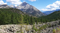
This very long hike starting from Montgenèvre will first take you through the forest before reaching a high-altitude pass. After a short descent, you’ll continue along a mountain-side path offering beautiful panoramic views of the surrounding peaks, before carrying on through wilder and more challenging terrain. With several stony and steep sections, this hike is suitable for experienced walkers.

Details

103909889
Creation:
Last update:
Last review:
  • Walking
    Activity: Walking
  • ↔
    Distance: 11.80 mi
  • ◔
    Duration according to the author: 10 hrs 
  • ▲
    Difficulty: Very difficult

  • ⚐
    Back to start: Yes
  • ↗
    Ascent: + 4,623 ft
  • ↘
    Descent: - 4,623 ft

  • ▲
    Highest point: 9,045 ft
  • ▼
    Lowest point: 6,093 ft

Description of the walk

Park near the car park by the obelisk.

(S/E) With your back to the car park, take the path opposite, heading east, which descends slightly towards a road. Walk carefully along this road to reach the start of the path towards the Col du Chaberton.

(1) Keep to the left to reach the Rocher Rouge area. Follow the path, which is signposted numerous times with signs for the Col du Chaberton.

(2) At the crossroads, take the yellow-marked path climbing to the right to reach the Col du Chaberton. The climb is steep in places and very stony. Take particular care on this section.

(3) At the pass, take the wide path on the left, which zigzags downwards towards a Y-junction.

(4) At the junction, take the path on the left that climbs up the mountainside towards La Croix du Vallon. The path is quite steep in places and quite stony.

(5) Pass the ruin on your right and continue the climb towards La Croix du Vallon. The path is bordered by a ravine on your right: take great care on this section.

(6) At the top, start your return journey to Montgenèvre (S/E) by following the same route back as on the way up. Take extreme care whilst descending the Col du Chaberton between points (3) and (2); the path is very stony, so it is easy to trip.

Waypoints

  1. S/E : mi 0 - alt. 6,093 ft - Montgenèvre – Obelisk car park
  2. 1 : mi 0.42 - alt. 6,152 ft - The Vallon des Baïsses
  3. 2 : mi 1.81 - alt. 6,765 ft - Les Gets Mountain Hut – Trail Junction
  4. 3 : mi 3.54 - alt. 8,799 ft - Col du Chaberton
  5. 4 : mi 4.45 - alt. 7,966 ft - Crossroads
  6. 5 : mi 5.63 - alt. 8,875 ft - Ruins of the Clôt des Morts
  7. 6 : mi 5.9 - alt. 9,042 ft - Croix du Vallon
  8. S/E : mi 11.8 - alt. 6,093 ft - Montgenèvre – Obelisk car park

Worth a visit

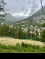
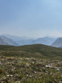
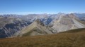
At the Col du Chaberton (3) and La Croix du Vallon (6), you can enjoy a magnificent360°viewofthe surrounding peaks.

Other walks in the area

For more walks, use our search engine .

The GPS track and description are the property of this route's author. Please do not copy them without permission.