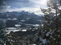
Soleil Bœuf as seen from Bouzoulières

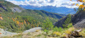
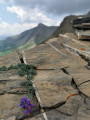
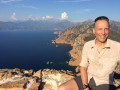
A lovely walk starting from Bouzoulières (in the commune of Faucon-de-Barcelonnette). A stunning view once you reach the top. Not to be missed!

Details

2241837
Creation:
Last update:
Last review:
  • Walking
    Activity: Walking
  • ↔
    Distance: 7.16 mi
  • ◔
    Average duration: 5h 15 
  • ▲
    Difficulty: Moderate

  • ⚐
    Back to start: Yes
  • ↗
    Ascent: + 2,241 ft
  • ↘
    Descent: - 2,224 ft

  • ▲
    Highest point: 7,205 ft
  • ▼
    Lowest point: 5,020 ft

Description of the walk

(S/E) Park at the Bouzoulières car park, then take the track heading due west, climbing towards Soleil Bœuf.

(1) Keep to the right. Do not take the track; a few metres further on, the track branches off to the left.
Continue along the track.

(2) Head straight on, westwards, keeping to the left towards Soleil Bœuf.

(3) Keep left on the track towards Soleil Bœuf. Cross the Torrent de Faucon. Stay on the wide track, ignoring the various offshoots.

(4) Leave the track and turn left onto the path leading up towards Soleil Bœuf.

(5) Return via the same route to reach the car park where you started (S/E).
Waypoints

  1. S/E : mi 0 - alt. 5,020 ft - Bouzoulières car park
  2. 1 : mi 0.29 - alt. 5,148 ft - Keep to the right on the track.
  3. 2 : mi 1.02 - alt. 5,545 ft - Straight ahead
  4. 3 : mi 2.02 - alt. 6,086 ft - Keep to the left on the track
  5. 4 : mi 3.25 - alt. 6,696 ft - Turn left onto the path towards Soleil Bœuf.
  6. 5 : mi 3.59 - alt. 7,205 ft - Sommet de soleil bœuf.
  7. S/E : mi 7.16 - alt. 5,020 ft - Bouzoulières car park

Notes

I’d advise you to take a bottle of water and a cap, as the sun is very strong (in summer, at least).

Worth a visit

Reviews and comments

3.4 / 5
Based on 4 reviews

Reliability of the description
2.5 / 5
Ease of following the route
5 / 5
Route interest
2.8 / 5
fredbes
fredbes

Overall rating : 4.3 / 5

Date of your route : Sep 02, 2024
Reliability of the description : ★★★★☆ Good
Ease of following the route : ★★★★★ Very good
Route interest : ★★★★☆ Good
Very busy route : No

A hike with no particular difficulties, mostly along forest tracks.
Stunning views once you reach the summit. A good way to stretch our legs the day after we arrived in Barcelonnette.

Machine-translated

Jfl
Jfl

Overall rating : 4.7 / 5

Date of your route : Dec 24, 2021
Reliability of the description : ★★★★☆ Good
Ease of following the route : ★★★★★ Very good
Route interest : ★★★★★ Very good
Very busy route : No

I don’t understand the other reviews left for this walk.
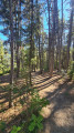
The walk passes through a lovely larch forest (which is magnificent in autumn) before climbing up to the Soleil Bœuf ridge, where there’s a magnificent panoramic view.
This walk may indeed be a bit long for those walking back down (in which case you can park further along the track), but for paragliders, this walk is a real treat.
The directions are clear and, contrary to what peperedu55 says, THE HIKE IS NOT ON A TARMACKED ROAD (nor is it in the Hautes-Alpes, for that matter)!!!
I highly recommend this hike.

Machine-translated

peperedu55
peperedu55

Overall rating : 1 / 5

Date of your route : Sep 20, 2021
Reliability of the description : ★☆☆☆☆ Very disappointing
Ease of following the route : Not used / Not applicable
Route interest : ★☆☆☆☆ Very disappointing
Very busy route : No

When you see this department with its majestic scenery, I do wonder what the point of this walk is.....
So if you’re setting off from the village at the starting point of this so-called walk, I wish you good luck…… it goes uphill…… and uphill…… along a narrow tarmac road…… that’s completely uninteresting…… With a bit of courage, but above all determination, you’ll reach the famous car park…… which has about four or five parking spaces.
Right, the climb isn’t over yet, but this time it’s along a stony path with a rather nice view on your left, which you’ll find again on your right as you follow the same path back…
After 1.6 kilometres… we turned back… very disappointed and found it completely uninteresting… absolutely no interest at all!!!!!
I wouldn’t even go there for a walk with the dog.
I’m being harsh in my words... but honestly, for the Hautes-Alpes... we’ve wasted our morning!

Machine-translated

ericentrecasteaux
ericentrecasteaux

Overall rating : 1 / 5

Date of your route : Sep 03, 2020
Reliability of the description : ★☆☆☆☆ Very disappointing
Ease of following the route : Not used / Not applicable
Route interest : ★☆☆☆☆ Very disappointing
Very busy route : No

A rather uninspiring walk: you follow a track suitable for vehicles almost all the way to the end (some people park a long way off, almost at the finish; Visorando advises parking at the end of the tarmac road, which is quite low down); admittedly, you do go uphill – a gentle climb – but you might as well be walking along a road. A rare let-down in this magnificent area. The signposting is misleading, because if you follow the ‘Soleil Boeuf’ sign (when you should actually be following ‘les crêtes’ at the end), you end up heading up towards the Trois Hommes. This allowed us to avoid the tedium of the path, but bear in mind that it adds 200 metres of steep ascent, plus a dangerous section crossing a ravine for about 300 metres to reach the Rasinières ridge.
I’d say ‘don’t do it’!

Machine-translated

Other walks in the area

For more walks, use our search engine .

The GPS track and description are the property of this route's author. Please do not copy them without permission.