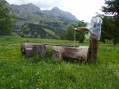
Crête de la Couagne and Col des Alaris

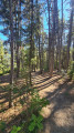
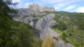
Cross the communal forest to reach the Crête de la Couagne. A refreshing walk in the foothills of the Chapeau du Gendarme, featuring a variety of woodland habitats (sequoia, larch, etc.). The route alternates between forest tracks and footpaths. Beautiful colours in autumn.

Details

16460299
Creation:
Last update:
Last review:
  • Walking
    Activity: Walking
  • ↔
    Distance: 5.10 mi
  • ◔
    Average duration: 3h 40 
  • ▲
    Difficulty: Moderate

  • ⚐
    Back to start: Yes
  • ↗
    Ascent: + 1,565 ft
  • ↘
    Descent: - 1,565 ft

  • ▲
    Highest point: 5,666 ft
  • ▼
    Lowest point: 4,101 ft

Description of the walk

Park in the small car park on the right at the hairpin bend.

(S/E) Start by taking the forest track that follows the Gaudessart ravine and its stream on the right-hand bank. Walk for about 300 m.

(1) Cross the bridge on the right and continue along the forest track.

(2) Look out for the return path on the left and continue along the track to the car park and the picnic area a little further on. Carry on along the forest track.

(3) Leave the track and take the path that cuts across several hairpin bends.

(4) Back on the track, carry on straight ahead and, at the next three-way junction, keep left onto a track.

(5) Leave the forest track and take the path on the right, which again serves as a shortcut.

(6) Do not follow the track you’ve rejoined, but carry on along the footpath which leads to the Crête de la Couagne and then the Col des Alaris with its magnificent view.

(7) Follow the track to the right to begin the return journey.

(8) Take the path on the left, which winds downwards and joins a forest track further on. Turn right and follow it for about a hundred metres.

(4) Set off straight ahead onto a path. At the junction, turn left to rejoin, further down, the track you took on the way out.

(2) Follow the route back in the opposite direction to reach the car park (S/E).

Waypoints

  1. S/E : mi 0 - alt. 4,101 ft - Car park
  2. 1 : mi 0.13 - alt. 4,170 ft - Bridge
  3. 2 : mi 0.43 - alt. 4,360 ft - Junction for both outward and return routes
  4. 3 : mi 1.08 - alt. 4,665 ft - Shortened route
  5. 4 : mi 1.23 - alt. 4,856 ft - Junction of the circular loop
  6. 5 : mi 1.9 - alt. 5,161 ft - Path on the right
  7. 6 : mi 2.41 - alt. 5,476 ft - Junction between track and path
  8. 7 : mi 2.92 - alt. 5,643 ft - Col des Alaris - Col des Alaris
  9. 8 : mi 3.64 - alt. 5,328 ft - Path on the left
  10. S/E : mi 5.1 - alt. 4,101 ft - Car park

Worth a visit

(7) Viewpoint at the Col des Alaris.

Reviews and comments

3.9 / 5
Based on 5 reviews

Reliability of the description
4.4 / 5
Ease of following the route
3.8 / 5
Route interest
3.4 / 5
bj7
bj7

Overall rating : 4.3 / 5

Date of your route : Aug 09, 2026
Reliability of the description : ★★★★☆ Good
Ease of following the route : ★★★★★ Very good
Route interest : ★★★★☆ Good
Very busy route : No

A lovely walk. Varied scenery. Very pleasant during a heatwave (30° in Barcelonnette), as there’s plenty of woodland to cool off in.
Unlike in 2024, there are no longer any scree slopes to be aware of. Access is easy.

Machine-translated

ploufy45230
ploufy45230

Overall rating : 3 / 5

Date of your route : Jun 18, 2024
Reliability of the description : ★★★★★ Very good
Ease of following the route : ★★★☆☆ Average
Route interest : ★☆☆☆☆ Very disappointing
Very busy route : No

A route mapped out to follow the track leading to the starting point.
The lack of maintenance in the area is glaringly obvious: fallen signposts, tracks littered with scree, paths cut off by torrents of water (though still passable)…
Apart from a spot in a flower-filled meadow on the Grand Bérard, this walk is of little interest. Very disappointed.

Machine-translated

Piolit
Piolit

Overall rating : 5 / 5

Date of your route : Jun 08, 2024
Reliability of the description : ★★★★★ Very good
Ease of following the route : ★★★★★ Very good
Route interest : ★★★★★ Very good
Very busy route : No

The start of the walk has been brought forward as the road is damaged and not very wide
Otherwise, a very beautiful and varied walk

Machine-translated

OSSAMLAD
OSSAMLAD

Hello.
Even the description of the starting point isn’t precise enough. FOR EXAMPLE, “Coming from the D902, do not cross the bridge towards Barcelonnette; instead, take the forest road immediately on the right before the bridge over the Gaudissard ravine” would have been more precise.
AT PRESENT, the problem is that, following a landslide on the road at the junction for “JALET”, access is restricted to local residents only. It is therefore impossible to reach the starting point of the walk.
We decided to try accessing it via Super Sauze, but this would have significantly lengthened the route, so we decided against this walk.

Machine-translated

mymyfred
mymyfred

Overall rating : 3.3 / 5

Date of your route : Aug 07, 2022
Reliability of the description : ★★★★☆ Good
Ease of following the route : ★★★☆☆ Average
Route interest : ★★★☆☆ Average
Very busy route : No

A ride on an e-MTB without cutting corners on the narrow trails. Lack of signposting at junctions. The first section along the track is rather uninteresting (do not access by car – the road has collapsed). Once in the woodland, it’s an enjoyable ride.
For mountain bikers, the return via SuperSauze is easier.

Machine-translated

algic
algic

Overall rating : 3.7 / 5

Date of your route : Jun 21, 2022
Reliability of the description : ★★★★☆ Good
Ease of following the route : ★★★☆☆ Average
Route interest : ★★★★☆ Good
Very busy route : No

We set off on the hike before the long weekend (see below); the road was closed due to rockfalls caused by hail
On the 7th, we opted for the PR route over the Col d’Alavis, which was more technical due to a few steep descents
than the track
For the start, the road is closed except to local residents – the choice is yours

Machine-translated

Other walks in the area

For more walks, use our search engine .

The GPS track and description are the property of this route's author. Please do not copy them without permission.