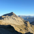
Refine your search for walks in Sommet de soleil bœuf.
Sommet de soleil bœuf. walks
 Refuge de la Pare, Soleil Bœuf and Crête des Cognetons
Hike starting from La Frache, a hamlet above Saint-Pons and Barcelonnette. This is a very pretty hike with beautiful views, but it is not recommended in bad weather.Moderator's rating: difficult, between (9) and (10), see reviews
Walks near Sommet de soleil bœuf.
 From Pra Loup 1600 via Coste Belle to La Dalle en Pente
A good walk to work up an appetite! Set off from Pra Loup to the La Dalle en Pente restaurant and return via the Chappe chairlift.
 Lac Sainte-Marguerite and Source de Jérusalem

A very pleasant circular above Les Orres resort, allowing you to discover a beautiful lake, Sainte-Marguerite, and the springs that feed Les Orres, named Jerusalem.
 From Restefond to Sestrière via Cime de la Plate and Col de la Braïssa

A very beautiful high-mountain hike at the foot of Cime de la Bonette between the Alpes Maritimes and Alpes de Haute Provence. Very little traffic. Magnificent, rocky landscape. The upper Braissette lake is a very beautiful spot for bivouacking.
 Trek around Chambeyron Mountain Range (1) Fouillouse - Refuge du Chambeyron

First stage around the Chambeyron Mountain Range which, after a steady climb, takes you to the shelter with the same name. You'll end up in a breath-taking setting, at the foot of Brec de Chambeyron.
 Trek around Chambeyron Mountain Range

Reaching over 3000 metres in altitude, Aiguilles de Chambeyron and Brec de Chambeyron form an impressive mountain range halfway between Queyras and the Moncantour. This hike offers a trek with no techincal difficulty, with passes over 2700 m in altitude and a summit of over 3000 m. Set in an outstanding landscape and for the most part within a high mountain setting.
 Mont Pelat - Allos via Le Cimet

Second part of the circular. This second stage will take you to the village of Allos, starting from Mont Pelat, via the Trou de l'Aigle, the Cimet and its many waterfalls, including the Cascade du Pich and the Bois de Vacheresse.
 Trek around Chambeyron Mountain Range (3) Refuge du Chambeyron - Maljasset

The most demanding stage of the hike during which you'll go through at least 4 passes at over 2700 metres in altitude. Beautiful scenery all along the way! The "Lacs Marinet" offer the opportunity for refreshments before the final descent.
 Camp des Fourches - Ferrere Refuge

This first stage of the Tour du Mont Aiga starts from Camp des Fourches on the Bonette road and, via the Col des Fourches, descends into the large Salso Moreno valley, which you climb back up to the Col de Pouriac. From the Col de Pouriac, you quickly reach Bassa di Colombart and then, after a long descent through the mountain pastures, the charming village of Ferrere. You may encounter flocks of sheep in Salso Moreno and, at night, the wolves that prey on them.
