Riou Bourdoux Discovery Trail

A short walk in the Ubaye valley around structures built in the 1900s.
Access and ford issues – see review dated 5 June 2023

Details

27660432
Creation:
Last update:
Last review:
  • Walking
    Activity: Walking
  • ↔
    Distance: 2.55 mi
  • ◔
    Average duration: 2h 00 
  • ▲
    Difficulty: Moderate

  • ⚐
    Back to start: Yes
  • ↗
    Ascent: + 991 ft
  • ↘
    Descent: - 978 ft

  • ▲
    Highest point: 5,528 ft
  • ▼
    Lowest point: 4,537 ft

Photos

Description of the walk

Park next to the house where you’ll find the sign for Le Tréou and the Riou Bourdoux Discovery Trail.

(S/E) Head towards the stream and you’ll reach it quickly. Cross it, then turn left onto the Sentier Découverte to follow its left bank. Continue until you reach a ford.

(1) Cross the ford and take the path that climbs through the forest. Then cross the small wooden bridge over the little stream. You’ll reach the Ravin de l’Église.

(2) Walk past a cross and then follow the signs for ‘Les Dalis’ marked on a yellow signpost. Continue through the woods, passing the Maison Forestière des Dalis at a designated rest area. You will soon reach a car park, which is also a designated area.

(3) Turn right onto the downhill path marked in yellow, which cuts across the bends in the road before joining it.

(4) Continue along the road, then alternate with the path that cuts across the hairpin bends. Stay on this path to reach the Tréou car park (S/E).

Waypoints

  1. S/E : mi 0 - alt. 4,580 ft - Le Tréou car park
  2. 1 : mi 0.66 - alt. 4,879 ft - Ford
  3. 2 : mi 1.25 - alt. 5,417 ft - Ravin de l’Église
  4. 3 : mi 1.64 - alt. 5,413 ft - Car park
  5. 4 : mi 1.85 - alt. 5,226 ft - Route
  6. S/E : mi 2.55 - alt. 4,580 ft - Le Tréou car park

Notes

Follow the yellow-marked trail.
There are no water points along the walk.
There are picnic tables before you head back down, where you can take a well-deserved lunch break.

Worth a visit

Information boards are located along the trail, telling the story of the structures and the region.
See also

Reviews and comments

3.5 / 5
Based on 6 reviews

Reliability of the description
3.7 / 5
Ease of following the route
3.2 / 5
Route interest
3.6 / 5
chralto63
chralto63

Overall rating : 3 / 5

Date of your route : Sep 23, 2025
Reliability of the description : ★★★★☆ Good
Ease of following the route : ★★★☆☆ Average
Route interest : ★★☆☆☆ Disappointing
Very busy route : No

We were very disappointed with this route, the first two-thirds of which were more like an obstacle course than a hike. The two fords weren't too difficult, but we still had to find the right place to cross.
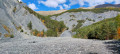
Then we walked along the riverbed, surrounded by eroded schist walls.
A steep climb awaits us at the exit and the "path" is very rutted. On either side, the forest looks like a battlefield.
The most beautiful views are in the last third of the route.

What we did appreciate, however, was discovering the very interesting history of this place, even if some of the information boards could do with being restored.

Machine-translated

fredybd
fredybd

Overall rating : 4 / 5

Date of your route : Aug 19, 2025
Reliability of the description : ★★★★☆ Good
Ease of following the route : ★★★★☆ Good
Route interest : ★★★★☆ Good
Very busy route : No

Nice hike but tricky fords to cross and a challenging climb for beginners.
We came back down via the track despite the heat because the descent via the path is quite steep.

Machine-translated

User 6905297

Overall rating : 3.7 / 5

Date of your route : Aug 18, 2025
Reliability of the description : ★★★★☆ Good
Ease of following the route : ★★★☆☆ Average
Route interest : ★★★★☆ Good
Very busy route : No

The first third is quite surprising because the torrent is in a rather sinister valley (smooth, grey, desertified rocks)
It's difficult to understand or pass the torrent the second time around!
I think that crossing the two fords must be very difficult in wet weather!
The climb back up is quite tough (note: this should be taken into account as we are all senior citizens!)
The descent and the view are very pleasant
Point to review if possible: crossing the stream, but it's true that it's not easy from the description!

(very happy with your app!)

Machine-translated

User 26555621

Overall rating : 3.7 / 5

Date of your route : Jul 14, 2025
Reliability of the description : ★★★★☆ Good
Ease of following the route : ★★★★☆ Good
Route interest : ★★★☆☆ Average
Very busy route : No

The hike went smoothly, we were able to cross the ford twice. The climb after the second crossing is a little steep, and my wife, who is not very fit, had to take several breaks. The route is well marked with yellow signs, no worries. Please note: make sure you activate Visorando with your GPS and follow the route indicated to avoid getting lost. A very pleasant route that allows you to discover the history of this place through the information boards along the way. And there's a beautiful view of the PraLoup resort and its ski area and the Grande Séolane opposite. We set off from the indicated starting point at 3pm (arriving by car via the stony track, where it's best not to drive fast because of the potholes) and completed the loop in 2 hours and 15 minutes... Walking sticks and good shoes are recommended.

Machine-translated

Nine 68
Nine 68

Hello, are there still any problems with access to and crossing the ford? Thank you

Machine-translated

PHILNOSAN
PHILNOSAN
• Edited:

Overall rating : 4.7 / 5

Date of your route : Jul 17, 2023
Reliability of the description : ★★★★★ Very good
Ease of following the route : ★★★★☆ Good
Route interest : ★★★★★ Very good
Very busy route : No

You need to use the Visorando and Waze apps to set off on the walk; you’ll reach the starting point without any trouble. After that, the route is very well signposted. Crossing the ford is a bit trickier, but doable. Then “you take the path that climbs through the forest”; I didn’t think it would be such a steep climb, but I was also stressed about snakes, as it was hot and humid with tall grass and rocks – in short, a real haven for those dear creatures I’m not particularly fond of… so I was quite stressed during that climb. The highlight was the information boards all along the walk about the Riou Bourdoux, and a village hidden away in the woods. The return journey is much quicker.

Machine-translated

Marteaux
Marteaux

Overall rating : 1 / 5

Date of your route : Jun 05, 2023
Reliability of the description : ★☆☆☆☆ Very disappointing
Ease of following the route : ★☆☆☆☆ Very disappointing
Route interest : Not used / Not applicable
Very busy route : No

We couldn’t get to the house mentioned at the start because of roadworks and a road closure. So we parked 1.5 km further up the road. Then, at the starting point, it was impossible to cross the torrent – there was no way across, no footbridge or anything. On foot, it would have been very dangerous to cross the torrent’s current. So we turned back, very disappointed.

Machine-translated

Other walks in the area

For more walks, use our search engine .

The GPS track and description are the property of this route's author. Please do not copy them without permission.