Country:

 City:
City:


Parking is available on Route des Moulins in Chalaux, in the few spaces opposite an old mill.
(S/E) At the entrance to the picnic area, take the path heading south which climbs slightly (Chemin du Terreau).
(1) Turn left towards the church and continue to the cemetery.
(2) Just before the cemetery, turn right. Do not go all the way to the gate, but take the path that climbs to the right.
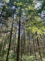
(3) Cut across a forest track and take the path opposite to continue the long climb to the summit of Mont de la Ferté, keeping straight on in a south-south-westerly direction.
(4) Begin the descent, keeping the same direction.
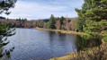
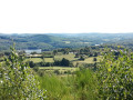
(5) Cross a forest road. At this point, the path splits in two: take the one on the right. From this path, you can catch a glimpse of the Chaumeçon Reservoir on the left. Continue to the four-way junction at La Guite Longue.
(6) Follow the path on the left downhill.
(7) When you reach the hamlet of Plainefas, turn left onto the RD235 and follow this main road through this peaceful area.
(8) At the horse-riding lodge, carry on to the right, staying on the same road. Go straight on at the next junction to reach the crossroads in front of the leisure centre.
(9) Follow the road that climbs up to the left almost directly opposite: you can also make a round trip by continuing straight on to reach the dam.
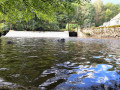
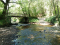
(10) At the car park, leave the road and take the path straight ahead, heading down to the bridge over the Chalaux.
(11) Cross the bridge and follow the path to the left. Walk alongside the river for a while until you reach a point where you need to cross a small branch of the river.
(12) Cross this: the path is then less visible. Continue on to the hamlet of Le Meix.
(13) Turn left onto the road.
(14) As you leave the hamlet, turn right onto Rue des Gothiots, then turn left after about 250 metres.
(15) Turn left again towards the centre of the village and rejoin the Route des Moulins.
(16) Turn left to reach the car park (S/E).


 Visorando Member
 Easy
Easy