Country:

 City:
City:


Parking and the start of the walk are on the banks of the Étang du Griottier Blanc.
(S/E) With your back to the pond, take the forest track leading down opposite, heading west towards the second car park.
(1) At the first junction, turn left towards a forest track
(2) Turn right and, as soon as possible, turn left. Carry on straight ahead until you reach the Route Forestière des Îles.
(3) Follow it to the right, descending steadily, and pass through the hamlet of Îles Ménéfrier.
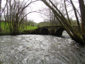
(4) Just over 200 m after the end of the hamlet, take the path on the left which runs alongside La Cure, until you reach the footbridge in the hamlet of Crottefou
(5) In the hamlet, turn right at the first junction, then cross the D128 with care , and carry on until you reach another road.
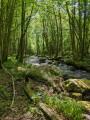
(6) Continue left along this road, then turn right again into Impasse de la Passerelle. Carry on along the River Cure until you reach a bend in the river.
(7) Leave the riverbank, rejoin the river further on, and follow it again until you reach a footbridge.
(8) Cross it and keep to the right-hand side of the path leading to Montgaudier le Haut, where it joins a road.
(9) Follow this road, cross the D55 carefully by taking a left-right turn, and follow the path uphill. You’ll reach the Croix Chassignot, near a telecoms mast.
(10) Turn right, towards Bousson le Bas.
(11) In the centre of the small hamlet, take the small road on the left, which continues as a track leading to a wildlife park.
(12) Take the second path that branches off to the right, and return to the junction you passed on the way out.
(1) Turn left for a final climb up to the car park by the lake (S/E).

 Visorando Member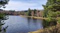


 Easy
Easy