Country:

 City:


In Saillagouse, park in the car park by the Post Office and the Town Hall, which is very easy to access.
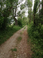
(S/E) Walk to Place Oliva and go round the Town Hall on the left. At the junction, leave the bridge over the Segre on your left and take the tarmac road (Chemin de Védrinyans) opposite. Pass the campsite on your left and leave the village whilst following the Rec de Vedrinyans. Navigate the sharp bend to the right.
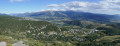
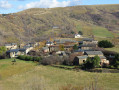
(1) Look out for the return path on the left and carry on straight ahead. Climb a short way to reach a three-way junction: a breathtaking view of Saillagouse and the Cerdagne valley, set amongst autumnal forests, green fields and Pyrenean peaks beneath a cloudy sky. A magnificent panorama, bathed in light and contrasts.
(2) Keep to the left, do the same at the next junction and reach the Coll del Forn.
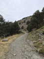
(3) Continue to the left and enter the forest, staying close to the edge at first. Then turn sharply right, make a wide hairpin bend before reaching a junction at the next hairpin bend.
(4) Take the track on the left, cross two streams in quick succession and reach the highest point of the walk: an exceptional view over the Cerdagne plateaus.
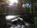
(5) Continue along the path, which winds its way down and emerges from the forest at a bridge on the right.
(6) Turn left without crossing the bridge and carry on to the hamlet of Vedrinyans: another viewpoint.
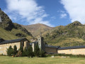
(7) Take the path on the right at the corner by the chapel and rejoin the Route de Vedrinyans.
(1) Head to the right and follow the outbound route in the opposite direction to return to the car park (S/E).
 Visorando Member

 Easy
 Difficult