Country:
 City:
City:


The starting point is in the car park of the Mulhouse ice rink, 47 Boulevard Charles Stoessel. Access is available by tram, at the ‘Palais des Sports’ stop.
(S/E) Go round the ice rink on the left, towards the Stade de l’Ill.
(1) On the other side of the ice rink, turn left and walk past the mini-golf course on your right. Continue to the bridge over the Ill.
(2) Turn left (following the ‘Red Ring’ signpost; do not cross the bridge). Walk along the Ill with the river on your right. About a hundred metres after passing under the railway bridge, take the footbridge to cross the river.
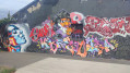
(3) On the other side, turn right onto the Quai des Pêcheurs and follow the Ill, keeping it on your right (you’ll be at the Street Art gallery). Pass under the railway bridge again, then cross the old course of the Ill. Walk past a playground on your left, followed by some sports pitches.
(4) Turn right onto the Chinese Bridge and return to a junction you passed earlier.
(2) Turn left (Blue Diamond signposting) and walk alongside the Ill on your left and the Illberg water sports centre on your right. Cross Rue de Donarch at the pedestrian crossing.
(5) Immediately cross the bridge over the Ill. On the other side, turn right onto a path leading down towards the Ill. Walk alongside the river on your right. Pass under the bridge of a cycle path. Walk for a long stretch along the Ill, passing sports grounds on your left, followed by a residential area and then more sports grounds.
(6) At the entrance to a small car park, turn right, keeping as close to the river as possible. You’ll join the D8b1 and follow it to the right to cross the Ill again.
(7) On the other side of the bridge (car park), turn left, cross the road and follow a path towards Hochstatt (Blue Diamond). Walk alongside the River Ill on your left.
(8) A little further on, the path moves away from the river; continue south. At a T-junction, turn right.
(9) At the next T-junction, follow the road to the left for about 1 km (marked with a Blue Diamond).
(10) As you approach a left-hand bend, leave the road and take a path on the right (marked with a Red Cross symbol). You’ll climb a steep slope and pass under a high-voltage power line.
(11) At the T-junction, turn right. At the next junction (altitude 293), turn left and climb up to a junction which marks the highest point of the walk.
(12) You then turn right (marked with a blue-white-blue Blue Rectangle) towards the Saint-Gall Chapel. After passing under a high-voltage power line, you arrive at the chapel.
(13) Carry on to a reservoir (with a bench). Then veer right onto a path that leads downhill. Take a hairpin bend to the left. The path ends with a flight of steps. At the bottom, first turn right then left onto Rue de l’Église. You’ll arrive at the foot of the church.
(14) Turn right onto Rue Willer (D8b1). Continue along Rue de Brunstatt, passing the town hall. Immediately afterwards, turn left into Rue des Chars. At the end of the street, you’ll reach the River Ill.
(15) Turn left and follow the river on your right. Continue along this route for a while until you reach a cycle path.
(16) Follow the cycle path to the right towards Mulhouse (marked with a Blue Diamond). Walk alongside the River Ill on your right and you’ll reach a junction you’ve already passed on the way there.
(5) Cross Rue de Dornach and continue along the River Ill.
(2) At the Chinese bridge (which you crossed on the way there), turn left and cycle past the mini-golf course on your left.
(1) Go round the ice rink on the left to reach the car park (S/E).

 Visorando Member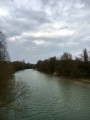
 Easy
Easy 
 Tourist office