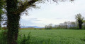
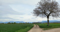
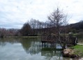
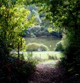
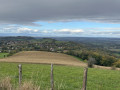
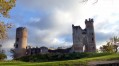
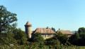
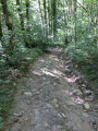
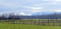
The Bièvre plateau as seen from Saint-Étienne-de-Saint-Geoirs

A completely flat walk. You’ll be walking mainly along small tarmac roads, or else on good dirt tracks. Throughout the route, you’ll be accompanied by the surrounding peaks: Mont du Chat, Chartreuse, Vercors, Pilat…

Details

33181814
Creation:
Last update:
Last review:
  • Walking
    Activity: Walking
  • ↔
    Distance: 6.79 mi
  • ◔
    Average duration: 3h 15 
  • ▲
    Difficulty: Moderate

  • ⚐
    Back to start: Yes
  • ↗
    Ascent: + 108 ft
  • ↘
    Descent: - 108 ft

  • ▲
    Highest point: 1,381 ft
  • ▼
    Lowest point: 1,250 ft

Photos

Description of the walk

Park in the secondary school car park.

(S/E) Leave the secondary school car park by heading north along Rue Pierre de Coubertin. You’ll immediately pass the nursery school and reach the grassy car park by the stadium. You’ll come to a T-junction.

(1) Turn right, passing a building called “Espace Jean Doucet”. Take the first street on the left and you’ll reach the D519C (give way sign).

(2) Cross this road and, opposite, slightly to the right, take the Chemin du Patou. This is a small tarmac road which you follow to the end. After a very slight incline, you’ll come out onto the D154 and follow it to the left.

(3) You’ll come onto a four-lane road (the Bièvre road). Once you’ve crossed the bridge, very soon after, you’ll see a small road leading down to the left. You’ll take a hairpin bend. Directly in front of you is a field of solar panels. Your road bends to the right, then, further on, to the right again (you’ll be going round the famous field of solar panels). Carry on along this small road (be careful, as there isn’t really a hard shoulder). You’ll reach the end of the runway at Grenoble-Alpes-Isère Airport.

(4) Carry on along this small road. When it takes a 90° bend to the left, leave it and take a dirt track on the right, which you follow until you reach a junction of dirt tracks. You’ll see the sign for “Plaine de Bièvre – alt. 410m”.

(5) Turn right, towards Izeaux, and you’ll come out onto the D154 again. Cross the road and continue along the gravel track. Pass a junction, continuing straight ahead, and you’ll reach another junction. You’ll see a sign for “La Vie d’Izeaux alt. 420m”.

(6) Turn right. Almost immediately, you’ll come to a solitary tree, where you turn right again, and straight after that, turn right once more. You’re now on a relatively straight dirt track. Follow it for a long time, ignoring any paths branching off to the right or left. After quite a while, the dirt track turns into a small tarmac road. You’ll return to the four-lane road.

(7) You cross it via a bridge and continue your journey along this small road. Your route leads to a T-junction. Opposite, there is a small path cutting across a dry riverbed. You take it. Almost immediately, you find yourself in a narrow lane that
leads onto the D519c.

(8) Cross over and carry on straight ahead. After a short while, you’ll come out onto the D514 again. Cross over and continue along the footpath to the left.

(9) When you reach a well-known discount store, turn right, then take the first street on the left and the first street on the right. You’ll pass a junction. A little further on, on the left, you’ll see the Maison des Associations.

(10) Turn right after the car park. Very soon, the street becomes a ‘no entry’ road. Your alley turns to the right. Opposite, you’ll find a gap in a hedge. Go through it, then turn left to return to your starting point (S/E).

Waypoints

  1. S/E : mi 0 - alt. 1,273 ft - Secondary school car park, 1 Rue Pierre de Coubertin
  2. 1 : mi 0.16 - alt. 1,260 ft - Espace Jean Doucet
  3. 2 : mi 0.43 - alt. 1,257 ft - Road D519c
  4. 3 : mi 1.24 - alt. 1,309 ft - Bièvre Road (4-lane)
  5. 4 : mi 2.04 - alt. 1,312 ft - Eastern end of the airport runway
  6. 5 : mi 2.93 - alt. 1,348 ft - Signpost Bièvre Plain, alt. 410m
  7. 6 : mi 3.57 - alt. 1,381 ft - La Vie d’Izeaux signpost alt. 420m
  8. 7 : mi 4.81 - alt. 1,339 ft - Bièvre Route – 2nd leg
  9. 8 : mi 5.81 - alt. 1,270 ft - Road D519c
  10. 9 : mi 6.26 - alt. 1,270 ft - Crossroads near a discount store
  11. 10 : mi 6.63 - alt. 1,286 ft - Crossroads near the Maison des Associations
  12. S/E : mi 6.79 - alt. 1,273 ft - Secondary school car park, 1 Rue Pierre de Coubertin

Notes

The walk starts from the car park of the secondary school in Saint-Étienne-de-Saint-Geoirs, 1 Rue Pierre de Coubertin.

This walk through the heart of the Bièvre plain has no elevation gain. Two-thirds of the route follows small tarmac roads.

The ‘Moderate’ difficulty rating is justified solely by the length of the walk.

Worth a visit

You’ll pass the eastern end of the runway at Grenoble–Saint-Étienne-de-Saint-Geoirs Airport. You may therefore have the pleasure (?) of seeing aeroplanes taking off or landing.
Throughout the route, you’ll enjoy views of the region’s various peaks.

Reviews and comments

4.8 / 5
Based on 2 reviews

Reliability of the description
5 / 5
Ease of following the route
5 / 5
Route interest
4.5 / 5
gilbert.agnes@orange.fr

Overall rating : 4.7 / 5

Date of your route : May 22, 2023
Reliability of the description : ★★★★★ Very good
Ease of following the route : ★★★★★ Very good
Route interest : ★★★★☆ Good
Very busy route : No

Despite the overcast sky, it was a lovely walk that day

Machine-translated

DAVID  jean luc
DAVID jean luc

Overall rating : 5 / 5

Date of your route : May 10, 2023
Reliability of the description : ★★★★★ Very good
Ease of following the route : ★★★★★ Very good
Route interest : ★★★★★ Very good
Very busy route : No

A lovely walk in the Plaine de la Bièvre – no change in elevation (completely flat). A brilliant stretch at the end of the path leading to Grenoble Airport. One slight downside: this little road is very busy with cars, which is a shame as it’s a bit of a nuisance. Otherwise, there’s a lovely view of the various mountains all around and, of course, of the Vercors and the Chartreuse, the iconic mountains of our region.

Machine-translated

Other walks in the area

For more walks, use our search engine .

The GPS track and description are the property of this route's author. Please do not copy them without permission.