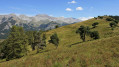
Montclar Castle, starting from Seyne-les-Alpes

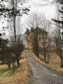
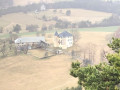
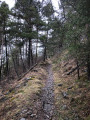
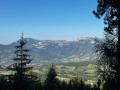
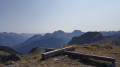
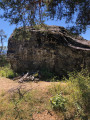
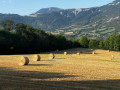
A very beautiful forest walk, situated on the outskirts of Seyne-les-Alpes. Once on the ridge, the Alpine massif offers magnificent views. Montclar Castle is a lovely find.

Details

46273336
Creation:
Last update:
Last review:
  • Walking
    Activity: Walking
  • ↔
    Distance: 6.10 mi
  • ◔
    Average duration: 4h 05 
  • ▲
    Difficulty: Moderate

  • ⚐
    Back to start: Yes
  • ↗
    Ascent: + 1,490 ft
  • ↘
    Descent: - 1,470 ft

  • ▲
    Highest point: 4,698 ft
  • ▼
    Lowest point: 3,907 ft

Photos

Description of the walk

Park in the car park of the Church of Notre-Dame-de-Nazareth, in Seyne-les-Alpes.

(S/E) Cross the Grand Rue (look out for a sign pointing towards the Citadelle Vauban). Walk past the church porch and take the path to quickly reach the entrance to Fort Vauban.

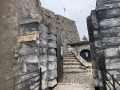
(1) Walk a few metres to the left to cross the bridge leading to the citadel, where you can admire the first sections of the 17th-century walls; then, from this car park, walk round the citadel, keeping the outer wall on your left, until you reach the Rochas crossroads.

(2) Continue to the left along this road, which is lined with woodland. Keep left at the next crossroads. Walk alongside the Barneaud housing estate and, after the last buildings, turn right (you’ll see the ‘La Gineste’ sign here). After a slight climb, turn left at the transformer onto the path marked in yellow, at the edge of the woods (there is a wooden signpost pointing towards La Pare). You will soon reach an unmarked crossroads of paths,

(3) Continue straight on along this ascending path. The junction by the drinking trough is barely visible. Carry on straight ahead. Continue the climb to reach a high point marked by the ‘La Pare’ signpost.

(4) Follow the ridge line, which ends in a steep descent, leading, after a tight hairpin bend, to a junction with a track suitable for vehicles. There is a marker at this junction.

(5) Carry on straight ahead. At the next track, take the path on the right, heading towards the castle whilst continuing to follow the yellow markings. You will reach a junction of tracks, situated just after the entrance to the castle.

(6) Turn right onto a gently sloping path and you will soon come to a junction of trackways.

(7) Leave the yellow markings here. Continue to the right, climbing via a few tight bends on a wide track, and carry on uphill to reach the junction.

(8) Turn right and continue on level ground for 300 m

(9) Turn left at this crossroads and you’ll reach a hairpin bend.

(10) Take the clearly visible path on the left, which leads into the woodland, and follow it.

(11) Continue left along this wide path through the woodland and carry on straight ahead until you reach a large field near the hamlet of La Pare. Please note: on this section, ignore the tracks created in the woodland by agricultural machinery.

(12) Turn right – look out for a concrete electricity pylon lying on the right. Continue along the uphill track. After the house, carry on straight ahead, skirting the edge of the woodland.

(13) Take a clearly visible path slightly to the right up the embankment. Then, following a circular loop, reach a junction at the top of this climb. Turn right to return to the junction at the start of the walk. The Visorando app will be a great help here, as there are several paths branching off which could lead to you taking a wrong turn.

(3) At the end of the path, head down the slope to the left to rejoin the original path from the start of the walk. Follow the route you took on the way there, but in the opposite direction.

(2) Continue straight on along Rue Antoine Niquet, which leads into La Seyne-les-Alpes, and after about a hundred metres, turn left down the flight of steps. Once on the Grand Rue, take the pavement on the right, which leads back to the car park (S/E).


Waypoints

  1. S/E : mi 0 - alt. 3,907 ft - Car park at Notre-Dame-de-Nazareth Church
  2. 1 : mi 0.19 - alt. 3,999 ft - Fort car park
  3. 2 : mi 0.27 - alt. 4,006 ft - Crossroads
  4. 3 : mi 0.85 - alt. 4,347 ft - Crossroads of footpaths
  5. 4 : mi 1.31 - alt. 4,695 ft - La Pare signpost
  6. 5 : mi 2.37 - alt. 4,091 ft - Junction of footpath and track
  7. 6 : mi 2.61 - alt. 3,934 ft - Junction of tracks suitable for vehicles
  8. 7 : mi 2.8 - alt. 3,914 ft - Crossroads: end of yellow signposting
  9. 8 : mi 3.13 - alt. 4,091 ft - Junction of tracks suitable for vehicles
  10. 9 : mi 3.32 - alt. 4,101 ft - Junction of tracks suitable for vehicles
  11. 10 : mi 3.55 - alt. 4,236 ft - Junction of footpath and track – Lacet
  12. 11 : mi 3.81 - alt. 4,380 ft - Junction of tracks suitable for vehicles
  13. 12 : mi 4.47 - alt. 4,308 ft - Junction of tracks suitable for vehicles
  14. 13 : mi 4.81 - alt. 4,465 ft - Path
  15. S/E : mi 6.11 - alt. 3,921 ft - Car park at Notre-Dame-de-Nazareth Church

Notes

Take care between points (1) and the transformer station due to road traffic
After point (12), using the app is a good idea.
There is no water along the route.
This walk is best enjoyed in dry weather.
(1) At the citadel, picnic area
Public toilets

Worth a visit

(S/E) The Church of Notre-Dame-de-Nazareth is a fine example of Romanesque architecture in Provence; it has been a listed historic monument since 1842 and is open only on Sundays from 10.30 am to 11.30 am
(1) The Vauban Citadel, also known as the Seyne Citadel, is open to the public all year round for self-guided tours from 10.00 to 12.30 and from 13.30 to 17.00, as well as for guided tours organised by the Fort et Patrimoine association.

Reviews and comments

4 / 5
Based on 4 reviews

Reliability of the description
3.8 / 5
Ease of following the route
3.8 / 5
Route interest
4.5 / 5
bernard bb
bernard bb

Thank you Lou cigalou for this clear opinion
best regards, B.

Machine-translated

Lou cigalou
Lou cigalou

Overall rating : 4 / 5

Date of your route : Sep 23, 2025
Reliability of the description : ★★★★☆ Good
Ease of following the route : ★★★★☆ Good
Route interest : ★★★★☆ Good
Very busy route : No

Quite a pleasant hike, the climb is through forest so it's very shady, which is nice in hot weather. A few nice views but not enough for my liking! Be sure to follow the Visorando trail on the way back, as you can quickly find yourself without a path or markings in the middle of nowhere!

Machine-translated

bernard bb
bernard bb

Hello Frédéric
I understand your disappointment
I’m not sure what to say about this lovely forest walk
as the previous review was positive
Did you use the app?

Kind regards

Machine-translated

Frédéric Berthalon
Frédéric Berthalon

Overall rating : 2 / 5

Date of your route : Sep 14, 2024
Reliability of the description : ★☆☆☆☆ Very disappointing
Ease of following the route : ★☆☆☆☆ Very disappointing
Route interest : ★★★★☆ Good
Very busy route : Yes

Hello.
There’s some confusion between the explanation in the text and the diagram. Nothing matches up.
I use Visorando regularly; this is the first time I’ve come across this problem.

Kind regards.

Machine-translated

bernard bb
bernard bb

Thanks, Sylvie La Crau, for this review
Best wishes, Rando, B.

Machine-translated

sylvie la crau
sylvie la crau

Overall rating : 5 / 5

Date of your route : May 13, 2024
Reliability of the description : ★★★★★ Very good
Ease of following the route : ★★★★★ Very good
Route interest : ★★★★★ Very good
Very busy route : No

Hello
The walk is very pleasant, with a lovely view from the ridge.
You can even do it when it’s warmer as there’s plenty of shade.

Machine-translated

bernard bb
bernard bb

Thank you, Patembrun, for your constructive feedback
Best regards, B.

Machine-translated

patembrun
patembrun

Overall rating : 5 / 5

Date of your route : Mar 23, 2024
Reliability of the description : ★★★★★ Very good
Ease of following the route : ★★★★★ Very good
Route interest : ★★★★★ Very good
Very busy route : No

Thanks for this walk. It was lovely from a heritage perspective.

Machine-translated

Other walks in the area

For more walks, use our search engine .

The GPS track and description are the property of this route's author. Please do not copy them without permission.