Country:

 City:
City:


In Saint-Jean Montclar, park at the Vieux Courtier chairlift car park and take the chairlift.
(S/E) Once at the top station, turn left onto the path and walk for about a hundred metres.
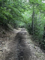
(1) Take a small path that heads into the woods on the left and follow it. This path descends gently through the woods and leads to a three-way junction just before the Ravin de Terre Noire.
(2) Carry on straight ahead until you reach the Mouriaye boundary marker.
(3) Keep to the right onto the path which climbs gently through more open woodland to a ridge.
(4) From this point, the path takes a hairpin bend to the right, following the ridge, and the climb becomes steep, though fairly short, up to the rocky outcrop, which is crossed via steps carved into the rock. After this, the path levels out again as it reaches La Montagnette.
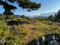
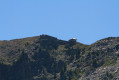
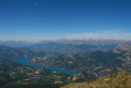
(5) Enjoy the view from this completely open spot, with distant views towards Serre-Ponçon and the Alps, towards the Ubaye valley, and a view of the fort from below. Turn right towards the fort and climb up the ridge to the orientation table. There are places where the path is overgrown, and it’s helpful to follow the GPX track on the app to find your way. You’ll also have to climb over a few rocks before reaching the orientation table, which is the highest point of the walk.
(6) From there, you can quickly reach the fort. We chose to head back down via the wide military track. After a few hairpin bends, it runs straight ahead and joins a major junction.
(7) Please note: follow the path that descends to the right to return to the chairlift. Otherwise, you’ll need to continue until you’re directly below the Col Bas to reach the forest road. After a hairpin bend, the path joins the forest road.
(8) Continue to the right to return to the chairlift (S/E).

 Visorando Member

 Easy
Easy