Refine your search for walks in Pic Chauve (1771 m)
Pic Chauve (1771 m) walks


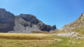
 Pic Chauve as seen from the Maison Forestière des Sauvas
 Visorando Member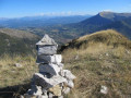
 6.83 mi
 +1,703 ft
 -1,703 ft
 4h 35
4h 35
 Moderate
 Departure from Montmaur (Hautes-Alpes)
From the Maison Forestière des Sauvas (in the commune of Montmaur), this round-trip route is the easiest way to climb the Tête Plumée and then the Pic Chauve via the Col des Sérigons.The route runs mainly through woodland, with a few clearings offering views of the landscape, all the way to the Pic Chauve, which overlooks the upper valley of the Petit Buëch and offers stunning panoramic views.
Walks near Pic Chauve (1771 m)
Plateau and Pic de Bure via the Joue du Loup chairlift
 8.05 mi
+2,037 ft
-2,867 ft
5h 30
Moderate
Departure from Agnières-en-Dévoluy (Hautes-Alpes)
8.05 mi
+2,037 ft
-2,867 ft
5h 30
Moderate
Departure from Agnières-en-Dévoluy (Hautes-Alpes)
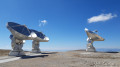
The easiest route to explore the Bure massif in summer, ascending via the ski resort’s chairlifts (open one day a week in July and August only). The plateau offers a lunar landscape with the observatory’s satellite dishes, and in clear weather, the view from the Pic de Bure is extraordinary.
The route is described here starting from La Joue du Loup, but there is a similar route starting from SuperDévoluy. Please note: this route is only accessible during the summer opening period of the ski lifts!
Col des Aiguilles - Return circular via Le Chauvet
 7.94 mi
+2,743 ft
-2,723 ft
6h 00
7.94 mi
+2,743 ft
-2,723 ft
6h 00
 Difficult
Departure from Agnières-en-Dévoluy (Hautes-Alpes)
Difficult
Departure from Agnières-en-Dévoluy (Hautes-Alpes)
Most of the route follows theGRP® Tour du Dévoluy trail markedGR®94.
For the return journey, rather than going back the same way, you can vary the route by returning via Small Pass and Le Charvet. This is an off-trail route.
This alternative route must be taken in good visibility and requires the ability to use a map and compass, which is essential for off-trail hiking.
The view from Le Chauvet over Le Dévoluy is magnificent.
From Col des Guérins to Tallard
 Association / Club / Walk leader12.56 mi
+482 ft
-2,812 ft
6h 10
Difficult
Departure from Sigoyer (Hautes-Alpes) (Hautes-Alpes)
Association / Club / Walk leader12.56 mi
+482 ft
-2,812 ft
6h 10
Difficult
Departure from Sigoyer (Hautes-Alpes) (Hautes-Alpes)
A short, all-downhill stage towards the Durance valley, as far as Tallard. You can make a detour via Sigoyer and rejoin the route via the D19.
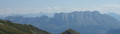
This route runs partly through woodland, with the Durance valley and the peaks of the Écrins and Ubaye massifs as a backdrop. A glimpse of Montagne Saint Maurice above Valserres, a stage on the ITAC route.
Lachaup – Les Amayères
 12.04 mi
+4,262 ft
-5,033 ft
9h 15
Difficult
Departure from Agnières-en-Dévoluy (Hautes-Alpes)
12.04 mi
+4,262 ft
-5,033 ft
9h 15
Difficult
Departure from Agnières-en-Dévoluy (Hautes-Alpes)
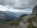
Through the Charnier valley at the foot of the Grand Ferrand, then via Pointe Feuillette, the final stage of this route.
From the village of Le Saix to Lake Peyssier via the Col de Combe Escure
 6.66 mi
+2,320 ft
-719 ft
5h 05
Difficult
Departure from Le Saix (Hautes-Alpes)
6.66 mi
+2,320 ft
-719 ft
5h 05
Difficult
Departure from Le Saix (Hautes-Alpes)
Setting off from the village of Le Saix is an alternative to starting from Veynes station. This stage leads to Lake Peyssier and continues the trek.
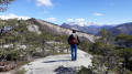
It offers a variety of attractions: a ridge walk, a bird’s-eye view of the Gouravour Gorge, unique views of the Buëch Valley and the Dévoluy massif, a walk through the former hamlet of La Péguière, a visit to the site of Clausonne Abbey and a walk across the Peyssier plateau.
An easier alternative route to reach Lake Peyssier is via the forest track from the village of Le Saix, passing through the Gouravour Gorge; it takes 1 hour to climb to Clausonne Abbey.