


Refine your search for walks in Barrage d'Ossoue
Barrage d'Ossoue walks


 Lac de la Bernatoire
 Visorando Member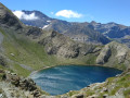
 5.88 mi
 +1,923 ft
 -1,926 ft
 4h 25
4h 25
 Moderate
 Departure from Gavarnie (Hautes-Pyrénées)
Pure beauty! A hike that will take your breath away, surrounded by cows, marmots and chamois!
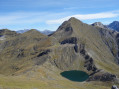
Pic de la Bernatoire
 8.00 mi
+2,621 ft
-2,602 ft
6h 00
Moderate
Departure from Gavarnie (Hautes-Pyrénées)
8.00 mi
+2,621 ft
-2,602 ft
6h 00
Moderate
Departure from Gavarnie (Hautes-Pyrénées)
A hike that allows you to discover a magnificent deep-blue lake nestled in its crater and to reach a peak offering a breathtaking panoramic view of the high summits. You’ll see plenty of marmots and perhaps a few chamois and griffon vultures.
Le Petit Vignemale via the Ossoue Dam
10.59 mi
+4,347 ft
-4,344 ft
8h 40
 Difficult
Departure from Gavarnie (Hautes-Pyrénées)
Difficult
Departure from Gavarnie (Hautes-Pyrénées)
Overlooking its imposing neighbours (the Vignemale and Pique Longue), the Petit Vignemale offers a beautiful panorama of the Vignemale massif and its glacier, as well as the 3,000-metre peaks of the Cirque de Gavarnie.
A high-mountain hike, suitable only for experienced walkers.
Lac de Gaube - Cabane des Tousaus
 13.88 mi
+3,950 ft
-3,638 ft
9h 50
Difficult
Departure from Cauterets (Hautes-Pyrénées)
13.88 mi
+3,950 ft
-3,638 ft
9h 50
Difficult
Departure from Cauterets (Hautes-Pyrénées)
Second stage of the four-day adventure from Cauterets to Luz-Saint-Sauveur via Petit Vignemale and Gavarnie. It can be done in one day, but I think it would be more enjoyable to split it into two days to take the time to appreciate the magnificent scenery!
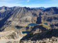
Pic de Labas and the Tour des Lacs d’Estom Soubiran
 11.39 mi
+5,650 ft
-5,663 ft
10 hrs
11.39 mi
+5,650 ft
-5,663 ft
10 hrs
 Very difficult
Departure from Gavarnie (Hautes-Pyrénées)
Very difficult
Departure from Gavarnie (Hautes-Pyrénées)
Lakes, lakes, lakes!
Gazing out over the Pyrenees from the Vignemale is a much-sought-after experience. But taking in the full expanse of the Vignemale Massif from the Pic de Labas viewpoint (2,947 m) is a sight that no lover of the High Pyrenees mountains can afford to miss!The climb to reach it is manageable, and from up there the 360° view is exceptional.Adding an extra touch of wilderness to this summit by completing the circular route around the Estom and Soubiran lakes is a challenging undertaking, but one that brings unrivalled satisfaction!
Walks near Barrage d'Ossoue
Col de Tentes - Goritz Refuge
9.92 mi
+4,829 ft
-4,265 ft
8h 45
Very difficult
Departure from Gavarnie (Hautes-Pyrénées)
First day of the trek to Mont Perdu. Departure from Col de Tentes, passage through Brèche de Roland, at the foot of Pic du Marboré, and ascent of Mont Perdu. The first day is the most technical. You quickly reach the high mountain ranges of the Gavarnie massif.
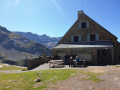
Gavarnie to the Espuguettes Refuge
 7.16 mi
+3,868 ft
-1,677 ft
6h 40
Difficult
Departure from Gavarnie (Hautes-Pyrénées)
7.16 mi
+3,868 ft
-1,677 ft
6h 40
Difficult
Departure from Gavarnie (Hautes-Pyrénées)
Day 1The Cirque de Gavarnie needs no introduction; it is a monument, a cathedral, a colossus.The route via the Plateau de Bellevue allows you to discover it from this remarkable vantage point.The path running along the slopes of the Bosquet Long adds an element of excitement, allowing you to appreciate it in all its splendour, whilst offering a tranquillity not found on the better-known routes.The return route along the ledge on the right-hand side takes you back to the Refuge des Espuguettes, where you’ll spend the first night.
Gavarnie – Refuge des Espuguettes
7.36 mi
+3,901 ft
-1,759 ft
6h 45
Difficult
Departure from Gavarnie (Hautes-Pyrénées)
Start from Gavarnie and climb towards the Plateau de Bellevue, then descend to the Grande Waterfall. From the Hôtellerie du Cirque, climb via the ledges to the Refuge des Espuguettes, with a campsite nearby.
Route of the three cirques: Gavarnie, Estaubé and Troumouse
29.94 mi
+9,777 ft
-9,252 ft
4 days
Moderate
Departure from Gavarnie (Hautes-Pyrénées)
A four-day route of the three cirques of Gavarnie, Estaubé and Troumouse, including the ascent of the Piméné. A self-guided route with nights spent in bivouacs.
Refuge des Espugettes – Cirque d’Estaubé.
7.61 mi
+3,235 ft
-3,740 ft
6h 20
Difficult
Departure from Gavarnie (Hautes-Pyrénées)
Route from the Espuguettes refuge to the Cirque d’Estaubé, including the ascent of the Petit and Grand Piméné (2,801 m) via the Hourquette d’Alans. Bivouac in the cirque, entirely self-sufficient.
From the Espuguettes refuge to the Tuquerouye refuge via the Piméné
 5.82 mi
+4,114 ft
-2,044 ft
8 hrs
Very difficult
Departure from Gavarnie (Hautes-Pyrénées)
5.82 mi
+4,114 ft
-2,044 ft
8 hrs
Very difficult
Departure from Gavarnie (Hautes-Pyrénées)
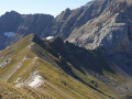
Day 2This beautiful day-long high-mountain hike offers breathtaking views of the Cirque de Gavarnie from the summit of the Pic de Pimené (2,801 m), as well as a 360° panorama of the entire Pyrenean border range and the French Piedmont region of the Hautes-Pyrénées.The walk then follows the Pimené ridge, offering a fun and exhilarating experience.The highlight of the day is the gruelling ascent of the Couloir de Tuquerouye to reach the highest unmanned mountain hut in the Pyrenees.
From the Refuge Wallon to Cauterets via the Col d'Arratille and the Col des Mulets
 13.24 mi
+2,789 ft
-5,502 ft
8h 30
Difficult
Departure from Cauterets (Hautes-Pyrénées)
13.24 mi
+2,789 ft
-5,502 ft
8h 30
Difficult
Departure from Cauterets (Hautes-Pyrénées)
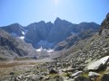
This circular is best done from mid-June until the first cold spells.
This isthe third and fairly longday of a three-day route in the Central Pyrenees National Park.
In case of bad weather or unforeseen circumstances, it is possible to shorten the route by descending directly from the (1) to the (8).
Pont d'Espagne - Bayssellance Refuge
7.06 mi
+4,147 ft
-279 ft
6h 50
Difficult
Departure from Cauterets (Hautes-Pyrénées)
Approach walk starting from Pont d'Espagne, passing by the magnificent Lac de Gaube, the Oulettes de Gaube and the refuge of the same name. The stage continues with a steeper climb to the Lacs d'Arraillé, then the Hourquette d'Ossoue pass before descending to the Refuge de Bayssellance.
From Cauterets to Ilhéou
 9.24 mi
+4,295 ft
-1,217 ft
8h 00
Moderate
Departure from Cauterets (Hautes-Pyrénées)
9.24 mi
+4,295 ft
-1,217 ft
8h 00
Moderate
Departure from Cauterets (Hautes-Pyrénées)
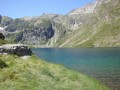
First day of a three-day route in the Central Pyrenees National Park.
This circular is best done from mid-June until the first cold spells.
Ascent to Lac Noir, Col d'Ilhéou, Ilhéou Refuge and Lac d'Ilhéou.
3 days in the Central Pyrenees Park from Cauterets
30.88 mi
+10,197 ft
-10,226 ft
3 days
Difficult
Departure from Cauterets (Hautes-Pyrénées)
Explore the Pyrenees National Park (central section) with a trip to Spain, lakes and mountain passes at an altitude of 2,600 metres.
With an average elevation gain of ± 1,230 m and a distance of 17 km per day, this trip is, all in all, quite strenuous.
Please take into account the cumulative elevation gain and the distance to be covered.
The trip takes place between 1000 m and 2655 m altitude.
The start of this route is accessible by public transport (coaches and shuttle bus from Cauterets in summer).