Country:
 City:
City:


Start from Villiers-aux-Chênes, the washhouse car park.
(S/E) Leave the car park heading west and follow the D60 for about 800 m until you reach the junction with the D229, at the wayside cross.
(1) Follow the farm track which heads westwards at the start, between the two departmental roads, and passes in front of some farm sheds. Join a cross-track (elevation 225).
(2) Turn left onto this track and then, at the second junction, near a copse (elevation 236), turn right. When you reach a T-junction, turn left towards the wayside cross.
(3) Walk past the wayside cross and follow the gently sloping path up to the entrance to the village of Blumeray. Turn right onto the D60 and continue to the junction with the D227.
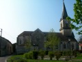
(4) Turn left onto Rue Saint-Laurent (D227), passing the church, and continue to the village boundary, 150 metres past the last farm.
(5) Turn left onto a farm track (Chemin d’Arnancourt) and follow it to the second junction on the left, at the edge of a small copse (elevation 259).
(6) Turn left, towards the plain. At the next junction (elevation 259), turn right and follow the track to reach the D27.
(7) Turn left onto the D27 and proceed very carefully to the village of Villiers-aux-Chênes, then to the washhouse car park (S/E).
 Visorando Member
 Moderate