From Korea to the Blaise to Doulevant-le-Château

A lovely little walk through the woods, following the River Blaise and the old railway line linking Saint-Dizier to Doulevant-le-Château.

Details

780911
Creation:
Last update:
Last review:
  • Walking
    Activity: Walking
  • ↔
    Distance: 4.06 mi
  • ◔
    Average duration: 2h 00 
  • ▲
    Difficulty: Easy

  • ⚐
    Back to start: Yes
  • ↗
    Ascent: + 194 ft
  • ↘
    Descent: - 197 ft

  • ▲
    Highest point: 879 ft
  • ▼
    Lowest point: 666 ft

Photos

Description of the walk

The route starts at Place André Burgeat.

(S/E) As you leave the square, turn right onto Rue Basse, then turn right again onto Rue des Tilleux. At the end of the street, turn left onto Rue de la Gare, heading towards the factory car park and the recycling centre.

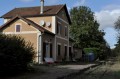
(1) As you come out of the bend, turn left towards the old station.

(2) Opposite, follow the path that climbs towards the forest. Ignore the paths on either side.

(3) When the path starts to descend, at the first Fork in the road, stay on the left-hand path as the right-hand path leads onto private property. At the second Fork in the road, again stay on the left-hand path, which runs along the left-hand side of a meadow, and follow it.

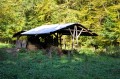
(4) On leaving the woodland, shortly after the shed on the right in the meadow, take the path on the right to reach the Bas de Corée field. Then take the path on the left to skirt the field on the right, following the Voie Saunière as far as the farm sheds and past them. Continue straight on along the path until you reach a crossroads (wooden cross).

(5) Take the second path on the left, then turn left again as indicated by the hiking sign marked ‘Saint-Louvent’ (green-and-yellow markings). Follow this path, which runs between the old railway line and the River Blaise.

(6) At the end of the path, before the recycling centre, turn right to walk alongside it and continue along the River Blaise until you reach Rue de la Gare.

(1) Turn right to cross the Blaise bridge and pass the wash house on your left, then follow the street as it bends to the right to return to the starting point (S/E).

Waypoints

  1. S/E : mi 0 - alt. 686 ft - Place André Burgeat
  2. 1 : mi 0.28 - alt. 686 ft - The junction of the circular loop after the bridge at the - Blaise (rivière) - Affluent de la Marne
  3. 2 : mi 0.4 - alt. 682 ft - Former railway station, straight ahead
  4. 3 : mi 1.13 - alt. 758 ft - At the fork in the road, turn left
  5. 4 : mi 1.79 - alt. 702 ft - As you emerge from the forest, turn right
  6. 5 : mi 2.56 - alt. 673 ft - At the junction, take the second left
  7. 6 : mi 3.61 - alt. 682 ft - Recycling centre, on the right
  8. S/E : mi 4.06 - alt. 686 ft - Place André Burgeat

Worth a visit

The walk, at the start (2) and in the second section (5), crosses the tracks of the old railway line that linked Saint-Dizier to Doulevant-le-Château. The line was opened along its entire route on 10 December 1868. Passenger services ceased on 1 May 1952, freight services on 31 March 1991, and operations were definitively halted in 2011.

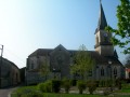
On both the outward and return journeys, you will pass by the wash house and you won’t fail to notice the 16th-century parish church dedicated to Saint Louvent, which was listed as a historic monument in 2000.

On your return journey, if you head up the Blaise valley, you can stop off at the Château de Cirey-sur-Blaise, just as Voltaire once did at the invitation of Madame du Châtelet, or carry on to Colombey-les-Deux-Églises, the final resting place and memorial to General de Gaulle.

Alternatively, if you follow the Blaise Valley, you can visit Métallurgic Park, a museum revealing the secrets of metallurgy in the Haute-Marne region through interactive displays and modern exhibition design.

Reviews and comments

4.3 / 5
Based on 2 reviews

Reliability of the description
5 / 5
Ease of following the route
3.5 / 5
Route interest
4.5 / 5
Y et Y
Y et Y

Overall rating : 4.3 / 5

Date of your route : Oct 18, 2025
Reliability of the description : ★★★★★ Very good
Ease of following the route : ★★★★☆ Good
Route interest : ★★★★☆ Good
Very busy route : No

Hello,
For your information, Rue des Tilleux is currently closed due to construction work on a school complex. It is therefore best to start the route from the bridge over the Blaise at the southern entrance to the village (near the EuroFence factory)

Machine-translated

Gilles MSD
Gilles MSD

Overall rating : 4.3 / 5

Date of your route : Jan 10, 2022
Reliability of the description : ★★★★★ Very good
Ease of following the route : ★★★☆☆ Average
Route interest : ★★★★★ Very good
Very busy route : No

Hello, fellow walker
A lovely little walk that’s just what I’m looking for in terms of short walks for the older members of the club. The description is very good, but the route isn’t straightforward because there are lots of small paths not shown on the map (that said, it would be hard to do any better).
Many thanks and enjoy your walks.
Gilles, local organiser at “La rando wasseyenne”

Machine-translated

Other walks in the area

For more walks, use our search engine .

The GPS track and description are the property of this route's author. Please do not copy them without permission.