Le Pas du Ranc, starting from Le Charmeil

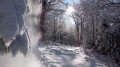
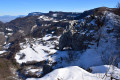
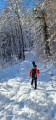
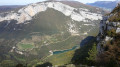
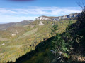
A snowshoe outing in the great outdoors, far, far from any civilisation. Following very well-maintained paths, this walk takes us to the Pas du Ranc above the Bourne Valley. A magnificent viewpoint.

Details

4524793
Creation:
Last update:
Last review:
  • Snowshoeing
    Activity: Snowshoeing
  • ↔
    Distance: 5.21 mi
  • ◔
    Duration according to the author: 4 hrs 
  • ▲
    Difficulty: Moderate

  • ⚐
    Back to start: Yes
  • ↗
    Ascent: + 1,778 ft
  • ↘
    Descent: - 1,772 ft

  • ▲
    Highest point: 4,003 ft
  • ▼
    Lowest point: 2,972 ft

Photos

Description of the walk

Park at the entrance to the hamlet of Le Charmeil in the commune of Presles.

(S/E) Head towards the Pétouze fountain.
On leaving the village, take the wide path on the right heading north-east towards Reziron.

(1) Before you reach the houses, turn left onto the path heading due east and follow it until you reach the road.

(2) Walk a few metres along the edge of the road as it climbs, then turn right towards La Goulandiére, heading south. Follow the yellow-and-red markings ofthe GRP® Tour des Coulmes. You’ll reach a crossroads of paths.

(3) Carry on to the left, still on the GRP®. Reach the highest point and begin a steep descent to quickly reach another junction.

(4) Turn right onto the path, leaving theGRP® here. Continue along this lovely, fairly wide path. You will then join theGR®9.

(5) Turn right onto it, heading due south, and descend to the Pas du Ranc to enjoy a breathtaking view.

(6) Take the same path back to the junction you passed on the way out, where theGRP® and the footpath meet.

(3) Turn left and leave theGRP® here. Follow the path; at the next junction, climb over a row of barbed wire and follow the path to arrive directly at Charmeil (S/E).

Waypoints

  1. S/E : mi 0 - alt. 2,979 ft - Car park at the entrance to the hamlet of Charmeil
  2. 1 : mi 0.38 - alt. 3,114 ft - Houses
  3. 2 : mi 0.79 - alt. 3,373 ft - Towards La Goulandière
  4. 3 : mi 1.61 - alt. 3,307 ft - Panorama
  5. 4 : mi 2.52 - alt. 3,852 ft - Crossroads - Belvédère du Ranc
  6. 5 : mi 3.02 - alt. 3,507 ft - Junction with the GR9 - Belvédère du Ranc
  7. 6 : mi 3.15 - alt. 3,333 ft - Belvédère du Ranc
  8. S/E : mi 5.21 - alt. 2,979 ft - Car park at the entrance to the hamlet of Charmeil

Notes

This walk is not difficult. There are numerous paths you can take to pass through the ghost village of La Goulandière. Allow extra time if you choose this route. Please note: there is no water and mobile coverage is poor.
Do not undertake this walk in foggy conditions.
In the event of heavy snowfall, progress will be slower; keep an eye on the time, as night falls quickly.

Worth a visit

A visit to La Goulandière is recommended.

Always be cautious and plan ahead when you're outdoors. Visorando and the author of this route cannot be held responsible for any accidents occurring on this route.

The GR® and PR® markings are the intellectual property of the Fédération Française de Randonnée Pédestre.

Reviews and comments

4.4 / 5
Based on 3 reviews

Reliability of the description
4.7 / 5
Ease of following the route
4.3 / 5
Route interest
4.3 / 5
toposrandos
toposrandos

Overall rating : 5 / 5

Date of your route : Nov 25, 2022
Reliability of the description : ★★★★★ Very good
Ease of following the route : ★★★★★ Very good
Route interest : ★★★★★ Very good
Very busy route : No

We extended this short route by heading towards the Presles rocks and back, then we passed by the Goulandière shelter.

Machine-translated

momoe2673
momoe2673

Overall rating : 4 / 5

Date of your route : Apr 10, 2022
Reliability of the description : ★★★★☆ Good
Ease of following the route : ★★★★☆ Good
Route interest : ★★★★☆ Good
Very busy route : No

That day, there was more snow than we’d expected.
And as we hadn’t brought our snowshoes, we had to turn back.
We’ll have to try again soon.

Machine-translated

Duche
Duche

Overall rating : 4.3 / 5

Date of your route : Jan 16, 2022
Reliability of the description : ★★★★★ Very good
Ease of following the route : ★★★★☆ Good
Route interest : ★★★★☆ Good
Very busy route : No

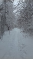
A lovely snowshoe walk, with a section through the woods where the snow remains in good condition. At the end, there’s a magnificent panoramic view before heading back – a very pleasant walk.
NB: On the way back, there’s a short stretch where you need to climb over a fence – it’s not particularly difficult, but you mustn’t miss it.

Machine-translated

Other walks in the area

For more walks, use our search engine .

The GPS track and description are the property of this route's author. Please do not copy them without permission.