Domaine des Coulmes

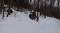
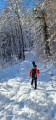
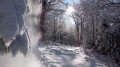
Starting from Patente, explore the Malleval-en-Vercors cirque and its vertiginous cliffs. Then cross Les Serres through the forest along paths used by rabbits, roe deer and… wolves!

Details

n°2908850
Creation:
Last update:
Last review:
  • Snowshoeing
    Activity: Snowshoeing
  • ↔
    Distance: 4.23 mi
  • ◔
    Duration according to the author: 3 hrs 
  • ▲
    Difficulty: Average

  • ⚐
    Back to start: Yes
  • ↗
    Ascent: + 951 ft
  • ↘
    Descent: - 951 ft

  • ▲
    Highest point: 4,564 ft
  • ▼
    Lowest point: 3,780 ft

Photos

Description of the walk

Park in the Patente car park.

(S/E) Head east along the Mont Noir forest road. Take the nature trail just above it, as snowshoe walkers are not permitted to continue further.

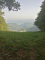
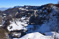
(1) Once you reach the viewpoint and after admiring the Malleval cirque, take the path heading east which runs alongside the cliffs. Take care not to get too close when there is snow on the ground. Continue uphill, passing the paragliders’ launch pad.

(2) Turn right, heading south-west, as you descend. Follow this path until you reach the Mont Noir forest track.

(3) Head straight ahead. A little further on, turn onto the path on the left and continue down until you cross a track reserved for cross-country skiers; follow this into the forest.

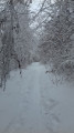
(4) At this point, continue down the path on the right. This very pleasant path leads deep into the forest. Keep going in the same direction.

(5) At the car park, turn right and follow the road uphill for 300 m. Leave the road at the nursery and take the path on the left towards a chalet/garage; follow it uphill until it leads to the Clos Michet car park.

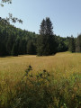
(6) Go through the gate on the left and continue along this path, passing the Clos Michet, then head straight on towards the north-east to reach the Ganasse meadow.

(7) Take the small path on the right heading east, climbing towards the Bury fountain. At the fountain, cross the stream flowing from it and continue straight ahead, climbing towards the car park where you started (S/E).

Waypoints

  1. S/E : mi 0 - alt. 4,190 ft - Patente car park
  2. 1 : mi 0.4 - alt. 4,232 ft - Viewpoint
  3. 2 : mi 0.93 - alt. 4,564 ft - Pas de l’Âne
  4. 3 : mi 1.47 - alt. 4,314 ft - Mont Noir forest track
  5. 4 : mi 1.82 - alt. 4,193 ft - Descend to the right
  6. 5 : mi 2.66 - alt. 3,783 ft - Car park by the Route des Coulmes.
  7. 6 : mi 3.06 - alt. 3,947 ft - Clos Michet car park, 1,196 m
  8. 7 : mi 3.67 - alt. 3,898 ft - Ganasse Meadow 1,185 m
  9. S/E : mi 4.23 - alt. 4,203 ft - Patente car park

Notes

In foggy conditions, take care at the edge of the cliffs.

Worth a visit

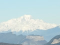
Visit the viewpoint and, far below, the village of Malleval-en-Vercors.
During the walk, look out for the many animal tracks.

Reviews and comments

3.3 / 5
Based on 4 reviews

Reliability of the description
3.5 / 5
Ease of following the route
3 / 5
Route interest
3.3 / 5
MIFA46
MIFA46

Overall rating : 3.7 / 5

Date of your route : Jul 19, 2023
Reliability of the description : ★★★★☆ Good
Ease of following the route : ★★★☆☆ Average
Route interest : ★★★★☆ Good
Very busy route : No

Winter hike (snowshoeing) done in summer .
Watch out for the sharp rocks after the viewpoint. I’ve never been there when it’s snowed, but given the danger, I don’t think I’ll be going…
At point 3, after crossing the road, continue up the path opposite.
At point 4, in summer the path is barely visible as it’s overgrown with grass. The ONF has recently installed a ‘fake’ telescope here for curious visitors (educational trail).
And in summer, there’s sometimes forestry work going on that disrupts the route ...I had a real nightmare, which led me to rate the ease of following the route as ‘average’: huge logs piled up in the middle of the path, a zigzagging descent with some fairly significant detours at times (just over 8 km instead of the advertised 6.8 km). This is in no way the author’s responsibility.

After point 5 on the path, make sure you pass right in front of the chalet/shed
At point 7, at the sign for the Prairie de GANASSE, the path on the right also disappears a little into the grass, which shouldn’t be the case in winter .

Machine-translated

DAVID  jean luc
DAVID jean luc
• Edited:

Overall rating : 4.3 / 5

Date of your route : Jan 08, 2021
Reliability of the description : ★★★★☆ Good
Ease of following the route : ★★★★☆ Good
Route interest : ★★★★★ Very good
Very busy route : No

A lovely day, with well-signposted trails

Machine-translated

craco.35
craco.35

Hello Patricia26
That’s precisely what makes this walk so appealing: no sign of human activity, no signposts. The stretch along the cliffs is quite impressive, isn’t it?

As for the reliability of the route, it all depends on your GPS. And then, the appeal of this route is entirely personal. Why walk in the forest? What are you looking for there? Everyone has their own reasons.

Machine-translated

Patricia26
Patricia26

Overall rating : 2.3 / 5

Date of your route : Jan 11, 2021
Reliability of the description : ★★★☆☆ Average
Ease of following the route : ★★★☆☆ Average
Route interest : ★☆☆☆☆ Very disappointing
Very busy route : No

no tracks or markings

Machine-translated

craco.35
craco.35

Hello
It’s best to do the route as described the first time round. This makes it much easier to get your bearings. However, it goes without saying that doing it the other way round the second time is a good idea. We don’t all have the same requirements or the same physical and navigational abilities. Knowing when to give up means being able to start again.
Kind regards.

Machine-translated

Gguyot
Gguyot

Overall rating : 2.7 / 5

Date of your route : May 18, 2020
Reliability of the description : ★★★☆☆ Average
Ease of following the route : ★★☆☆☆ Disappointing
Route interest : ★★★☆☆ Average
Very busy route : No

To begin with, a large (despite the current guidelines) and noisy group invited us to do the route the other way round.
As the trail is marked for snowshoes, we lost the markings after the car park at 1155m whilst heading north through the middle of the forest. We reached the Route de la Faz via a path not shown on the maps, ending up at the magnificent viewpoint.
We spotted a roe deer.

Machine-translated

Other walks in the area

For more walks, use our search engine .

The GPS track and description are the property of this route's author. Please do not copy them without permission.