Country:

 City:


Park in the car park on the D48.2 at a place called “Noirrrupt” (https://maps.app.goo.gl/KCygtNS3r8kB3wZWA) –
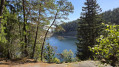
(S/E) With your back to the road, follow the path marked with a Red Rectangle crossed by a White Rectangle, which leads to Lac Noir through the forest alongside the stream of the same name: this initial climb is quite steep and technical.
(1) Once you reach the lake, cross the road and walk past the inn, following the Yellow Saltire. You’ll come to a junction.
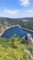
(2) There are two options for walking round the lake: either carry on straight ahead on the Yellow Saltire for the short route, or take the sharp right-hand bend to follow the Blue Disc-marked path for the long route (choice of route). This path will take you through beautiful countryside and offer stunning views of the lake and the valley. Begin the second part of the hike’s ascent: the terrain is similar to before but more open, and the climb is steep! Follow the signposted trail which passes through woods and more open areas: please note that some paths are closed to protect the wildlife, and barriers indicate these closures.
(3) Ignore the path on the right leading to the Belmont Observatory and stick to the Blue Disc markings. Reach the highest point of the route at the source of Lac Noir (alt. 1,275 m).
(4) Begin the descent. At the junction, leave the Blue Disc markings, which head off to the left, and carry on straight ahead to reach the junction with a path marked with Yellow Triangles.
(5) Follow this path, keeping in the same direction, until you reach a junction of several paths at the edge of the forest.
(6) Turn left at a 90° angle, rejoin the Blue Disc trail and follow it, keeping to the right to return to Lac Noir.
(7) Head to the right to follow the GR®532, marked with a Yellow Rectangle, towards Orbey – Pairis. After all this effort, you can enjoy some well-deserved refreshment and perhaps have a bite to eat to regain your strength at the Refuge des Amis de la Nature in Orbey (https://amisnature-val-orbey.fr/chalet-refuge-lac-noir/). Continue along the path until you reach a three-way junction.
(8) Leave the Yellow Rectangle markings and follow the signs for Orbey – Pairis along the path marked with a Yellow Rectangle crossed by a white bar, staying on the tarmac road. You’ll reach a large star-shaped junction.
(9) Ignore the dirt track on the right and carry on straight ahead to reach the junction where the route meets the Yellow Triangle markings coming from the right.
(10) Keep left and continue downhill, passing through various hamlets where you can discover the authentic farms of the Vosges. You’ll reach the junction with the D48.4
(11) Turn left, then cross the road immediately with care to take a forest track, continuing to follow the Yellow Triangle markings. Continue the descent towards Orbey–Pairis through the forest until you emerge onto the D48.2. Cross carefully and carry on straight ahead to the cemetery, where you’ll join the route marked with a Red Rectangle crossed out in a White Rectangle.
(12) Turn left (towards Grotte de Marie) for a very scenic climb. Once you reach the farm at the top of this lovely climb, follow the signposting and join the D48.
(13) Head to the right and walk carefully alongside the road for about 250 m until you reach the ‘Ferme Auberge des Deux Lacs’.
(14) Leave the road by turning right: the Deux Lacs fish farm ponds will be on your right. Walk alongside the Ruisseau du Lac Noir, taking care not to stray from it, and rejoin the D48.2. Cross with care (there’s a bend) and return to the car park opposite (S/E).
 Visorando Member

 Easy
 Difficult
 Association / Club / Walk leader