


Refine your search for walks in source du lac noir
source du lac noir walks


 Lac Noir, its source, two viewpoints and the stubble fields.
 Visorando Member
 4.07 mi
 +1,165 ft
 -1,152 ft
 2h 55
2h 55
 Moderate
 Departure from Orbey (Haut-Rhin)
A varied hike starting from Lac Noir, winding through the beautiful Vosges forest and taking you to the Hans rock, which overlooks Lac Blanc. The return route, which is less busy, allows you to discover the lake’s source and the stubble fields near Gazon du Faing.
PLEASE NOTE: The notice dated August 2026 indicates a diversion at the end of the route, adding an extra 2 km.
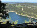
Lac Noir, Col du Calvaire and Lac Blanc circular
 6.10 mi
+1,102 ft
-1,099 ft
3h 45
6.10 mi
+1,102 ft
-1,099 ft
3h 45
 Difficult
Departure from Orbey (Haut-Rhin)
Difficult
Departure from Orbey (Haut-Rhin)
10 km with stunning views of two glacial lakes. The largest and highest, Lac Blanc (depth 72 m) covers 29 ha at an altitude of 1,055 m; Lac Noir (depth 45 m) covers 14 ha at 955 m. Breathtaking views from the Belmont Observatory. Don’t forget your camera.
Walks near source du lac noir
Schupferen – Hahnenbrunnen
 12.27 mi
+1,798 ft
-1,762 ft
7h 15
Moderate
Departure from Stosswihr (Haut-Rhin)
12.27 mi
+1,798 ft
-1,762 ft
7h 15
Moderate
Departure from Stosswihr (Haut-Rhin)
A stage of around twenty kilometres that begins in the shade of the forest, then runs alongside the Hirschsteine and Spitzenfels rocks, with a few sections secured by metal steps and fixed handrails, before continuing along the ridges after the Col de la Schlucht and passing beneath thethird-highest peak in the Vosges, the Hohneck.
Col de la Schlucht – Le Grand Ballon: the Sentier des Crêtes
 16.57 mi
+3,238 ft
-2,556 ft
8 hrs
16.57 mi
+3,238 ft
-2,556 ft
8 hrs
 Very difficult
Departure from Le Valtin (Vosges)
Very difficult
Departure from Le Valtin (Vosges)
A very beautiful hike, taking in some remarkable sights: the Martinswand rocks, the summit of the Hohneck, the summit of the Kastelberg and the Grand Ballon (with the ‘Boule’ at the summit).
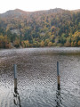
Charlemagne car park - Schiessrothried Lake
 5.84 mi
+728 ft
-1,683 ft
3h 20
Moderate
Departure from Xonrupt-Longemer (Vosges)
5.84 mi
+728 ft
-1,683 ft
3h 20
Moderate
Departure from Xonrupt-Longemer (Vosges)
day1: hike around Hohneck, snowfield route and descent to Schiessrothried Lake.
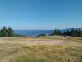
Col de Bagenelles – Schupferen
 10.77 mi
+2,694 ft
-1,847 ft
7h 20
Moderate
Departure from Le Bonhomme (Haut-Rhin)
10.77 mi
+2,694 ft
-1,847 ft
7h 20
Moderate
Departure from Le Bonhomme (Haut-Rhin)
This third day follows the Sentier des Crêtes for the most part, passing through the burnt-out fields with beautiful panoramic views. A walk of moderate difficulty with several opportunities to stop and enjoy a blueberry tart
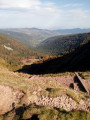
Schiessrothried Lake - Charlemagne car park
 5.08 mi
+2,352 ft
-1,398 ft
4h 25
Moderate
Departure from Metzeral (Haut-Rhin)
5.08 mi
+2,352 ft
-1,398 ft
4h 25
Moderate
Departure from Metzeral (Haut-Rhin)
From Schiessrothried, tour of Petit Hohneck, Dagobert's cave, Frankenthal and Col de Falimont.
This route is not accessible in winter. The route is closed between (3), (4), (5) and (6) from 1 November to 30 April 2022 (Prefectural Order of 18 May 2022).
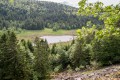
From Lake Longemer to Lake Blanchemer
 11.03 mi
+2,979 ft
-2,169 ft
7h 40
Difficult
Departure from Xonrupt-Longemer (Vosges)
11.03 mi
+2,979 ft
-2,169 ft
7h 40
Difficult
Departure from Xonrupt-Longemer (Vosges)
The first stage of a two-day bivouac hike with an overnight stay at Lac de Blanchemer, passing by Lac du Lispach, which is reminiscent of a Canadian landscape, and the Machais peat bog.
Difficulty and beautiful views sum up this first stage.
From Lac de Blanchemer to Lac de Longemer
 6.46 mi
+738 ft
-1,532 ft
3h 35
Moderate
Departure from La Bresse (Vosges)
6.46 mi
+738 ft
-1,532 ft
3h 35
Moderate
Departure from La Bresse (Vosges)
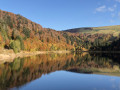
Second stage of this hike with bivouac. This time, Lac Lalande, Lac de Retournemer, Cascade Charlemagne and Cascade de Retournemer will be on your route, allowing you to discover magnificent colours.
From Lac de Blanchemer to the Chalet de Rouge Mousse
 7.13 mi
+1,880 ft
-2,054 ft
4h 55
Moderate
Departure from La Bresse (Vosges)
7.13 mi
+1,880 ft
-2,054 ft
4h 55
Moderate
Departure from La Bresse (Vosges)
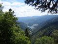
Starting from Lac de Blanchemer, the route follows theGR®531, taking you via the Rainkopf (alt. 1,305 m), before descending towards the Tourbière de Machais, the Col de Bramont and the Étang de Sèchemer to reach the Chalet de Rouge Mousse.
Gérardmer – Honneck – Sotré
 12.06 mi
+1,220 ft
-2,782 ft
6h 35
Difficult
Departure from La Bresse (Vosges)
12.06 mi
+1,220 ft
-2,782 ft
6h 35
Difficult
Departure from La Bresse (Vosges)
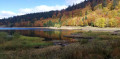
This second stage of the Gérardmer Mini-Trek links the Chalet des Champis to Petit Xonrupt, passing through some of the most beautiful landscapes of the Hautes-Vosges. After a descent into the Vologne valley, the route climbs back up to the heights of La Bresse-Hohneck, before reaching Lac de la Lande, the Schmargult farmhouse inn and the famous Route des Crêtes. The walk continues with a long descent past the Sotré mountain refuge, Lake Retournemer and the shores of Lake Longemer, before reaching the centre of Xonrupt-Longemer. A varied stage combining forests, high-altitude scree slopes, glacial lakes and remarkable panoramic views.
From the Cabane des Champis to Lac de Blanchemer
 8.77 mi
+1,627 ft
-2,201 ft
5h 25
Moderate
Departure from La Bresse (Vosges)
8.77 mi
+1,627 ft
-2,201 ft
5h 25
Moderate
Departure from La Bresse (Vosges)
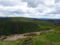
Starting from Les Champis, the route passes through the Marécage Rouge Feigne, the Col de Thiaville (alt. 1,112 m), the Hohneck (alt. 1,363 m) and the Col du Wormspel (alt. 1,277 m) before descending towards Lac de Blanchemer.