The Mountain and the Fossettes

Bouelles is a rural village that doesn’t attract much attention.
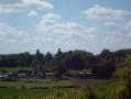
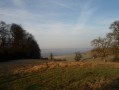
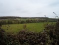
The surrounding countryside is magnificent, with lovely undulating terrain for walkers. In fine weather, you can take some lovely panoramic photos from the top of its hills.

Details

n°18289540
Creation:
Last update:
Last review:
  • Walking
    Activity: Walking
  • ↔
    Distance: 7.70 mi
  • ◔
    Average duration: 4h 00 
  • ▲
    Difficulty: Moderate

  • ⚐
    Back to start: Yes
  • ↗
    Ascent: + 538 ft
  • ↘
    Descent: - 538 ft

  • ▲
    Highest point: 787 ft
  • ▼
    Lowest point: 325 ft

Photos

Description of the walk

(S/E) The route starts from the car park at level crossing 71 on Avenue Verte, situated between Neufchâtel-en-Bray and Forges-les-Eaux. Ignore Avenue Verte; head up the street, Impasse du Frais Agneau, until you reach the T-junction. Cross the Route de Neufchâtel (D1314), taking great care with traffic; continue straight ahead past the sign for the village of Bouelles and carry on straight on until you reach the T-junction.

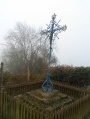
(1) Turn right onto Route de Nesle-Hodeng; at the T-junction with the wayside cross, carry on straight ahead along Rue du Centre. Ignore the first turn-off on the left, marked with route signposts, and continue towards the centre of the village of Nesle-Hodeng. Walk to the town hall, which is decorated with ceramic artwork, then retrace your steps, ignoring a turn-off on the right onto Rue l’Abbé Andrieux.

(2) Turn right, heading uphill towards the church; follow the road to the T-junction and turn left onto Rue Verte. At the end, continue along the path straight ahead, climbing for approximately 1,160 metres, until you reach a T-junction. Turn left; the path is much wider, level and appears to be frequently used by farm machinery. Walk for about 190 m until you reach the first turn-off on the right.

(3) Turn right, along the edge of the woods, following the green signposts, until you reach the road.

(4) Turn right and then immediately left onto the D56 towards the hamlet of La Montagne. Walk through the hamlet, past the ‘hamlet exit’ sign, and continue to the first turn-off on the left, which is a path.

(5) Turn left onto the path leading down towards Les Fossettes. At the next Fork in the road, keep right and continue until you reach the road.

(6) Turn left to return to the village of Bouelles. Walk past the church, the town hall and the former presbytery (1736) on the Route du Bourg.

(1) At the wayside cross, ignore the turn-off to the right and turn right a little further on, onto Route du Bourg. Continue straight on along the same route you took on the way out to return to the starting point (S/E).

Waypoints

  1. S/E : mi 0 - alt. 325 ft - Level crossing 71, Avenue Verte. Near the - Béthune (rivière) - Affluent de l'Arques
  2. 1 : mi 1.04 - alt. 390 ft - Junction of the circular loop
  3. 2 : mi 1.9 - alt. 400 ft - Rue du Centre
  4. 3 : mi 2.96 - alt. 551 ft - Chemin des Macmonts
  5. 4 : mi 4.05 - alt. 768 ft - Road junction
  6. 5 : mi 5.21 - alt. 758 ft - Junction on the path
  7. 6 : mi 6.19 - alt. 482 ft - Road junction
  8. S/E : mi 7.7 - alt. 325 ft - Level crossing 71, Avenue Verte

Notes

To reach the car park and starting point of the route:
Route de Neufchâtel D 1314: at the sign marking the entrance to the village of Bouelles, do not turn into the village. Take the street directly opposite, Impasse du Frais Agneau, towards the Frais Agneau picnic area at level crossing 71 on Avenue Verte.
PN = Level crossing

Worth a visit

Bouelles:
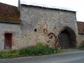
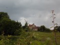
The castle, converted into a farmhouse, features a dovecote decorated with frieze motifs.
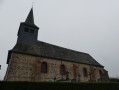
The Church of Saint-Martin, dating from the 12th and 16th centuries.
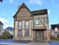
The former vicarage dates from 1736 and is now a private residence.

Nesle-Hodeng:
Saint-Pierre Church dates from the 18th century.
Saint-Denis Chapel in the hamlet of Hodeng.
Bival Abbey.
The Town Hall and its magnificent ceramics.

Reviews and comments

5 / 5
Based on 1 review

Reliability of the description
5 / 5
Ease of following the route
5 / 5
Route interest
5 / 5
BaladeRando
BaladeRando

Overall rating : 5 / 5

Date of your route : Feb 11, 2022
Reliability of the description : ★★★★★ Very good
Ease of following the route : ★★★★★ Very good
Route interest : ★★★★★ Very good
Very busy route : No

At the moment there aren’t many walkers, despite the lovely weather that day.
A lovely route – a bit of a workout, but very enjoyable to do several times throughout the different seasons.

Machine-translated

Other walks in the area

For more walks, use our search engine .

The GPS track and description are the property of this route's author. Please do not copy them without permission.