Country:

 City:
City:


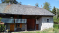
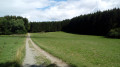
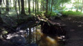
Park in the car park of the Pays de Gavot secondary school, set back from the D52 road linking Saint-Paul-en-Chablais and Larringes. Note the GéoPark Chablais information board about the peat bogs.
Mountain bike signposting
(S/E) Head for the west exit of the car park (towards Larringes) and, just before reaching it, turn left onto a tarmac lane towards the Pays de Gavot Inter-municipal Library.
(1) For now, ignore the Sentier du Maravant, which branches off to the right, and continue along the tarmac road. Opposite the library, turn right onto an uphill path and walk alongside the building on your left.
Unmarked
Cross a small road and step onto a wooden jetty leading towards the marsh.
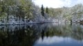
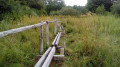
(2) At the fork in the road, take the left-hand boardwalk and start your clockwise walk around the marsh. First, walk alongside a wet meadow, then follow a path through the woodland. The route alternates between sections on boardwalks, wooden beams with handrails (most of the way) and a simple footpath.
(2) Turn left to leave the marsh.
Mountain bike signposting
Cross the small road again and follow the library and secondary school buildings on your right.
Signposting for the Sentier du Maravant + MTB signpost no. 18
(1) Just before the car park, turn left onto the Sentier du Maravant towards La Pastourelle. Follow this shaded path with a meadow on your right. Cross a small road (bridge on the left) and head straight on into a spruce woodland. After about a hundred metres, at a junction (south of a car park shown on the map), continue straight on towards La Pastourelle.
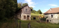
Winding your way beneath the spruce trees with the Maravant stream on your left. At a fork in the road (not shown on the map), take the left-hand path and cross the stream via a footbridge. Carry on along the main path towards La Pastourelle, ignoring any vague offshoots to the left. Cross the Maravant again and, as you come off the footbridge, veer left to follow the stream. Note a building on the opposite bank and you’ll come out onto a small road.
Mountain bike signpost no. 18
(3) Follow the road to the right and leave the Sentier du Maravant. At the Stop sign, cross the D52 (take care) and take the path opposite which leads diagonally to the left.
Signposting for the fitness trail
At the junction about a hundred metres further on, carry straight on along the fitness trail (ignore the mountain bike signposting leading off to the left). Immediately ignore a turn-off to the right. At a fork in the road (not shown on the map), go right. At the next fork in the road (also not shown), pass obstacle no. 6 on your right and head down through the middle of a beautiful beech and fir forest. At the next junction, turn right.
Adventure Trail signposts + Red and Yellow markings + Yellow markings
(4) At the T-junction, follow a wide path to the right. At the Fork in the road that appears shortly afterwards (obstacle no. 8), continue straight ahead (ignore the path on the right). Pass obstacle no. 9 and cross a large meadow. Enter the woods again (obstacle no. 12). At the T-junction (obstacle no. 14), turn right and head gently uphill.
Red and yellow markings + yellow markings
(5) At the signpost for “Les Taillées”, turn left towards Le Chevallay (let the fitness trail continue straight ahead).
No markings
After about 75m, at a fork in the road, turn right (ignore the markings heading left). At the next junction, continue straight ahead along a shaded path between two meadows. Head eastwards, alternating between shaded sections and the edge of the meadow on your right. At the T-junction, follow a stony path to the right.
Yellow signposting
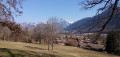
(6) At the three-way junction (view of the Mémises-Oche massif), veer right onto a small, gently ascending road, and ignore the turn-offs to the left. At the Stop sign (view of Mont Billiat and the Montagne d’Hermone), follow the D52 to the right (take care, as this is a busy road).
No markings
Ignore the small road on the left leading to Maravant; carry straight on and you’ll very quickly come to the school car park on the left (S/E).
 Visorando Member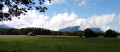

 Moderate