Country:

 City:
City:




Park in the car park of the Pays de Gavot secondary school, set back from the D52 road linking Saint-Paul-en-Chablais and Larringes. Note a GéoPark Chablais information board about peat bogs.
Signposts are provided at major junctions.
Mountain bike signposting 1 (one-sided, in the direction of travel)
(S/E) Head for the western exit of the car park (towards Larringes) and, just before reaching it, turn left onto a tarmac track towards the Pays de Gavot Intercommunal Library. Ignore the Sentier du Maravant, which branches off to the right (this will be your return route), and continue along the tarmac track. Opposite the library, turn right onto an uphill path and walk alongside the building on your left.
Yellow markings + MTB signpost 1
(1) You’ll come out onto a small road; follow it to the right and cross the Maravant. At the end of the tarmac, ignore a turn-off to the right and carry straight on along a gently sloping stony track through the meadows. At the T-junction, turn right towards Vinziers and Larringes and head towards a wood.
Markings: Yellow + Dark Blue + MTB 1 signposts
(2) At the edge of the woodland, ignore the path on the left, carry on straight ahead towards Cré Bouché and enter the woodland. Cross through the woodland (dense beech forest, damp sections). As you emerge from the woodland, turn right, cross a stream and continue along a small tarmac road. Climb gently, leaving the houses on your right. You’ll come out onto the D32 at the edge of the hamlet of Cré Bouché, and follow it to the right as it descends.
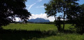
(3) Just before the first houses and at the corner by an EDF substation, turn left onto a gravel track. At the crossroads (various buildings), take the path on the right, pass a shed on the left and continue through the meadows. Note the green domes of a waste disposal site on the left. At the junction (elevation 860), carry straight on and descend very gently. You’ll come out onto a small road and follow it to the left for about 600 m.
Mountain bike signpost 18 (one-sided, in the opposite direction to your walk)
(4) At the ‘Rippe’ signpost, turn right onto a small road that winds gently downwards (note the bell tower of Larringes church in the distance on the left).
(5) After about 500 m, and before a wayside shrine, leave the road and take a path on the right. At the junction that appears after about 50 metres, turn right and head uphill along the edge of the woods. Further on, enter the woods. Then ignore a faint path branching off to the right, veer left and pass a secluded chalet on your right. Leave the woods and walk alongside a meadow on your left. Cross a stream, head uphill and pass a materials storage site on your right. Come out onto the River Maravant on your left and arrive at a T-junction below the D32 road.
(6) Turn left and cross the river. Then walk alongside the D32 and, at the junction that appears immediately, follow the D52 to the right towards Saint-Paul-en-Chablais (take care when crossing). Immediately ignore a road on the left (towards Chez Crosson) and continue towards Saint-Paul on the pavement of the D52. Once the pavement ends, take a gravel path that runs alongside the road on its left-hand side. At the edge of a wood, leave the road via the path and enter the wood. Climb gently up a stony path.
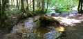
(7) At the junction (with fitness trail signs opposite), turn right and head downhill. Cross the D52 (a busy road but with good visibility) and continue straight ahead along a small tarmac road. At a place called La Pastourelle, just before the bridge over the Maravant and a gate, turn left onto a path that enters the woodland and runs alongside the river on your right. Cross a footbridge over a stream, then another footbridge over the Maravant, and follow the river on your left. Then follow a patch of forest undergoing regeneration on your right. Cross the Maravant again via the Pont des Communaux and follow the river on your right.
Mountain bike signposts 3, 8, 11 and 18 (in either direction)
(8) At the next junction, go straight on (ignore the turn-off to the left towards the fitness trail car park). There are two paths to choose from: one directly opposite but which may be very wet, and the other slightly further to the left, running alongside a meadow. These two paths merge and lead onto a small road (with a bridge on the right). Cross the road and continue along the path straight ahead, slightly to the left. You’ll come out onto the tarmac lane you took at the very start of the walk; follow it to the left to return immediately to the starting car park (S/E).


 Visorando Member



 Moderate