Country:

 City:


Start at the Hugstein Castle car park, situated at the junction of the Chemin de l’Ermite and the Chemin du Liedenberg in Guebwiller.
(S/E) Walk down Rue de l’Ermite. Turn right at the end of the street along Rue de la République and you’ll reach a Y-junction with a traffic island.
(1) Cross with care and go round the traffic island to follow Rue Théodore Deck on the left. Take thethird street on the right (Rue de l’Industrie). Keep to the right at the end of the street and turn onto Rue du Réservoir to find the start of the Way of the Cross. It begins, after a dead-end on the right, between the two streets at the next junction.
Signpost: White Rectangle with Crosses
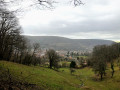
(2) Take this path and climb slightly to enjoy views over the Lauch valley. You’ll reach the large cross towards the end of the climb. At this point, keep to the right twice. At Rue du Kreyenbach, take the path on the right. Then turn left and begin the ascent to the Col de Peternit. After passing the houses, continue along the ascending path, ignoring seven junctions with tracks and paths – some of which are clearly marked, whilst others are overgrown. If in doubt, carry on to the pass, but do not go beyond it.
(3) Once at the pass, take the path on the right and follow it to the next track at a place called Peternit Rosstal.
(4) Keep to the right and ignore a track coming from the same direction; instead, take the path on the left leading up to the Col de Peternit.
(5) Turn right twice at the pass to follow the same signposting and stay on a track called the Chemin du Geisskopf. After about 1 m, ignore the start of a track on the left and cross another track coming from the right.
(6) Follow the track on the left as it climbs. A few hundred metres further on, pass an abandoned track on the right. You’ll reach the Munsteraeckerle, with its shelter and picnic area.
Blue Disc markings
(7) Follow the track to the right towards Murbach. The track gradually narrows until it disappears into the vegetation, eventually joining a junction of several paths.
(8) Turn left onto the path which winds down to Murbach. Carry on straight ahead at the junctions with the next three tracks. Cross a stream via a footbridge which leads onto a street. Turn left, then right at the next junction along Rue de l’Église and continue to the abbey church.
(9) Take in the sights, then return to the first lane on the right (Chemin de la Chapelle).
Blue Triangle signposting
Walk up it, then turn right towards the Notre-Dame de Lorette Chapel. With your back to the chapel, follow the path as it continues to climb towards the Horupf. Cross the Chemin de l’Eckelsbach and follow the switchbacks to negotiate a steeper slope, arriving at the wide path known as the Fosse aux Loups.
(10) Cut across the path and head due north uphill. After climbing about 100 metres, turn right and reach the ridge path.
Unmarked
(11) Turn off onto the inconspicuous grassy path on the left. Join another, much better signposted path at the top of the climb and take a left-right turn towards the Hohrupf.
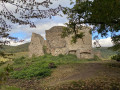
(12) Enjoy the view over the valley and the ruins of the castle at the summit. Return to the junction on the ridge where you started.
Yellow Triangle markings
(11) Carry on straight ahead towards the Col de Schrangen. Continue to the junction with the track.
(13) Leave the wide, steep track that descends and turn right onto the winding path. At the end of the second bend, you’ll pass quite close to the track. When you reach the forest track, turn left then right towards Bulh and the Col de Schrangen. Then keep heading in the same direction, continuing down the track opposite.
Red Triangle markings
(14) At the pass, carry on straight ahead towards Bulh. Ignore an overgrown, barely visible track on the right and you’ll reach a forest road: the Chemin du Geffenthal.
(15) Cross this and turn left until you can see the houses of Bulh. At the first junction, carry straight on. Do the same at the second junction and you’ll reach Rue Schrangen. Follow this road to its end at Place de l’Église.
No signposting
Then cross Rue de l’Église six times, ignoring the lanes and paths to the right and left, until you reach the end of the street at the junction where Rue Florival curves round.
(16) Turn right along Rue Florival. Follow it to the junction by the stream, turn left, then take a sharp right-hand turn for a few dozen metres.
Blue Triangle signposting
Facing the crucifix, take the path on the left towards Hugstein Castle.
(17) Take in the castle ruins and the view over the valley. Then continue along the path heading south down towards Guebwiller. Turn right at the edge of the forest, then take a left-hand bend and return to the starting point (S/E).


 Visorando Member
 Moderate

 Tourist office
 Easy
 Association / Club / Walk leader