Axwald Trail

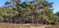
A lovely walk with no major difficulties, offering the chance to discover around twenty species of trees and plants native to the region.

Details

n°44182299
Creation:
Last update:
Last review:
  • Walking
    Activity: Walking
  • ↔
    Distance: 2.74 mi
  • ◔
    Average duration: 1h 45 
  • ▲
    Difficulty: Easy

  • ⚐
    Back to start: Yes
  • ↗
    Ascent: + 577 ft
  • ↘
    Descent: - 577 ft

  • ▲
    Highest point: 1,670 ft
  • ▼
    Lowest point: 1,211 ft

Description of the walk

(S/E) Starting from the Sungrube car park in Guebwiller, begin the route by following the Yellow Disc markings and the track that starts just beyond the car park. Ignore a path on the right and continue uphill to the next Fork in the road.

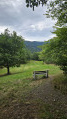
(1) Leave the return path on your left. Climb up to the Bildstoeckle, with its table and wayside cross, keeping straight ahead.

(2) Continue along the path to the left (east) until you reach a crossroads.

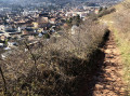
(3) Leave the main path and take the track on the left. Pass the Fuchfelsen and its viewpoint. Turn left a second time to reach a junction.

(4) Take the path on the left. Stay on the same side when you reach the track, then turn left again onto the footpath. You’ll come to a Fork in the road.

(5) Continue along the path on the right. Pass a track on the right and take the second one. Pass a footpath, then, just before the lodge, turn left uphill. Keep going straight ahead until you cross the path you took on the way there.

(1) Turn right and head back down the opposite way to the outward route until you reach the car park (S/E).

Waypoints

  1. S/E : mi 0 - alt. 1,211 ft - Sungrube car park
  2. 1 : mi 0.3 - alt. 1,388 ft - Fork
  3. 2 : mi 0.52 - alt. 1,506 ft - Bildstoeckle
  4. 3 : mi 0.95 - alt. 1,670 ft - Fork
  5. 4 : mi 1.3 - alt. 1,594 ft - Junction
  6. 5 : mi 1.88 - alt. 1,476 ft - Crossroads
  7. S/E : mi 2.74 - alt. 1,211 ft - Sungrube car park

Worth a visit

- (4) Fuchsfelsen and its viewpoint.

Reviews and comments

4.3 / 5
Based on 2 reviews

Reliability of the description
5 / 5
Ease of following the route
4.5 / 5
Route interest
3.5 / 5
Papinouxe
Papinouxe

Overall rating : 4.3 / 5

Date of your route : Jan 01, 2025
Reliability of the description : ★★★★★ Very good
Ease of following the route : ★★★★☆ Good
Route interest : ★★★★☆ Good
Very busy route : Yes

A short run to shake off the festive weight after the celebrations. Easy. Quite busy, but that’s to be expected on 1 January...

Machine-translated

Michela2018
Michela2018

Overall rating : 4.3 / 5

Date of your route : Jun 23, 2024
Reliability of the description : ★★★★★ Very good
Ease of following the route : ★★★★★ Very good
Route interest : ★★★☆☆ Average
Very busy route : No

An easy walk.

Machine-translated

Other walks in the area

For more walks, use our search engine .

The GPS track and description are the property of this route's author. Please do not copy them without permission.