A short circular loop at the foot of the Demberg

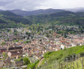
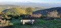
This short circular route (1 hour 10 minutes recorded on the stopwatch), starting from Buhl, will allow you to get some fresh air in the wooded areas at the foot of the Demberg and enjoy a lovely view of your starting village from the west.

Details

3111586
Creation:
Last update:
Last review:
  • Walking
    Activity: Walking
  • ↔
    Distance: 2.08 mi
  • ◔
    Average duration: 1h 15 
  • ▲
    Difficulty: Easy

  • ⚐
    Back to start: Yes
  • ↗
    Ascent: + 341 ft
  • ↘
    Descent: - 341 ft

  • ▲
    Highest point: 1,470 ft
  • ▼
    Lowest point: 1,119 ft

Photos

Description of the walk

(S/E) In the car park at Place du Marché, turn your back on the road and take the alleyway on your left. At the end of this, turn right onto Rue du Florival, then leave this street when it turns left, continuing straight ahead.

A little further on, at the first three-way junction in the road, turn left onto Rue du Breuel, ignoring the road leading to the church, then at the second three-way junction (be careful, it’s easy to miss this one), turn slightly to the right. You’ll then start a gentle climb and pass behind the cemetery

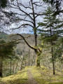
(1) At the top, at the junction, turn left and enter the wooded area. Carry on straight ahead to the end of the path.

(2) When you reach the D40.2 county road, take the sharp right-hand bend onto the small dirt track that climbs uphill. Carry on straight ahead and begin the climb to the highest point of your circular route. Do not change direction until the track naturally curves to the left.

(3) At this point, take the first path on the right. Carry on straight ahead to the end of the path, descending gently towards the village.

(4) At the junction, turn right and enter Buhl again. Walk downhill to the crossroads, in the centre of which stands a traffic island with a bench and an old wash house. Turn left to continue downhill. About a hundred metres further down, turn right onto Rue de l’École. Walk downhill until you reach the car park where you started (S/E).


Waypoints

  1. S/E : mi 0 - alt. 1,129 ft - Car park at the Place du Marché
  2. 1 : mi 0.41 - alt. 1,181 ft - Crossroads behind the cemetery
  3. 2 : mi 0.95 - alt. 1,247 ft - Junction with the D40.2
  4. 3 : mi 1.35 - alt. 1,470 ft - Trail junction
  5. 4 : mi 1.72 - alt. 1,293 ft - Crossroads at the entrance to Buhl
  6. S/E : mi 2.08 - alt. 1,129 ft - Car park at the Place du Marché

Notes

This walk requires no special equipment and is suitable for everyone.
However, after rain, the section between waypoints (2) and (4) may be muddy and slippery. Sturdy footwear is therefore required.

Worth a visit

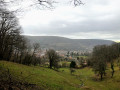
Between waypoints (1) and (2), you’ll pass the Sainte-Vierge de Kentelackerweg on your left, which also offers a view of the Hochkopf and the hamlet of Rimlishof below, behind the Breitenbachzung stream that separates the two mountains.
The Demberg, the ‘sacred mountain of the people of Buhlo’, which you will walk along the lower part of its eastern slope.
Between the waypoints (3) and (4), you’ll be able to enjoy a beautiful view of the southern part of Buhl.

Reviews and comments

4.8 / 5
Based on 2 reviews

Reliability of the description
5 / 5
Ease of following the route
5 / 5
Route interest
4.5 / 5
ACKERMANN André
ACKERMANN André

Overall rating : 4.7 / 5

Date of your route : Aug 10, 2024
Reliability of the description : ★★★★★ Very good
Ease of following the route : ★★★★★ Very good
Route interest : ★★★★☆ Good
Very busy route : No

A lovely little walk, especially towards the end, when you look down over the village from a path surrounded by beautiful pastures.

Machine-translated

Mickanside
Mickanside

Good evening, Adecali, and thank you for your feedback – I’m delighted that you enjoyed the hike!

Machine-translated

Adecali
Adecali

Overall rating : 5 / 5

Date of your route : Mar 10, 2024
Reliability of the description : ★★★★★ Very good
Ease of following the route : ★★★★★ Very good
Route interest : ★★★★★ Very good
Very busy route : Yes

A lovely walk, very well described and suitable for beginner walkers. However, as mentioned, you’ll need to wear walking shoes as there are some muddy patches (in March).

Machine-translated

Other walks in the area

For more walks, use our search engine .

The GPS track and description are the property of this route's author. Please do not copy them without permission.