


Refine your search for walks in Col de Peternit
Col de Peternit walks


 The heights of Jungholtz
 Visorando Member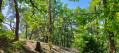
 6.49 mi
 +1,417 ft
 -1,411 ft
 4h 15
4h 15
 Moderate
 Departure from Jungholtz (Haut-Rhin)
The hike starts in Jungholtz and crosses the communal forest of Guebwiller to take you to the Col de Peternit. Hike between the Guebwiller and Rimbach valleys, among conifers and deciduous trees.
The hike can also be done by mountain bike.
Tour of Rimbach-près-Guebwiller via the Glasshütte farmhouse inn
 7.78 mi
+1,759 ft
-1,755 ft
5h 05
Moderate
Departure from Rimbach-près-Guebwiller (Haut-Rhin)
7.78 mi
+1,759 ft
-1,755 ft
5h 05
Moderate
Departure from Rimbach-près-Guebwiller (Haut-Rhin)
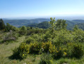
A pleasant circular on the heights of Rimbach-près-Guebwiller in beautiful forests, passing through Münsteraeckerle and Judenhut. Halfway through, why not stop off at the very friendly and cosy Ferme Auberge du Glasshütte?
From the Pont Saint-Barnabé via the summit of Ebeneck
 5.41 mi
+1,578 ft
-1,581 ft
3h 50
Moderate
Departure from Buhl (Haut-Rhin) (Haut-Rhin)
5.41 mi
+1,578 ft
-1,581 ft
3h 50
Moderate
Departure from Buhl (Haut-Rhin) (Haut-Rhin)
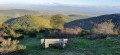
A circular walk leading to the Ebeneck hilltops, offering superb views of the Alsace plain, the Black Forest and, weather permitting, the Alps on a clear day.
From Guebwiller to the Grand Ballon
 Tourist office
 11.92 mi
+3,406 ft
-3,406 ft
8h 25
11.92 mi
+3,406 ft
-3,406 ft
8h 25
 Difficult
Departure from Guebwiller (Haut-Rhin)
Difficult
Departure from Guebwiller (Haut-Rhin)
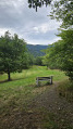
This hike will take you up to the Grand Ballon, the highest peak in the Vosges mountains, rising to 1,424 metres. From the summit, weather permitting, you can enjoy an exceptional panoramic view across the whole of the Alsace plain, the Black Forest and even as far as the Alps. Along the way, you’ll pass through a variety of landscapes, from coniferous and deciduous forests to clearings and pastures. As you gain altitude, you’ll notice how the flora of the Vosges changes.
The Grand Ballon from Soultz loop
17.91 mi
+4,206 ft
-4,203 ft
2 days
Difficult
Departure from Soultz-Haut-Rhin (Haut-Rhin)
The Grand Ballon is a legendary peak in the Vosges. It is easily accessible by car. More experienced hikers can reach it on foot via various hiking trails. One of the longest routes starts from Soultz. The climb is steady on the first day and the descent is steady on the second. The more athletic can complete this hike in a single day, but to fully enjoy the scenery, it is better to do it over two days. This hike will leave you with lasting memories of the view from the summit at over 1,400 metres above sea level.
Walks near Col de Peternit
Le Col du Grand Ballon depuis Soultz
8.15 mi
+3,596 ft
-89 ft
6h 55
Difficult
Departure from Soultz-Haut-Rhin (Haut-Rhin)
Randonnée presque quasiment en montée qui permet de relier Soultz, sympathique village culturel, au Col du Grand Ballon où vous pourrez passer la nuit avant d'aller le lendemain matin au sommet. Bien que cette étape soit courte en kilomètres, elle comporte un important dénivelé à ne pas négliger. Mais que de beautés en revanche entre les forêts et points de vues remarquables dans la dernière partie du parcours.
Linthal – Grand Ballon – Markstein
12.20 mi
+3,553 ft
-1,319 ft
8h 40
Difficult
Departure from Linthal (Haut-Rhin)
A very physically demanding first day with a wide variety of landscapes.
Starting from Linthal, the most mountainous village in the Guebwiller region, the first day of this multi-day hike will take you to the Auberge du Steinlebach, via the Grand Ballon – the highest peak in the Vosges mountains, rising to an altitude of 1,424 metres – and the Markstein resort. The ascent is quite challenging and requires a good level of fitness. Along the way, you’ll pass the Gustiberg farmhouse inn, Lake Ballon and the Haag farmhouse inn…
Ascent to the Grand Ballon from Sengern (Guebwiller) via the lake
 5.78 mi
+2,910 ft
-39 ft
5h 10
Difficult
Departure from Lautenbachzell (Haut-Rhin)
5.78 mi
+2,910 ft
-39 ft
5h 10
Difficult
Departure from Lautenbachzell (Haut-Rhin)
A challenging climb to the Grand Ballon from Sengern (past Guebwiller). The route passes by the beautiful Lac du Ballon and the Gustiberg farmhouse inn, both of which offer very pleasant places to stop for a break.
On the ridges: Grand Ballon – Markstein – Petit Ballon
 13.44 mi
+2,110 ft
-3,022 ft
8h 00
Difficult
Departure from Murbach (Haut-Rhin)
13.44 mi
+2,110 ft
-3,022 ft
8h 00
Difficult
Departure from Murbach (Haut-Rhin)
An easy route, gently undulating across the highest peaks of the Vosges, through stubble fields and forests. Magnificent views over the surrounding valleys.
Petit Ballon - Sengern
 5.91 mi
+604 ft
-2,608 ft
3h 15
Moderate
Departure from Luttenbach-près-Munster (Haut-Rhin)
5.91 mi
+604 ft
-2,608 ft
3h 15
Moderate
Departure from Luttenbach-près-Munster (Haut-Rhin)
The route begins in alpine pastureland, then passes through very shady forests.
Le Markstein – Thann
 Tourism professional
 17.72 mi
+2,359 ft
-5,187 ft
10h 10
17.72 mi
+2,359 ft
-5,187 ft
10h 10
 Very difficult
Departure from Oderen (Haut-Rhin)
Very difficult
Departure from Oderen (Haut-Rhin)
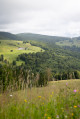
From the Markstein, the sixteenth stage of the journey across the Vosges proposed by Passion Vosges magazine continues along the Great Vosges Ridge towards the massif’s highest point, the Grand Ballon. After a visit to the Hartmannswillerkopf battlefield (1914–1918) and a climb to the summit of the Molkenrain, a long descent through the forest begins, heading towards Thann and its famous Gothic collegiate church. Franck Buchy’s account of this sixteenth stage can be found in *Passion Vosges*.
Markstein – Petit Ballon – Linthal
12.88 mi
+1,407 ft
-3,619 ft
7h 10
Difficult
Departure from Oderen (Haut-Rhin)
Take the time to admire the landscapes and views that make this second day’s walk so special. The route follows the ridges for the most part, leading to the Petit Ballon via the Klintzkopf. Once again, you’ll be able to fully enjoy the panoramic views over the plains and valleys on either side of the mountain. This route, which passes through forests and stubble fields, will allow you to discover the richness of the local flora.
Rouffach – Turckheim
14.19 mi
+1,375 ft
-1,250 ft
7h 45
Difficult
Departure from Rouffach (Haut-Rhin)
Wine-growing is an integral part of the Alsatian landscape. There is also a route named after it. This route is the third stage of the ‘Traversée des Vignes’ and links Rouffach to Turckheim. There are numerous vantage points, indeed they are almost everywhere outside the villages. The villages themselves are very traditional, with pretty half-timbered houses, and possess an undeniable charm. The region’s heritage is equally well represented.
Hahnenbrunnen Pass and Uff Rain from Langenwasen
 9.32 mi
+2,182 ft
-2,146 ft
6h 10
Difficult
Departure from Metzeral (Haut-Rhin)
9.32 mi
+2,182 ft
-2,146 ft
6h 10
Difficult
Departure from Metzeral (Haut-Rhin)
A lovely climb towards the Vosges ridge along the River Pfahlrunz, with a stop at a charming little lake (unnamed). Lots of remarkable trees. Then an easy walk along theGR®5along the ridge before heading towards the farm inns at Salzbach and Uff Rain, with panoramic views of the Vosges peaks.
 Easy
Easy