Country:
 City:
City:



Car park: Place de l’Église.
Route marked in red
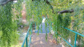
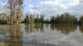
(S/E) From the car park, walk alongside the lake, keeping it on your right, cross a small bridge over the stream and join the road.
(1) Turn right towards the hamlet of Tartifume and continue along this road for 500 metres. Then carry on straight ahead along the farm track towards La Vrinière.
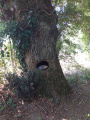
(2) Once you’ve passed the buildings at La Vrinière, take the road on the right, running alongside the farm buildings. Then turn left 100 metres further on. Walk past the hamlet of La Vollerie, skirting the field, and just after the Saint-Joseph oak (a remarkable oak), take the footbridge leading onto a grassy strip in the field. Follow this path alongside the oaks.
(3) Cross the road carefully and head straight ahead onto the grassy track running alongside the fields. Continue straight on, ignoring the paths branching off to the left, until this main track turns sharply left 600 metres further on.
(4) At the junction, take the path on the right, then turn right to follow the D15 road for about 150 metres. Cross carefully, then take the first left to join the road leading to the hamlet of Le Gué Haussang. Walk past the old chapel and follow the path heading to the left.
(5) Follow the path to Moulin Neuf as far as the hamlet of Le Mesnil. At the T-junction in Le Mesnil, go round the hamlet by turning right, then take the path on the left. Follow this for 600 metres until you reach the crossroads.
(6) Cross the road and continue straight on for 650 metres, leaving the buildings at La Noirdière on your left. You are walking along a farm track. When you reach the road, turn right and stay on the road until you reach La Poitevinière.
(7) Opposite the Town Hall, cross the road, then turn left towards the church and finally right to return to the starting point (S/E).

 A very well-signposted route that’s lovely to enjoy with others.
 Visorando Member

 Tourist office
 Moderate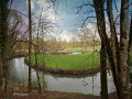
 Difficult