Country:
 City:
City:


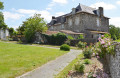

Park in the car park by the community centre and make your way to the starting point sign nearby. Follow the yellow markings.
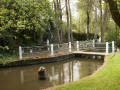
(S/E) Following the yellow markings, go round the small pond on the right and turn onto Rue de la Morosière. Pass through the hamlet of Bel-Air.
(1) Then take the path on the left just before the pond. Walk alongside the pond on your right, then past the Morosière estate. Next, walk alongside the woodland on a gravel path. At the crossroads directly beneath a high-voltage power line, turn left and join a tarmac road.
(2) Follow the road to the left. When it curves to the right, take a path on the left. Pass under the high-voltage power line again, leave the Allairie buildings on your left and head back towards the high-voltage power line. At the junction, turn left and stay on the edge of the woodland.
(3) At the junction (cross), turn right (north-east) onto a track that leads into the woods. Continue in the same direction along the edge of the woods and then through the fields.
(4) You’ll come out onto the D249; first turn left then right to follow the access road to the hamlet of La Pagote. Continue south-east, skirting the facilities of a racehorse training centre (Landes Gontard).
(5) At the junction, turn left. Ignore the turn-off to the left for Landes Gontard and cross the Ruisseau de l’Aubance. Shortly afterwards, when the road curves to the right, carry on straight ahead along a track.
(6) At the road, make the first turn left then right (take care when crossing) and follow the Route de Pinier.
(7) About 250 m past this hamlet, turn right onto a track. Then take thefirst track on the left (marker 106).
(8) At the T-junction, turn right (south). Pass in front of La Haute Clerjauderie and continue along the road.
(9) After the farm buildings, turn left onto a track and head straight on towards the north-east.
(10) At the Cramail wayside shrine, take thesecond left, the D131, to the hamlet of La Miotterie.
(11) Then take a small road on the right. Pass under a high-voltage power line and carry on to the hamlet of Les Carroils.
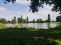
(12) Turn left at the entrance to the hamlet. When the road bends left, carry on straight ahead along the farm track, passing livestock buildings on your left. At the next junction, by the corner of a pond, turn right. Ignore a turn-off on the right and join a road.
(13) Follow the road to the left and walk past the Manoir de l’Aunay Gontard. Cut left between some small buildings and cross over a stream. Then turn right and walk alongside the property. Continue along a small tarmac road.
(14) Turn left onto a small road. Cross the D131 (crossroads), pass under a high-voltage power line and carry on straight ahead until you reach the hamlet of La Châtaigneraie.
(15) Just after crossing a stream, take the gravel track on the left which climbs slightly. Pass the hamlet of L’Épinay and continue south-west.
(16) You’ll come out onto a road; follow it to the left. Pass the hamlet of La Haute Gougeonnière.
(17) Shortly afterwards, take a path on the right. Cross a stream, walk alongside a pond on your left and head up through the fields.
(18) Return to the tarmac road, turn left and pass through the hamlet of La Brosse. Pass under the high-voltage power line once more.
(19) At La Croix Mercier, cross the D149 with care and carry on straight ahead along a field track. Leave the Chemin de la Colinière on your right and continue south. At the T-junction, turn right and you’ll soon come to a junction with the D249.
(4) Cross the road and take the path opposite, the one you took on the way there (south-west).
(3) At the junction (crossroads), turn right. Head north along the edge of the woods. Further on, continue along the tarmac road.
(20) You will come out onto the D249 (cross) and follow it to the left. Enter the village via Rue François Cougoul. Cross Rue des Loisirs and carry on straight ahead. Then turn left onto Rue de la Morosière to return to the car park where you started (S/E).

 Tourist office
 Moderate
 Easy
Easy 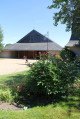
 Visorando Member