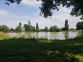
La Poulaine to La Jubaudière

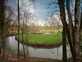
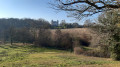
In the woods of La Gautrèche and along tree-lined paths, you’ll discover a rural and bucolic landscape characteristic of the Mauges region. The great diversity of landscapes will make for a rich and varied walk.
As this route covers a large part of the Jubaudière area, it will allow you to discover a town with many different facets.

Details

4390734
Creation:
Last update:
Last review:
  • Walking
    Activity: Walking
  • ↔
    Distance: 8.20 mi
  • ◔
    Average duration: 4h 00 
  • ▲
    Difficulty: Moderate

  • ⚐
    Back to start: Yes
  • ↗
    Ascent: + 266 ft
  • ↘
    Descent: - 285 ft

  • ▲
    Highest point: 381 ft
  • ▼
    Lowest point: 240 ft

Photos

Description of the walk

Follow the yellow markings

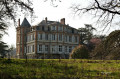
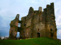
Park at La Gautrêche near the castle. Walk through the Bois de la Gautrêche to Rue de l’Èvre.

(S/E) At the junction with Rue de l’Èvre, by the wayside cross, turn left and stay on the road for 2 km, passing close to La Crouzière.

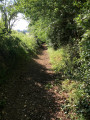
(1) Turn right onto the dirt track through the hedgerow for 500 m.

(2) At the junction, there are two options:
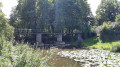
- for a round trip, carry on straight ahead to visit the Saint-Tibère Chapel and its Gallo-Roman bridge (500 m away)
- or turn right to continue the walk and carry on for
2 km to the junction with the D15.

(3) Turn right, then cross the road to take the path on the left opposite the Croix de la Jallière. Follow this path to the next crossroads.

(4) Turn right onto the farm track towards the hamlet of Terre-Neuve, cross a road and carry on straight ahead, due north, for 1.8 km.

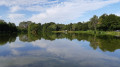
(5) Turn left towards La Coudraie, on your left, to reach the Étang du Bois Ham and walk around it on the left-hand side. At the junction with a road, turn right to continue round the pond.

(6) When you reach the crossroads, take the farm track opposite.

(7) Turn right at the farm, cross the Ruisseau du Pont des Landes, then continue through fields and wooded countryside. After a few metres, turn right onto the track, then right again until you reach Le Mesnil.

(8) Cross through Le Mesnil, then continue along the tarmac road until you reach the village of La Jubaudière

(9) Walk past the cemetery on your left at the Chemin des Vendéens. Turn left into Rue du Commerce, cross the roundabout and return to the starting point. (S/E)

Waypoints

  1. S/E : mi 0 - alt. 344 ft - Rue de l’Èvre and the wayside cross
  2. 1 : mi 1.25 - alt. 351 ft - Dirt track through the bocage
  3. 2 : mi 1.56 - alt. 344 ft - Junction. Towards the - barrage sur l'èvre pour moulin à eau
  4. 3 : mi 2.92 - alt. 344 ft - D15, Croix de la Jallière
  5. 4 : mi 3.77 - alt. 377 ft - Farm track towards Terre-Neuve
  6. 5 : mi 4.86 - alt. 344 ft - Étang de la Coudraie
  7. 6 : mi 5.75 - alt. 338 ft - Bois Ham crossroads
  8. 7 : mi 6.37 - alt. 328 ft - Farm
  9. 8 : mi 7.21 - alt. 338 ft - A hamlet known as Le Mesnil
  10. 9 : mi 7.82 - alt. 344 ft - Cemetery
  11. S/E : mi 8.2 - alt. 344 ft - Rue de l’Èvre

Worth a visit

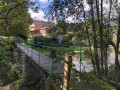
The many hedgerow paths invite you to take a leisurely, intimate stroll through lush greenery. You’ll also have the chance to discover heritage sites such as the Pont de Lunette, also known as the Pont Qui Breuille, and – if you venture a little off the path – the Saint-Tibère Chapel and its Gallo-Roman bridge.

Reviews and comments

3.6 / 5
Based on 5 reviews

Reliability of the description
3.8 / 5
Ease of following the route
3.8 / 5
Route interest
3.4 / 5
Gourdon Michel
Gourdon Michel

Overall rating : 4.3 / 5

Date of your route : May 11, 2026
Reliability of the description : ★★★★☆ Good
Ease of following the route : ★★★★★ Very good
Route interest : ★★★★☆ Good
Very busy route : No

Having grown up in the La Jubaudière area, I know the area well. Accompanied by some locals from La Jubaudière, we did the route in reverse; the signposting was a bit sparse, there were very few roads and it was shaded. Overall, it was very good, with very little elevation gain.
Michel = Mitou

Machine-translated

Richard49
Richard49
• Edited:

Overall rating : 2 / 5

Date of your route : Mar 08, 2026
Reliability of the description : Not used / Not applicable
Ease of following the route : Not used / Not applicable
Route interest : ★★☆☆☆ Disappointing
Very busy route : No

This is just my personal opinion.
Hike completed in March 2021 and March 2026.

I am not judging the signposting as I use a guidance app on my phone.

Easy hike, almost no shade and very little of interest, apart from the Bois Ham pond.
Too much tarmac road.
Park at the cemetery.

Machine-translated

Corciulo Giuseppe
Corciulo Giuseppe

Overall rating : 2.7 / 5

Date of your route : Sep 26, 2023
Reliability of the description : ★★★☆☆ Average
Ease of following the route : ★★☆☆☆ Disappointing
Route interest : ★★★☆☆ Average
Very busy route : No

Yet another issue with the signposting.

Machine-translated

Franck AUGEREAU
Franck AUGEREAU

Overall rating : 4 / 5

Date of your route : Mar 27, 2023
Reliability of the description : ★★★★☆ Good
Ease of following the route : ★★★★★ Very good
Route interest : ★★★☆☆ Average
Very busy route : No

A change of scenery, a bit muddy in winter

Machine-translated

manuuher
manuuher

Overall rating : 4 / 5

Date of your route : Nov 21, 2021
Reliability of the description : ★★★★☆ Good
Ease of following the route : ★★★☆☆ Average
Route interest : ★★★★★ Very good
Very busy route : No

A pleasant walk on the whole; the walk around the Coudraie pond is very pretty. The castle is well maintained.
The route is easy to follow, except around the castle!
You mustn’t try to go round the back of it under any circumstances – the path isn’t signposted and I’m not sure you can see it very clearly. It’s better to go round the front at the point (10), even if it means getting a bit closer to see it properly.
Do not follow the stream; instead, follow the road back to the starting point.

Incidentally, the starting point is poorly chosen as there are very few places to park
It’s best to park at the Étang de la Coudraie or the Étang du Bois Ham, where there are designated car parks.

This route is suitable for mountain bikes.

Machine-translated

Other walks in the area

For more walks, use our search engine .

The GPS track and description are the property of this route's author. Please do not copy them without permission.